Gesamtpreis (1 Artikel Artikel):
Versandziel:

Report Exploring Expedition Rocky Mountains Year 1842 (17 Ergebnisse)
Direkt zu den wichtigsten Suchergebnissen
Produktart
- Alle Produktarten
- Bücher (17)
- Magazine & Zeitschriften
- Comics
- Noten
- Kunst, Grafik & Poster
- Fotografien
- Karten
-
Manuskripte &
Papierantiquitäten
Zustand
Einband
Weitere Eigenschaften
- Erstausgabe (9)
- Signiert
- Schutzumschlag
- Angebotsfoto (14)
Land des Verkäufers
Verkäuferbewertung
-
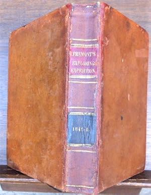
Report of the Exploring Expedition to the Rocky Mountains in the Year 1842 and to Oregon and California in the Years 1843-44
Verlag: Gales and Seaton, Washington, 1845
Anbieter: Ken Sanders Rare Books, ABAA, Salt Lake City, UT, USA
Verbandsmitglied: ABAA ILAB IOBA RMABA
Bewertung:

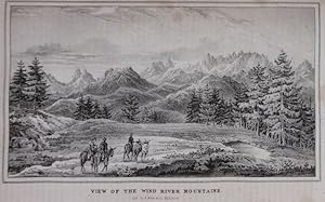
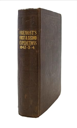
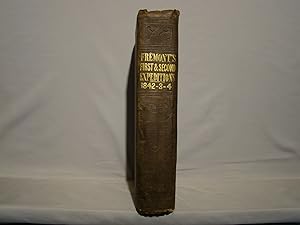
Hardcover. Senate Issue. 691pp. Octavo [23 cm] Rebound in sturdy tan cloth. New endsheets and flyleaves. Good plus. The plates and pages are foxed, and there are sporadic tidemarks of varying sizes on the pages as well. 22 single-sided plates (views, botanical, fossils) and 3 maps (missing the large folding map by Charles Preuss, and the map at p. 247). John Fremont's expeditions of 1842 and 1843-44 were the most spectacular reconnaissance of the American West since Lewis and Clark. Performed under the auspices of the Army Bureau of Topographical Engineers, the expedition's published reports and maps brought a factor of dependability and trustworthiness that would aid American settlement of the West. Fremont's report was the most detailed observations of the western territories at the time. The country covered by the report was previously terra incognito--Brigham Young is said to have used both the report as a guide in bringing the Mormon people West. Utah was then part of Mexico and would first become Deseret and then Utah territory. One of the seminal works for any western or Utah collector. Howes F-372(Senate Issue). Wagner/Camp 115.2.
-
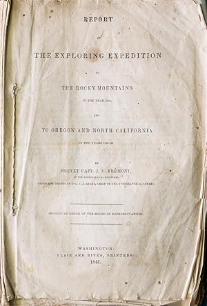
REPORT OF THE EXPLORING EXPEDITION TO THE ROCKY MOUNTAINS IN THE YEAR 1842, AND TO OREGON AND NORTH CALIFORNIA IN THE YEARS 1843-44
Verlag: Blair and Rives, Washington, 1845
Anbieter: Glenn Books, ABAA, ILAB, Prairie Village, KS, USA
Bewertung:

Erstausgabe
Full Brown Leather. Zustand: General Cover Wear. Zustand des Schutzumschlags: No Dust Jacket. First Edition. Rebacked with original spine laid-down. Red and black spine labels, original. New free endpapers. Professional repair of folding map pp. 132-33. 22 plates (collated complete) and four maps, two of which are folding. Plates are generally clean, some occasional peripheral foxing. Text with mild to moderate foxing. Title-page shows peripheral browning and moderate foxing as well. Map pocket is loosened but present at rear. Small facsimile of the large map is provided in the pocket. Large facsimile of the Preuss map is included in separate folder. A good-plus copy of this important report, printed by order of the House of Representatives. 583pp. See the following for additional information. Streeter 3131, Howes F370, Wagner-Camp 115.2, Field 565, Graff 1436. See photos. Size: Large Octavo.
-

Report of the Exploring Expedition to the Rocky Mountains in the Year 1842 and to Oregon and North California in the Years 1843-44
Verlag: Gales and Seaton
Anbieter: Wonder Book, Frederick, MD, USA
Bewertung:
Erstausgabe
Zustand: Good. Washington, D.C.: Gales and Seaton, 1845. 1st edition. Senate Issue. Later binding. Sm 4to Hardcover. (6)+693pp+(7). B/W plates, tables, includes 2 folding maps, p. 133 and p. 247. lacking 3 remaining maps, including Charles Preuss map. Good book. 1/2 leather brown boards with raised spine bands, gilt spine lettering and marbled endpapers. Heavy edgewear. Approx. 1 inch chip to the upper rear board. Pages age toned. Hinges starting. Decorative early penciled gifter's inscription to the first blank. Creasing to the upper corner of pages 247-256. Heavy vertical creasing to the second rear blank. Inclludes astronomical and meteorological reports omitted from the House issue. In polypropylene bag. (US history, exploration, american west) Inquire if you need further information.
-
Report of the Exploring Expedition to the Rocky Mountains in the Year 1842, and to Oregon and North California in the Years 1843-'44
Anbieter: Argosy Book Store, ABAA, ILAB, New York, NY, USA
Bewertung:
Erstausgabe
hardcover. First Edition. 4 maps, 2 folding; 21 of 22 lithograph plates, some tinted. 576pp. 8vo, 19th century boards, crudely rebacked in library cloth; (ex-lib, corners worn, light foxing including most plates). Washington: Blair and Rives, 1845. U.S. 28th Congress, 2nd Session, House Doc. No. 166. This copy lacks the large folding map in back and one of fossil plates. The map of the Great Salt Lake is chipped in the margin. The folding map of the route through the Sierra Nevadas has been repaired with no loss of text. That map has several small holes in blank areas and has several small chips on the edge. The last page is part of a table and is torn with a half page loss of text. Howes F-370. Wagner-Camp 115:2. Streeter Sale V, 3131. Cowan p. 223-4. Graff 1436.
-
Report of the Exploring Expedition to the Rocky Mountains in the Year 1842, and to Oregon and North California in the Years 1843-'44
Verlag: Gales and Seaton, Washington, 1845
Anbieter: Ken Sanders Rare Books, ABAA, Salt Lake City, UT, USA
Verbandsmitglied: ABAA ILAB IOBA RMABA
Bewertung:
Hardcover. Senate Issue. 693pp. Octavo [23 cm] Brown cloth covered boards with a gilt stamped title on the spine and blind stamped decorative patterns on the covers. Very good. Light rubbing to boards. Minor bumping to corners. Gentle sporadic foxing throughout. 22 single-sided plates and 4 maps (missing the large folding map by Charles Preuss). John Fremont's expeditions of 1842 and 1843-44 were the most spectacular reconnaissance of the American West since Lewis and Clark. Performed under the auspices of the Army Bureau of Topographical Engineers, the expedition's published reports and maps brought a factor of dependability and trustworthiness that would aid American settlement of the West. Fremont's report was the most detailed observations of the western territories at the time. The country covered by the report was previously terra incognito--Brigham Young is said to have used both the report as a guide in bringing the Mormon people West. Utah was then part of Mexico and would first become Deseret and then Utah territory. One of the seminal works for any western or Utah collector. Howes F-372(Senate Issue). Wagner/Camp 115.2.
-
REPORT OF THE EXPLORING EXPEDITION TO THE ROCKY MOUNTAINS IN THE YEAR 1842, AND TO OREGON AND NORTH CALIFORNIA IN THE YEARS 1843-44
Verlag: Gale and Seaton Printers, Washington, 1845
Anbieter: Bartleby's Books, ABAA, Chevy Chase, MD, USA
Verbandsmitglied: ABAA ESA ILAB IOBA
Bewertung:
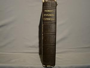
8vo. 693 pp. Twenty-two plates, five maps, three folding, the largest in rear pocket. Howes F-370. Wagner-Camp 115:1. Wheat Gold Regions 3266. Wheat Transmississippi 497. Zamorano 80, 39. Cowan, p. 223. Graff 1437. Grolier Club One Hundred American Books 49. Mintz 165. Rittenhouse 229. Streeter sale 3131: "Though the map accompanying the report is unsigned, Lt. G.K. Warren in his Memoir, p. (45), says 'it was drawn by Charles Preuss, whose skill in sketching topography in the field and representing it on the map has probably never been surpassed.'" This, the Senate printing, is considered the best edition of this work, containing one of the most historically important maps of the Western exploration. Original brown blindstamped cloth, rebacked, with original spine laid down. Usual foxing, a few tears to large map in pocket.
-
Report of the Exploring Expedition to the Rocky Mountains in the Year 1842, and to Oregon and North California in the Years 1843-'44
Verlag: Printed by Order of the Senate, by Gales and Seaton, Washington, D.C., 1845
Anbieter: James Cummins Bookseller, ABAA, New York, NY, USA
Bewertung:
Erstausgabe
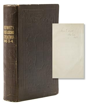
First Edition. First Edition. 693pp. 22 engraved plates and 5 maps (including large folding map in pocket). 8vo. The Senate issue of the Fremont report, certainly one of the most important single pieces of Western Americana. In various editions this report was more widely read than any other account of the West before the Gold Rush, and the text and map had a profound effect on the routes frequented during the great period of emigration. "The great folding map is an altogether memorable document in the cartographic history of the West." [Trans-Mississipi West II,497]Christopher "Kit" Carson was one of the guides for Fremont along with many other famous scouts of the day, and Fremont's book was instrumental in paving the way for expansion West. A classic of American exploration, scarce in such fine condition and complete with the large folding map in the rear pocket. Howes F 370; Wagner-Camp 115; Wheat Transmississippi 497; Cowan pp. 223-24; Sabin 25845; Graff 1437; Hasse, p. 31; Hill p. 112; Zamorano Eighty, #39; Grolier Club, One Hundred American Books, #49; Reese, Best of the West 86. Provenance: Samuel Tuck (early signature on ffep); William H. Claflin, Jr. (bookplate) Publisher's cloth. Minor wear along front joint. Small void to corner of blank front endpaper. A very good copy, in nicer condition than usually encountered 693pp. 22 engraved plates and 5 maps (including large folding map in pocket). 8vo.
-
Report of the exploring expedition to the Rocky Mountains in the year 1842, and to Oregon and North California in the years 1843 - '44.
Anbieter: Gert Jan Bestebreurtje Rare Books (ILAB), Vianen, Niederlande
Bewertung:
Erstausgabe
Washington, Gales & Seaton, 1843.Contemporary calf, with black titlelabel on spine, in fine slipcase. With 4 (of 5) maps (3 folding, including the large folding map (repaired); missing map Beer Springs), and 22 lithographed plates. 693 pp.First edition. - The Senate issue of the Fremont report, certainly one of the most important single pieces of Western Americana. In various editions this report was more widely read than any other account of the West before the Gold Rush, and the text and map had a profound effect on the routes frequented during the great period of emigration. The maps include the huge folding "Map of.Oregon & North California in the Years 1843-44," with many lakes and rivers traced in color.- (Foxed). - A classic of American exploration.Hill 640; Cowan p.223. Howes F370; Sabin 25845; Wagner-Camp 115:1; Graff Collection 1436.
-
Report of the Exploring Expedition to the Rocky Mountains in the year 1842 and to the Oregon and North California, in the years 1843, 44.
Verlag: British Library, Historical Print Editions, 2011
ISBN 10: 1241318468ISBN 13: 9781241318468
Buch
Zustand: New.
-

Report of the Exploring Expedition to the Rocky Mountains in the year 1842 and to the Oregon and North California, in the years 1843, 44.
Verlag: British Library, Historical Print Editions, 2011
ISBN 10: 1241342326ISBN 13: 9781241342326
Buch
Zustand: New.
-

Report of the Exploring Expedition to the Rocky Mountains in the year 1842 and to the Oregon and North California, in the years 1843, 44
Verlag: British Library, Historical Print Editions, 2011
ISBN 10: 1241440077ISBN 13: 9781241440077
Buch
Zustand: New.
-
Report of the Exploring Expedition to the Rocky Mountains in the year 1842 and to the Oregon and North California, in the years 1843, 44.
Verlag: British Library, Historical Print Editions, 2011
ISBN 10: 1241339678ISBN 13: 9781241339678
Buch
Zustand: New.
-
Report of the Exploring Expedition to the Rocky Mountains in the year 1842 and to the Oregon and North California, in the years 1843, 44.
Verlag: British Library, Historical Print Editions, 2011
ISBN 10: 1241327262ISBN 13: 9781241327262
Buch
Zustand: New. KlappentextbTitle:/b Report of the Exploring Expedition to the Rocky Mountains in the year 1842 and to the Oregon and North California, in the years 1843, 44.br/br/bPublisher:/b British Library, Historical Print Editionsbr/br/The Britis.
-
Report of the Exploring Expedition to the Rocky Mountains in the Year 1842, and to Oregon and North California in the Years 1843-'44 . Printed by Order of the House
Verlag: Blair and Rives, Washington, D.C., 1845
Anbieter: James Cummins Bookseller, ABAA, New York, NY, USA
Bewertung:
Erstausgabe
First edition, House issue. First edition, House issue. With 22 engraved plates and 5 maps, including large folding map. 583 pp. 1 vols. 8vo. A classic of American exploration. Christopher "Kit" Carson was one of the guides for Fremont along with many other famous scouts of the day, and Fremont's book was instrumental in paving the way for expansion West, providing the first truly accurate information regarding the routes thereto. Scarce in original condition. "The great folding map is an altogether memorable document in the cartographic history of the West." [Trans-Mississipi West II,497]. Howes F 370; Wagner-Camp 115:2; Wheat Transmississippi 497; Cowan pp. 223-24; Sabin 25845; Graff 1437; Hasse, p. 31; Hill p. 112; Zamorano Eighty, #39; Grolier Club, One Hundred American Books, #49 Stitched as issued, untrimmed and partially unopened. Custom calf backed clamshell box With 22 engraved plates and 5 maps, including large folding map. 583 pp. 1 vols. 8vo.
-
Report of the Exploring Expedition to the Rocky Mountains in the Year 1842, and to Oregon and North California in the Years 1843-44.Printed by order of the Senate of the United States.
Verlag: Gales and Seaton, Printers, Washington, 1845
Anbieter: Heritage Book Shop, ABAA, Beverly Hills, CA, USA
Bewertung:
Erstausgabe
in the Year 1842, and to Oregon and North California in the Years 1843-44. Printed by order of the Senate of the United States. Washington: Gales and Seaton, Printers, 1845. First edition, Senate issue with all the scientific data. Octavo (9 x 5 3/4 inches; 228 x144 mm). 693, [1, blank] pp. Complete. With twenty-two plates and five maps, two of which are small folding and the very large folding map in the rear pocket. Publisher's vertically-ribbed dark brown cloth. Covers with blind-stamped borders and floral loops. Spine lettered in gilt. Some foxing and toning throughout. Cloth lightly rubbed and bumped. Binding a bit skewed, causing a crease in the spine. Pocket map in very good condition with just a few small fold-line splits. Still a very good copy of this important narrative in the original binding and with the large map in the rear pocket. One of the most important publications on the history of the exploration of the American West. 'On January 18, 1844, Fremont determined to cross the Sierra instead of turning eastward. Crossing over what is now known as Carson's Pass, he reached the San Joaquin Valley and turned north to Sutter's Fort. It was a tattered and exhausted outfit that arrived there on March 6th, 1844. Here he learned much about the conditions in California.' Later he crossed the Tehachapi Pass into the Mojave Desert. The large map is of particular importance as it charts hitherto unknown areas. Graff 1436. Howes F-370. Sabin 25845. Streeter 3131. Wagner-Camp 115:1. Zamorano Eighty #39. HBS 68687. $2,250.
-
Report of the Exploring Expedition to the Rocky Mountains in the Year 1842, and to Oregon and North California in the Years 1843-'44, by Brevet Capt. J. C. Fremont, of the Topographical Engineers, Under the Orders of Col. J. J. Abert, Chief of the Topographical Bureau. Printed by Order of the Senate of the United States.
Verlag: Washington: Gales & Seaton, Printers, 1845. 28th Congress, 2nd Session, Senate Exec. Doc. 174. Serial 461., 1845
Anbieter: J & J House Booksellers, ABAA, Kennett Square, PA, USA
Bewertung:
Buch Erstausgabe
Hardcover. Zustand: Very Good. 1st Edition, Illustrated Edition. First edition, Senate issue, 8vo, pp. (1-3), 4-693, 22 lithograph plates, 4 maps (2 folding), lacks the large folding Pruess map & it's rear pocket. Original gilt lettered & blind decorated brown cloth. Sabin 25845, Howes F 370, Jenkins Full Howes 925, Wagner-Camp 115:2, Graff 1436, Zamorano 80, #39. Very good bright copy, cloth in unusually good shape with minor bumps & wear to extremities, corners bumped & showing. Lacks the large folding map & its pockets has been removed from the lower inner board with evidence but no real damage. Sheets with natural age toning & some offset but with stain to title diminishing throughout the first hundred pages or so, otherwise unmarked & complete. H9551 All Items Are Sent Insured. Insurance charges are included in the Shipping & Handling Charges. International buyers please be aware that we are not responsible for and do not include or estimate customs duties, fees or taxes in any way in our listings. We ship all orders within 5 days of cleared payment. We do not create and are not responsible for shipping times or delays associated with customs and international shipping. All Items Are Sent Insured. Insurance charges are included in the Shipping & Handling Charges.
-
Report of the Exploring Expedition to the Rocky Mountains in the Year 1842, and to Oregon and North California in the Years 1843-'44, by Brevet Capt. J. C. Fremont, of the Topographical Engineers, Under the Orders of Col. J. J. Abert, Chief of the Topographical Bureau. Printed by Order of the Senate of the United States. Copy of Julius L(ucius) Brenchley, explorer & author with M. Jules Remy of A Journey to Great Salt Lake City, 2 vols, 8vo, 1861, here signed on the front free endpaper & with his engraved bookplate on the front pastedown endpaper.
Verlag: Washington: Gales & Seaton, Printers, 1845. 28th Congress, 2nd Session, Senate Exec. Doc. 174. Serial 461., 1845
Anbieter: J & J House Booksellers, ABAA, Kennett Square, PA, USA
Bewertung:
Buch Erstausgabe
Hardcover. Zustand: Very Good. 1st Edition, Illustrated Edition. First edition, Senate issue, 8vo (9 1/4" x 5 3/4"), pp. (1-3), 4-693, 22 lithograph plates, 4 maps (2 folding), without the large folding Pruess map & no rear map pocket. Original gilt lettered & blind decorated brown cloth. Sabin 25845, Howes F 370, Jenkins Full Howes 925, Wagner-Camp 115:2, Graff 1436, Zamorano 80, #39. Very good bright cop y with some wear to joints & extremities, corners bumped & showing. Without the large folding map but clearly never had a rear map pocket. Sheets with natural age toning & some offset & minor occasional stains, clean, unmarked & complete. H9551 All Items Are Sent Insured. Insurance charges are included in the Shipping & Handling Charges. International buyers please be aware that we are not responsible for and do not include or estimate customs duties, fees or taxes in any way in our listings. We ship all orders within 5 days of cleared payment. We do not create and are not responsible for shipping times or delays associated with customs and international shipping. All Items Are Sent Insured. Insurance charges are included in the Shipping & Handling Charges.