Gesamtpreis (1 Artikel Artikel):
Versandziel:

arabian peninsula (28 Ergebnisse)
Direkt zu den wichtigsten Suchergebnissen
Produktart
- Alle Produktarten
- Bücher (27)
- Magazine & Zeitschriften
- Comics
- Noten
- Kunst, Grafik & Poster
- Fotografien
- Karten (1)
-
Manuskripte &
Papierantiquitäten
Zustand
- Alle
- Neu
- Antiquarisch/Gebraucht
Einband
Weitere Eigenschaften
- Erstausgabe (7)
- Signiert (2)
- Schutzumschlag
- Angebotsfoto (27)
Land des Verkäufers
Verkäuferbewertung
-

Area Handbook for the Peripheral States of the Arabian Peninsula
Verlag: American University, Washington, D.C., 1971
Anbieter: K Books Ltd ABA ILAB, York, YORKS, Vereinigtes Königreich
Verbandsmitglied: ABA ILAB PBFA
Bewertung:

Buch Erstausgabe
Cloth. Zustand: Very Good. No Jacket. First Edition. xiv + 389pp, many maps, original cloth, V.G. *Covers Yemen, Kuwait, Muscat, Oman, etc. and all aspects of life, culture, economics, etc.
-
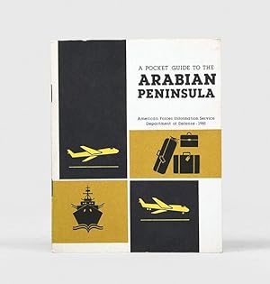
Pocket Guide.
Verlag: Washington, D.C.: American Forces Information Service, Department of Defense, 1981, 1981
Anbieter: Peter Harrington. ABA/ ILAB., London, Vereinigtes Königreich
Verbandsmitglied: ABA ILAB PBFA
Bewertung:
Erstausgabe
First edition, first printing, of this informative guide ending with profiles of each major state including the UAE. American personnel are reminded of the need to embrace cultural conventions and behave responsibly, including avoiding photographing people or military-industrial infrastructure. "Save your photography for ever-changing desert or for the spectacular sunsets along the coastal areas" (p. 6). Duodecimo. Original illustrated card wrappers, wire-stitched as issued, front cover lettered in black. Map and vignette headpieces in text. Wrappers lightly rubbed, a fine copy.
-
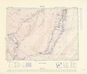
Laila. North F-38. Second edition. Army/Air Style. Sales copy.
Verlag: [London], War Office, 1944., 1944
Anbieter: Antiquariat INLIBRIS Gilhofer Nfg. GmbH, Vienna, A, Österreich
Verbandsmitglied: ILAB VDA VDAO
Bewertung:
Erstausgabe
Photolithographed map in 3 colours (705:600 mm). Scale 1:1,000,000. Rare RAF map of central Arabia, showing Jebal Tuwaiq, the desert west, and Wadi ad-Dawasir south. The first edition was published in 1925. - In good condition. - OCLC 634949403. Not in Al Ankary; Al-Qasimi.
-
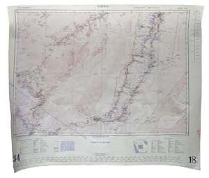
Laila. North F-38. Second edition. Army/Air Style.
Verlag: [London], War Office, 1944., 1944
Anbieter: Antiquariat INLIBRIS Gilhofer Nfg. GmbH, Vienna, A, Österreich
Verbandsmitglied: ILAB VDA VDAO
Bewertung:
Erstausgabe
707:601 mm. Photolithographed in 3 colours. Scale 1:1,000,000. Rare RAF map of central Arabia, showing Jebal Tuwaiq, the desert west, and Wadi ad-Dawasir south. Compiled by the R.G.S., drawn by the War Office, and photolithographed by the O.S. in 1943 for the Royal Air Force. The first edition was published in 1925. - Slightly wrinkled, but in good condition. - OCLC 634949403.
-
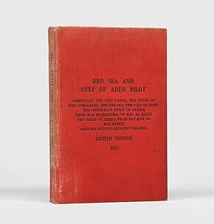
Red Sea and Gulf of Aden Pilot comprising the Suez Canal, the Gulfs of Suez and Aqaba, the Red Sea, the Gulf of Aden, the South-East Coast of Rabaia from Ras Baghashwa to Ras al Hadd, the Coast of Africa from Ras Asir to Ras Hafun, Socotra and its Adjacent Islands. Eighth Edition, 1932.
Verlag: London: for the Hydrographic Department, Admiralty, by HMSO, 1932, 1932
Anbieter: Peter Harrington. ABA/ ILAB., London, Vereinigtes Königreich
Verbandsmitglied: ABA ILAB PBFA
Bewertung:
Eighth edition; this extremely uncommon and typically comprehensive pilot was prepared by the highly experienced hydrographer Commander Francis N. Shearme RN, co-editor of the Admiralty Manual of Navigation (1922); an online search identifies copies at just six institutional libraries: British Library, National Maritime Museum, and Scotland only in UK, and Chicago, UN Geneva, and Melbourne worldwide. Francis Noel Shearme (1884-1968), born in Plymouth, served on HMS Royal Oak during the Battle of Jutland and compiled numerous pilots for the Hydrographic Department of the Admiralty, including those for the North Sea (1935), Channel (1939), West Indies (1941), Australia (1950), and Malacca Strait (1958). The appendices to this edition of the Red Sea pilot include details of dry docks, patent slips, principal ports and their depths, meteorological tables, and magnetic observation spots; it followed the seventh edition of 1921. Provenance: stamp at head of front free endpaper of the Marineobservatorium Bücherei ("Naval Observatory Library"), neat accession date of 30 March 1938, and a few pencilled marginal notes in German. Octavo. Original red pebble-grain cloth over heavy stock card boards, spine and front cover lettered in black, red speckled edges. Numerous half-tone plates of coastal profiles, and line drawings in the text. Spine variably sunned, only minor shelf wear. A very good copy of a rather vulnerable publication.
-
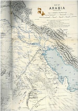
Map of Arabia. G.S. 4016.
Verlag: London, published at the Survey of Egypt for Arab Bureau, under authority from the War Office, Sept. 1916., 1916
Anbieter: Antiquariat INLIBRIS Gilhofer Nfg. GmbH, Vienna, A, Österreich
Verbandsmitglied: ILAB VDA VDAO
Bewertung:
794 x 628 mm. Scale 1:4,000,000. Mounted on cloth. Folded. Rare, large-scale map of western Arabia including all but the easternmost part of the Peninsula (ending about 100 miles east of Qatar). "This map has been compiled almost entirely from published sources, of which the principal are (1) Hunter's Arabia 1:2,000,000; (2) War Office quarter inch of S.W. Arabia; (3) War Office 1:250,000 of the rest of the Turkish Empire; R.G.S. materials have also been used" (editor's note). Some slight brownstaining in places, otherwise well-preserved. - Not in OCLC.
-
![Bild des Verkäufers für Jazirat al-'Arab wa-al-manatiq al-mutakhimah la-ha: kharitah tamhidiyah [The Arabian Peninsula and neighboring regions: an introductory map]. G-1-AA-1. zum Verkauf von Antiquariat INLIBRIS Gilhofer Nfg. GmbH](https://pictures.abebooks.com/inventory/md/md31732615078.jpg)
Jazirat al-'Arab wa-al-manatiq al-mutakhimah la-ha: kharitah tamhidiyah [The Arabian Peninsula and neighboring regions: an introductory map]. G-1-AA-1.
Verlag: Dharan, Arabian-American Oil Company, 1950-52 CE = 1369-71 H., 1950
Anbieter: Antiquariat INLIBRIS Gilhofer Nfg. GmbH, Vienna, A, Österreich
Verbandsmitglied: ILAB VDA VDAO
Bewertung:
Colour-printed map, 80 x 118 cm. Scale 1:4,000,000. Includes location map in the form of 2 hemispheres. Rare ARAMCO-issued wall map of the Arabian Peninsula, "prepared by the U.S. Ministry of the Interior and the U.S. Geological Survey, under the auspices of the Kingdom of Saudi Arabia, the Ministry of Petroleum and Mineral Resources, and the US Department of State". Printed entirely in Arabic; the annotations read: "The locations included in the basis of this map are dependent upon the best information available to us at their composition in 1942. The exact location of many of these locations goes back to the what the analyses and journies of foreigners showed and is therefore subject to modification. This map does not denote the borders in obscure regions". Other notes on the map indicate that the borders in the southeast, southwest, the Empty Quarter, and the northwest have not been delineated. Curiously, the map retains the designation "Al-khalij al-farsi" for the Arabian (Persian) Gulf, reflecting Arab-world naming conventions of the early 1950s. - Paper brittle; edges chipped; some repairs. Very rare: in spite of having been co-produced by the U.S. Government, today the only copies listed in research collections are those at Princeton, at the University of Manchester, and at the Beirut Library of Human Sciences. A greatly reduced new edition, measuring only 46 x 62 cms, was issued by Archive Editions in 1992. - OCLC 642632543.
-
Map: Prepared by the US Geological Survey and the Arabian American Oil Company under the joint sponsorship of the Kingdom of Saudi Arabia, Ministry of Finance and National Economy, and the US Department of State. Map 1-270 B-1. Scale 1:2,000,000.
Verlag: Washington, DC: US Geological Survey, 1958, 1958
Anbieter: Peter Harrington. ABA/ ILAB., London, Vereinigtes Königreich
Verbandsmitglied: ABA ILAB PBFA
Bewertung:
Erstausgabe
First edition of this impressively sized and important map; it shows the entire peninsula, including modern-day Bahrain, Kuwait, Oman, Qatar, the United Arab Emirates, and Yemen, and was the work of a team lead by the distinguished geologist Glen F. Brown, whose trailblazing work on surface geology, with its emphasis on water resources, minerals, and oil, pertains to this day. Brown (1911-2001) cut his teeth in mineral and coal investigations in South China and the Philippines and ground water investigations in Mississippi and Colorado, the latter mostly concerned with supplying water to military installations. In response to a request from Ibn Sa'ud for assistance from the United States Geological Survey (USGS), Brown was selected in 1944 to investigate water supplies in the Saudi Arabian desert. He "arrived in Saudi Arabia early in 1945 and joined a mission sponsored by the US Foreign Economic Administration to study possibilities for agricultural development in central Arabia. As part of the mission [Brown] carried out a detailed investigation of the geologic formations in the Al Kharj district and identified substantial ground-water resources in buried aquifers. His report on the results of that investigation was very enthusiastically received by Saudi officials. [Brown returned to Saudi Arabia at the request of Ibn Saud] to conduct reconnaissance geologic mapping, mineral evaluation, and water-resource studies in the western and central parts of the kingdom. The mapping was carried forward from 1950 to 1958 by [Brown] with USGS and Saudi associates and extended to the entire Arabian Peninsula in cooperation with the Arabian American Oil Company (Aramco), as well as to organizations and companies of other countries in the peninsula. This resulted in a remarkable series of bilingual geologic and geographic maps of Saudi Arabia at a scale of 1:500,000, and a geologic and geographic map of the entire Arabian Peninsula at a scale of 1:2,000,000, all of which were published by the USGS. These maps, together with reports on the geology, mineral deposits, and water resources prepared by [Brown] and his associates, providing the basis for Saudi Arabia to undertake a major national resource exploration and development program" (obituary Geological Society of America). As is stated in the legend: "this map has been prepared as a base for a geologic map in preparation". This point is elucidated in the official report that Brown co-wrote in 1989 (USGS Professional Paper 560-A): "while preparation of the geographic sheets was in progress, a need arose for early publication of a 1:2,000,000-scale peninsular geographic map. Consequently, a preliminary edition was compiled and published in both English and Arabic in 1958". The present map, in English, is from that preliminary edition - the basis for all future cartography of its kind in the region. Geographic compilation notes add that, where photography was unavailable, "World Aeronautical Charts, British War Office 1:1,000,000 and 1:250,000 maps, and ground traverse data were used". In addition to geographical features, towns, villages, roads (primary and secondary), trails, railways, stations, airports, landing fields, and ruins are all shown, as well as water pipelines, "important desert watering places", oilfields, pipelines, terminals, pumping stations, refineries, and mines. Glen F. Brown, Dwight L. Schmidt & A. Curtis Huffman, Jr., "Geology of the Arabian Peninsula: Shield Area of Western Saudi Arabia", U. S. Geological Survey Professional Paper 560-A, 1989. Colour map (1,195 x 1,375 mm). Housed in a black cloth flat-back box with chemise by the Chelsea Bindery. Creased where folded, a few other light creases to left hand side, overall in excellent condition.
-
Omoumi Mamalik Mahrousi Shahani [General map of the protected countries. Ottoman Empire].
Verlag: Istanbul, Matbaa-i Amire [Imperial Military Press], [1896 CE =] 1312 H., 1896
Anbieter: Antiquariat INLIBRIS Gilhofer Nfg. GmbH, Vienna, A, Österreich
Verbandsmitglied: ILAB VDA VDAO
Bewertung:
Karte
150 x 130 cm. Scale: 1:3,000,000. Colour lithograph, dissected into 24 sections and mounted on original linen. Very rare, monumental wall map of the Ottoman Empire, featuring one of the largest and most detailed printed representations of the Arabian Peninsula produced in the Islamic World prior to World War I. Perhaps more than any other map, it reveals the immense logistic challenges faced by Hajj pilgrims just in advance of the construction of the Baghdad and Hejaz Railway systems. Printed for official use, the map appeared at a time when the Sublime Porte was going to great lengths to shore up its authority in the Red Sea region (Hejaz, Asir, and Yemen), while being pressured by Britain to retreat from the domains it claimed in the Arabian Gulf (Kuwait, Al-Qatif/Hofuf, and Qatar). - Indeed, the present map would have been of great value to Ottoman generals and cabinet officials for strategic planning, as Arabia was increasingly a focus of global attention and interference. It served as the ideal strategic aid to chart the future construction of the Hejaz Railway (built 1900-08) and the Baghdad Railway (extended from the Anatolian Railway, from 1903 onwards) and delineates some of the world's most strategically important railway lines before 1900. - The main map encompasses most of the Arabian Peninsula, from Qatar and the Hadramaut westwards (while far eastern Arabia, including Oman and what is today the United Arab Emirates is featured in an inset, lower left). The coastlines and rivers are crisply depicted; mountain ranges are expressed by delicate tan shading; all cities and towns of note are labelled; the names of regions and tribal areas are revealed, while all key roads and Hajj caravan routes are delineated. The map features stellar coverage of the western Gulf region, labelling Qatar (then an autonomous part of the Ottoman Empire), Bahrain (a British protectorate prized for its fine natural harbour), and Kuwait, an autonomous Sheikhdom within the Ottoman Empire that would shortly become a British protectorate. Inland, the map details the Saudi-Wahhabi domain Nejd, with its capital Riyadh, while to the northwest lies the territory of the rival Al-Rashid clan, with its capital Ha il. - Minor soiling and waterstaining, occasional light edge wear. Tears in linen partly repaired. A rare survival. - Osmanli cografya literatürü tarihi [History of geographical literature during the Ottoman period], pp. 756f. David Rumsey Map Collection 13186.000 (the single other copy known in the trade). Not in Al-Qasimi collection (1493-1931).
-
![Bild des Verkäufers für [Map of the Eastern Arabian Peninsula]. zum Verkauf von Antiquariat INLIBRIS Gilhofer Nfg. GmbH](https://pictures.abebooks.com/inventory/md/md30657309763.jpg)
[Map of the Eastern Arabian Peninsula].
Verlag: No place or date (but probably 1970s)., 1970
Anbieter: Antiquariat INLIBRIS Gilhofer Nfg. GmbH, Vienna, A, Österreich
Verbandsmitglied: ILAB VDA VDAO
Bewertung:
32 photocopies in polypouch binder (ca. 23 x 34 cm). Highly detailed and extensively hand-annotated map of the eastern end of the Peninsula, photocopied from the one-million scale pilots' ONC maps (Operational Navigation Chart) as a set of 32 sheets and self-assembled by a traveller to the region. Covers Oman, including the eastern portion of the United Arab Emirates and Saudi Arabia. The repeated notations, "maximum elevation believed not to exceed 200 feet" and "limits of reliable relief information" bear witness to the measure in which the inner Peninsula still constituted frontier country in the later 20th century.
-
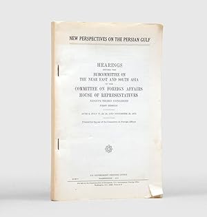
New Perspectives on the Persian Gulf.
Verlag: Washington DC: U. S. Government Printing Office, 1973, 1973
Anbieter: Peter Harrington. ABA/ ILAB., London, Vereinigtes Königreich
Verbandsmitglied: ABA ILAB PBFA
Bewertung:
Erstausgabe
First edition, first printing, of this fascinating document, prepared for the US Government's Committee on Foreign Affairs to consider US interests in and policies towards the Persian Gulf, in the lead up to and immediately following the oil price shock of October 1973: "If the Persian Gulf appeared to some Americans to be a remote, and perhaps inconsequential part of the world at the beginning of 1973, it was, by the end of the year, an area of major interest and speculation for many Americans" (Lee H. Hamilton, chair, Subcommittee on the Near East and South Asia (p. v). Through a series of witness statements and memoranda, this paper covers arms supply policy to Saudi Arabia, Kuwait and the lower Gulf states and Iran since 1942, its regional and international implications (Iraq, Yemen, the Arab-Israeli conflict, the Cold War), and how this policy alone is insufficient to build the desired political and economic relations with Gulf states; Saudi-Iran relations (rivalry over the Arabian Gulf (the Shah's perception of this as "his lake"), and mutual mistrust of the USSR; the need to promote non-oil economic and trade relations and development (a neglected area, in which Japanese business is perceived as being ahead of the game). Octavo. Original printed self-wrappers, wire stitched as issued. Short closed tear and curling at foot of front wrapper. In excellent condition.
-
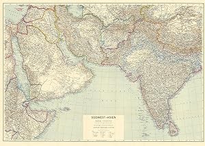
Südwest-Asien. 1:5,000,000. Grundlage: Stielers Handatlas.
Verlag: Gotha, Justus Perthes, 1942., 1942
Anbieter: Antiquariat INLIBRIS Gilhofer Nfg. GmbH, Vienna, A, Österreich
Verbandsmitglied: ILAB VDA VDAO
Bewertung:
117 x 78 cm. Constant ratio linear horizontal scale: 1:5,000,000. Relief shown by hachures, contours, and spot heights. Depth shown by soundings. Loosely stored within printer wrappers. Third edition of this German wartime map of the Middle East, parts of Asia, and India, first published thus in 1940. Based on "Stielers Handatlas" and issued within Perthes' "Ubique terrarum" series (no. 20). - In excellent state of preservation, detached from its original wrappers. - OCLC 164843864.
-
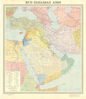
Jugo-zapadnaja Azija.
Verlag: Moscow, [Main Directorate of Geodesy and Cartography under the Council of Ministers of the USSR], 1972., 1972
Anbieter: Antiquariat INLIBRIS Gilhofer Nfg. GmbH, Vienna, A, Österreich
Verbandsmitglied: ILAB VDA VDAO
Bewertung:
82 x 96 cm. Original colour-printed map. Scale 1:5,000,000. Rare political map of Southwest Asia from the Cold War era, centred on the Arabian Peninsula and the Gulf region but including Turkey and the Levant, Iraq and Iran. With Cyrillic titles and captions. - Small marginal flaws.
-
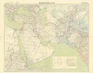
Vorderasien. 1:5,000,000.
Verlag: [Berlin], German General Staff, 1941., 1941
Anbieter: Antiquariat INLIBRIS Gilhofer Nfg. GmbH, Vienna, A, Österreich
Verbandsmitglied: ILAB VDA VDAO
Bewertung:
Erstausgabe
Colour-printed map, ca. 124 x 97 cm. Constant ratio linear horizontal scale 1:5,000,000. Conic projection. Rare German military wall map of the Near and Middle East, produced during the Second World War for the German General Staff. Marked as "First special edition, for service use only!". Shows international and administrative boundaries, as well as railways, roads, tracks, telegraph lines, and oil pipelines. - Traces of folds; a few minor edge chips. Formerly in the collections of the Geographical Institute of the University of Berlin with the Institute's stamp and pencil shelfmark. - OCLC 49986920.
-
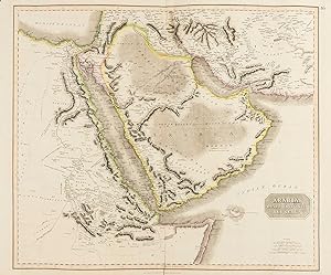
Arabia, Egypt, Abyssinia, Red Sea &c.
Verlag: [Edinburgh, John Thomson & Co., ca. 1823]., 1823
Anbieter: Antiquariat INLIBRIS Gilhofer Nfg. GmbH, Vienna, A, Österreich
Verbandsmitglied: ILAB VDA VDAO
Bewertung:
Engraved map in hand-drawn outline colour. 720 x 533 mm. Constant ratio linear horizontal scale 1:7,000,000. Relief shown by hachures and shading. Greenwich meridian. A fine engraved map of the Arabian Peninsula, also showing the Arabian Gulf, the Red Sea, and the Horn of Africa. Shows boundaries, rivers, deserts, caravan routes and principal settlements. With early outline hand-colouring on wove paper with watermark date of "1823". Also issued as plate 46 in Thomson's "A New General Atlas" (1821-29). - Well preserved. - Cf. Al-Qasimi (2nd ed.) pp. 255 & 258. Tooley's IV, 271. OCLC 43216571.
-
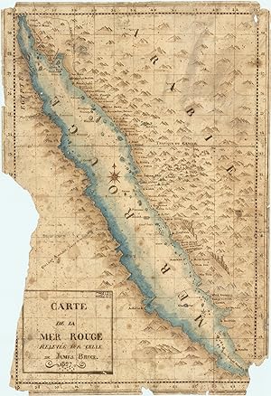
Carte de la mer Rouge, relevée sur celle de James Bruce.
Verlag: [Egypt, probably Cairo], 1827., 1827
Anbieter: Antiquariat INLIBRIS Gilhofer Nfg. GmbH, Vienna, A, Österreich
Verbandsmitglied: ILAB VDA VDAO
Bewertung:
Signiert
Manuscript map. Single sheet, folio (458 x 316 mm). Watercolour in pen and ink with French text on Middle Eastern hand-made paper. The extreme left side with a section including the line of longitude torn away; further marginal chipping, especially to corners; several longer tears expertly restored. Several contemporary inscriptions in Arabic on verso. A hand-drawn map of the Red Sea region of Arabia, based on a Western map but with compelling provenance from early 19th-century Egypt, where it was apparently prepared, bearing contemporary Arabic notes on the reverse. While based on the excellent map published in James Bruce's "Travels to Discover the Source of the Nile" (1790), a more exact work of cartography than previously available and originally titled "Chart of the Arabian Gulf with its Egyptian, Ethiopian and Arabian Coasts", the present manuscript copy is to a different scale and features an enlarged, improved detail showing only the Red Sea and its environs, revealing a particular local interest in the region during the early 19th century. The Egyptian copyist follows the coast from the Sinai Peninsula along what is today south-western Saudi Arabia as far south as Mocha in Yemen, and includes the holy cities of Mecca and Medina. The copy bears a French title, with the date 1827, in a cartouche at the lower left. A French translation of Bruce's work appeared in 1790-92, but no edition was published in 1827, which may therefore be presumed to be the date of execution of this copy. - The Arabic inscriptions on the map's otherwise blank verso include one by Ibrahim Khwajah al-Sarraf (i.e. Ibrahim Khwajah the moneychanger), dated "Misr 1223" (Cairo/Egypt, 1808/09 CE), which appears to indicate that the sheet of paper was made well before the map. Another inscription is signed "Sikandariyah 1244" (Alexandria 1828/29 CE), along with a religious invocation apparently including part of the genealogy of Jesus Christ from the Gospel of Matthew. - A rare document of early 19th century Middle Eastern cartography adapted from a Western source.
-
Aravijskij poluostrov. B-2118.
Verlag: Moskva, glavnoe upravlenie geodezii i kartografii pri sovete ministrov SSSR, 1977., 1977
Anbieter: Antiquariat INLIBRIS Gilhofer Nfg. GmbH, Vienna, A, Österreich
Verbandsmitglied: ILAB VDA VDAO
Bewertung:
Scale 1:4,000,000. Equal-area conic projection (ravnougol'naia konicheskaia proektsiia). Relief shown by gradient tints, shading, and spot heights. Depths shown by gradient tints and soundings. 77 x 65.5 cm. Index printed on verso. Stored in original printed sleeve. Re-issued third edition of the Soviet 1:4,000,000 reference map of the Arabian Peninsula, edited by N. I. Arep'ev with O. L. Kuznechov and K. D. Volkov. Includes insets (in 1:15,000,000 scale): "Ekonomicheskaia karta", "Karta plotnosti naseleniia i razmeshcheniia arabskikh plemen". - Old reference label "2" pasted to sleeve's cover. In excellent condition. Rare.
-
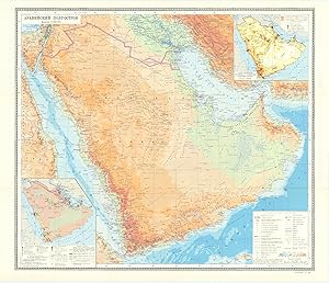
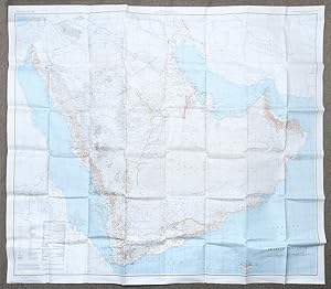
[United States Geological Survey of the Kingdom of Saudi Arabia]. Arabian Peninsula. Map I-270 B-2.
Verlag: Washington, D.C., The Survey (U.S. Geological Society), 1967., 1967
Anbieter: Antiquariat INLIBRIS Gilhofer Nfg. GmbH, Vienna, A, Österreich
Verbandsmitglied: ILAB VDA VDAO
Bewertung:
Large chromolithographed map (122 x 139 cm). Scale 1:2,000,000. On cloth. Second edition. A highly detailed map of the complete Peninsula, the first modern map in 1:2,000,000 scale. Based on the groundbreaking series prepared by the U.S. Geological Survey and the Arabian American Oil Company under the joint sponsorship of Saudi Arabia and the U.S. State Department, "a unique experiment in geological cooperation among several governments, petroleum companies, and individuals" (Seager/Johnston). Also includes the territories of today's Kuwait, Qatar, Bahrain, United Arab Emirates, Oman, and Yemen. "The plan for a cooperative mapping project was originally conceived in July 1953 [. By 1955] there was established a cooperative agreement between the Kingdom of Saudi Arabia, the U.S. Department of State, and the Arabian-American Oil Co. to make available the basic areal geology as mapped by Aramco and the U.S. Geological Survey" (ibid.). The plan provided for 21 maps on a 1:500,000 scale in both geologic and geographic versions; "a peninsular geologic map on a scale of 1:2,000,000 was to conclude the project [.] The first geographic quadrangle was published in July 1956 and the last in September 1962. While preparation of the geographic sheets was in progress, a need arose for early publication of a 1:2,000,000-scale peninsular geographic map. Consequently, a preliminary edition was compiled and published in both English and Arabic in 1958" (ibid.). This revised, final version ("I-270 B-2") that first appeared in 1963 incorporated additional photographic, topographic and cultural data. The present map, printed in 1967, is a re-issue of the 1963 edition, merely differing in the date. Includes a key with symbols for water pipelines, desert watering points, oil fields, pumping stations, refineries, and a glossary of Arabic names. - "Although the search for oil, gas and minerals was ultimately to drive geological survey work across the region [.], in its early years it was the need for water that was the catalyst for Saudi Arabia's resource exploration. In 1944 King 'Abd al-'Aziz approached the United States for a technical expert who could assist with the identification and plotting of the kingdom's natural resources, particularly its groundwater reserves. The individual who arrived, Glen F. Brown, was one of the pioneers of a partnership between the United States Geological Survey (USGS) and the government of Saudi Arabia that was to span the next five decades and play an important role in the development of the kingdom [.] By 1954 the Saudi Ministry of Finance, USGS and Aramco were working together to produce the first full series of geographic and geologic maps of the country. The first of their type in the Peninsula, these were published [.] in both Arabic and English versions, and the information they contained formed the basis of subsequent Saudi national development plans. To this day, all modern maps of the kingdom trace their roots back to these first publications" (Parry). - Several small tears and paper loss to right and upper margin, professionally restored. - James V. Parry, "Mapping Arabia", in: Saudi Aramco World 2004/1, p. 20ff. OCLC 6681002. O. A. Seager/W. D. Johnston, Foreword to the Geology of the Arabian Peninsula series (U.S. Geological Survey Professional Paper 560-A-D, 1966).
-
![Bild des Verkäufers für Neft ba-mizrah ha-tikhon. Zikaynot, shadot, tzinorot, batei zikuk. [= Oil in the Middle East. Concessions, oilfields, pipelines, refineries].Tel Aviv, Israel Defence Forces, General Staff, [1957]. 56 x 82.5 cm. Chromolithographic map of the Arabian Peninsula, from Turkey in the north to the Indian Ocean in the south, and covering Saudi Arabia, Egypt, Israel, Palestine, Jordan, Syria, Lebanon, Iraq, Iran, Kuwait, Bahrain, Qatar, United Arab Emirates, Oman, North and South Yemen. Scale 1:5,000,000. Scale and key in Hebrew inset to top-right, inset explanatory panels in Hebrew and English, compass rose in Saudi Arabia. Folded. zum Verkauf von Antiquariaat FORUM BV](https://pictures.abebooks.com/inventory/md/md31087900727.jpg)
Neft ba-mizrah ha-tikhon. Zikaynot, shadot, tzinorot, batei zikuk. [= Oil in the Middle East. Concessions, oilfields, pipelines, refineries].Tel Aviv, Israel Defence Forces, General Staff, [1957]. 56 x 82.5 cm. Chromolithographic map of the Arabian Peninsula, from Turkey in the north to the Indian Ocean in the south, and covering Saudi Arabia, Egypt, Israel, Palestine, Jordan, Syria, Lebanon, Iraq, Iran, Kuwait, Bahrain, Qatar, United Arab Emirates, Oman, North and South Yemen. Scale 1:5,000,000. Scale and key in Hebrew inset to top-right, inset explanatory panels in Hebrew and English, compass rose in Saudi Arabia. Folded.
Anbieter: Antiquariaat FORUM BV, Houten, Niederlande
Bewertung:
Extremely rare Israeli strategic map of the Arabian Peninsula showing oilfields and associated infrastructure. Printed in black, red and blue, the map demarks the political boundaries of the time along with the areas covered by oil companies concessions. Pipelines form a web across the northern part of the Arabian Peninsula (shown in an uncommon vertical orientation), while oilfields and refineries, large and small, are also marked. The IDF probably made the map in responce to the 1956 Suez Crisis and its associated geopolitical shifts. With the Egyptians operating the Suez Canal, and the USA forcing Britain and France to abandon their post-imperial plans, Israel now counted in both U.S. and Soviet plans for their control of Middle Eastern politics. Britain had to anchor its Middle Eastern influence in Cyprus, Aden and Iraq, while the increased American influence can be seen in the huge swathe of territory assigned to Aramco. We have located only one institutional copy of this map, in the National library of Israel.With traces of pins from former wall mounting. A couple of small light stains, some uneven creasing and tears at the edges of some folds and a couple tiny holes where the folds cross. Otherwise in good condition.
-
Carte de la mer Rouge, relevée sur celle de James Bruce.[Egypt, probably Cairo], 1827. Folio leaf (46 x 31.5 cm). Manuscript map in pen and ink with watercolour, with a French text on Middle Eastern hand-made paper.
Anbieter: Antiquariaat FORUM BV, Houten, Niederlande
Bewertung:
Signiert
A hand-drawn map of the Red Sea region of Arabia, based on a Western printed map but with compelling evidence that it originated in early 19th-century Egypt, where it was apparently prepared, and with contemporary Arabic notes on the back. While based primarily on the excellent map published in James Bruce's Travels to discover the source of the Nile (1790), with more accurate cartography than any previously available, the present manuscript, drawn on a larger scale, is an enlarged, improved detail showing only the Red Sea and its environs, revealing a particular local interest in the region during the early 19th century. The Egyptian copyist follows the coast from the Sinai Peninsula along what is today southwestern Saudi Arabia as far south as Mocha in Yemen, and includes the holy cities of Mecca and Medina. The copy bears a French title, dated 1827, in a cartouche at the lower left. A French translation of Bruce's work appeared in 1790-92, but no edition was published in 1827, which we therefore suppose to be the date of execution of the present manuscript copy.With several contemporary inscriptions in Arabic on the back, including one by Ibrahim Khwajah al-Sarraf (i.e. Ibrahim Khwajah the money changer), dated "Misr 1223" (Cairo/Egypt, 1808/09 CE), which appears to indicate that the sheet of paper was made and in use well before the map was drawn. Another inscription is signed "Sikandariyah 1244" (Alexandria 1828/29 CE), along with a religious invocation apparently including part of the genealogy of Jesus Christ from the Gospel of Matthew. The extreme left side with a section, including one meridian, torn away; further marginal chipping, especially in the corners; several longer tears expertly restored. Otherwise in good condition. A rare document of early 19th-century Middle Eastern cartography adapted from a Western source.
-
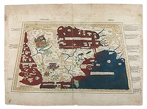
![Bild des Verkäufers für Sexta Asiae tabula.[Rome, Petrus de Turre, 1490 (engraved Rome, ca. 1478)]. Engraved map of the Arabian peninsula (topographic image 25.5 x 46 cm) printed, as usual, on two joined folio leaves (together 39.5 x 56 cm). Mounted on paper board, in a modern gilt frame (50.5 x 67 cm). zum Verkauf von Antiquariaat FORUM BV](https://pictures.abebooks.com/inventory/md/md30605216061.jpg)
Sexta Asiae tabula.[Rome, Petrus de Turre, 1490 (engraved Rome, ca. 1478)]. Engraved map of the Arabian peninsula (topographic image 25.5 x 46 cm) printed, as usual, on two joined folio leaves (together 39.5 x 56 cm). Mounted on paper board, in a modern gilt frame (50.5 x 67 cm).
Anbieter: Antiquariaat FORUM BV, Houten, Niederlande
Bewertung:
Second map of the Arabian peninsula ever published, in its first state. It was originally engraved as part of the extraordinary 1478 Rome edition of Ptolemy s Geographia, and the map was preceded by only the one published in the less detailed and crudely engraved Bologna edition published in 1477. It shows the city of Medina (Lathrippa) and the archaeological sites of Zubarah (Catara), and Al-Dur (Domana). The association of Macoraba with Mecca is disputed.The 1478 Geographia was created under the direction of Conrad Sweynheym, who together with Arnold Pannartz introduced printing to Italy, and after his death in 1477 finished by his successor Arnold Buckinck. The edition was planned as early as 1474 and possibly even 1473 and the plates were likely engraved before the publication of the 1477 Bologna edition. These two atlases contain the earliest copperplate maps ever produced and Sweynheym s careful experiments clearly paid off: "its firm, sure lines and crisp impression are in sharp contrast to the rather crudely engraved and muddily printed Bologna edition" (Karrow). "Many consider the Rome plates to be the finest Ptolemaic plates produced until Gerard Mercator engraved his classical world atlas of 1578" (Shirley). Christopher Columbus bought a copy.The map was reprinted unchanged in the Rome edition of 1490, published by De Turre, and again in a 1507 edition, reissued in 1508. It is here printed on two folio leaves, each watermarked with a cardinal's hat (the two slightly different and probably the twins of a single paper stock). They are very close to Briquet 3391 (Florence 1491), so our map probably comes from the 1490 edition.Some faint stains along the edges of the paper and in the gutter, small restoration in gutter of the lower margin and a very minor tear near the upper left corner. In good condition.l Campbell, Earliest printed maps, map 141 & atlas D42 (pp. 131-133), cf. pp. 122-127, 223-225; Nordenskiöld 201, map 21; Tibbetts 4 note; cf. Al Ankary 3 (1511?); Karrow 32/B1 (atlas, 1478 ed.); Shirley, Maps in atlases T.POL-2c (atlas, 1490 ed.); Shirley, Mapping of the world 4 note (atlas, 1490 ed.).
-
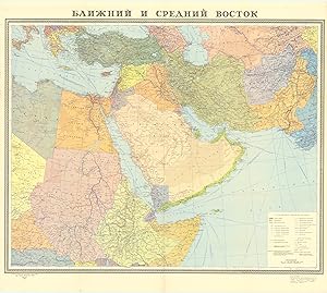
Blizhnij i srednij vostok.
Verlag: Moscow, [Main Directorate of Geodesy and Cartography under the Council of Ministers of the USSR], 1972., 1972
Anbieter: Antiquariat INLIBRIS Gilhofer Nfg. GmbH, Vienna, A, Österreich
Verbandsmitglied: ILAB VDA VDAO
Bewertung:
88 x 100 cm. Original colour-printed map. Scale 1:6,000,000. Rare political map of the Middle East from the Cold War era, centred on the Arabian Peninsula and the Gulf region, but also comprising Egypt, Sudan, Ethiopia and Somalia, as well as Greece, Turkey and the Levant, Iraq, Iran, Pakistan, and Afghanistan. With Cyrillic titles and captions. - Small marginal flaws.
-
[United States Geological Survey of the Kingdom of Saudi Arabia]. Arabian Peninsula. Map I-270 B-1.
Verlag: Washington, D.C., The Survey (U.S. Geological Society), 1958., 1958
Anbieter: Antiquariat INLIBRIS Gilhofer Nfg. GmbH, Vienna, A, Österreich
Verbandsmitglied: ILAB VDA VDAO
Bewertung:
1380:1216 mm. Lambert conformal conic projection, constant ratio linear horizontal scale 1:2,000,000. Relief shown by hachures and spot heights. Folded. A highly detailed map of the complete Peninsula, the first modern map in 1:2,000,000 scale: the rare preliminary edition, issued five years before the officical release. Based on the groundbreaking series prepared by the U.S. Geological Survey and the Arabian American Oil Company under the joint sponsorship of Saudi Arabia and the U.S. State Department, "a unique experiment in geological cooperation among several governments, petroleum companies, and individuals" (Seager/Johnston). Also includes the territories of today's Kuwait, Qatar, Bahrain, United Arab Emirates, Oman, and Yemen. "The plan for a cooperative mapping project was originally conceived in July 1953 [. By 1955] there was established a cooperative agreement between the Kingdom of Saudi Arabia, the U.S. Department of State, and the Arabian-American Oil Co. to make available the basic areal geology as mapped by Aramco and the U.S. Geological Survey" (ibid.). The plan provided for 21 maps on a 1:500,000 scale in both geologic and geographic versions; "a peninsular geologic map on a scale of 1:2,000,000 was to conclude the project [.] The first geographic quadrangle was published in July 1956 and the last in September 1962. While preparation of the geographic sheets was in progress, a need arose for early publication of a 1:2,000,000-scale peninsular geographic map. Consequently, a preliminary edition was compiled and published in both English and Arabic in 1958" (ibid.). While the revised, final version that appeared in 1963 ("I-270 B-2") would incorporate some additional photographic, topographic and cultural data, the exceedingly uncommon present, preliminary edition is surprisingly complete in virtually all respects - a testament to the precision with which Aramco's cartographers proceeded from the very first. Includes a key with symbols for water pipelines, desert watering points, oil fields, pumping stations, refineries, and a glossary of Arabic names. - "Although the search for oil, gas and minerals was ultimately to drive geological survey work across the region [.], in its early years it was the need for water that was the catalyst for Saudi Arabia's resource exploration. In 1944 King 'Abd al-'Aziz approached the United States for a technical expert who could assist with the identification and plotting of the kingdom's natural resources, particularly its groundwater reserves. The individual who arrived, Glen F. Brown, was one of the pioneers of a partnership between the United States Geological Survey (USGS) and the government of Saudi Arabia that was to span the next five decades and play an important role in the development of the kingdom [.] By 1954 the Saudi Ministry of Finance, USGS and Aramco were working together to produce the first full series of geographic and geologic maps of the country. The first of their type in the Peninsula, these were published [.] in both Arabic and English versions, and the information they contained formed the basis of subsequent Saudi national development plans. To this day, all modern maps of the kingdom trace their roots back to these first publications" (Parry). - In excellent condition. - James V. Parry, "Mapping Arabia", in: Saudi Aramco World 2004/1, p. 20ff. OCLC 30099393. O. A. Seager/W. D. Johnston, Foreword to the Geology of the Arabian Peninsula series (U.S. Geological Survey Professional Paper 560-A-D, 1966).
-
![Bild des Verkäufers für [United States Geological Survey of the Kingdom of Saudi Arabia]. Arabian Peninsula. Map I-270 B-1. zum Verkauf von Antiquariat INLIBRIS Gilhofer Nfg. GmbH](https://pictures.abebooks.com/inventory/md/md30912223282.jpg)
[United States Geological Survey of the Kingdom of Saudi Arabia]. Arabian Peninsula. Map I-270 B-1.
Verlag: Washington, D.C., The Survey (U.S. Geological Society), 1958., 1958
Anbieter: Antiquariat INLIBRIS Gilhofer Nfg. GmbH, Vienna, A, Österreich
Verbandsmitglied: ILAB VDA VDAO
Bewertung:
1380 × 1216 mm. Lambert conformal conic projection, constant ratio linear horizontal scale 1:2,000,000. Relief shown by hachures and spot heights. Framed and glazed. A highly detailed map of the complete Peninsula, the first modern map in 1:2,000,000 scale: the rare preliminary edition, issued five years before the officical release. Based on the groundbreaking series prepared by the U.S. Geological Survey and the Arabian American Oil Company under the joint sponsorship of Saudi Arabia and the U.S. State Department, "a unique experiment in geological cooperation among several governments, petroleum companies, and individuals" (Seager/Johnston). Also includes the territories of today's Kuwait, Qatar, Bahrain, United Arab Emirates, Oman, and Yemen. "The plan for a cooperative mapping project was originally conceived in July 1953 [. By 1955] there was established a cooperative agreement between the Kingdom of Saudi Arabia, the U.S. Department of State, and the Arabian-American Oil Co. to make available the basic areal geology as mapped by Aramco and the U.S. Geological Survey" (ibid.). The plan provided for 21 maps on a 1:500,000 scale in both geologic and geographic versions; "a peninsular geologic map on a scale of 1:2,000,000 was to conclude the project [.] The first geographic quadrangle was published in July 1956 and the last in September 1962. While preparation of the geographic sheets was in progress, a need arose for early publication of a 1:2,000,000-scale peninsular geographic map. Consequently, a preliminary edition was compiled and published in both English and Arabic in 1958" (ibid.). While the revised, final version that appeared in 1963 ("I-270 B-2") would incorporate some additional photographic, topographic and cultural data, the exceedingly uncommon present, preliminary edition is surprisingly complete in virtually all respects - a testament to the precision with which Aramco's cartographers proceeded from the very first. Includes a key with symbols for water pipelines, desert watering points, oil fields, pumping stations, refineries, and a glossary of Arabic names. - "Although the search for oil, gas and minerals was ultimately to drive geological survey work across the region [.], in its early years it was the need for water that was the catalyst for Saudi Arabia's resource exploration. In 1944 King 'Abd al-'Aziz approached the United States for a technical expert who could assist with the identification and plotting of the kingdom's natural resources, particularly its groundwater reserves. The individual who arrived, Glen F. Brown, was one of the pioneers of a partnership between the United States Geological Survey (USGS) and the government of Saudi Arabia that was to span the next five decades and play an important role in the development of the kingdom [.] By 1954 the Saudi Ministry of Finance, USGS and Aramco were working together to produce the first full series of geographic and geologic maps of the country. The first of their type in the Peninsula, these were published [.] in both Arabic and English versions, and the information they contained formed the basis of subsequent Saudi national development plans. To this day, all modern maps of the kingdom trace their roots back to these first publications" (Parry). - Some insignificant browning; a few slight edge defects professionally repaired. Altogether in fine condition. - James V. Parry, "Mapping Arabia", in: Saudi Aramco World 2004/1, p. 20ff. OCLC 30099393. O. A. Seager/W. D. Johnston, Foreword to the Geology of the Arabian Peninsula series (U.S. Geological Survey Professional Paper 560-A-D, 1966).
-
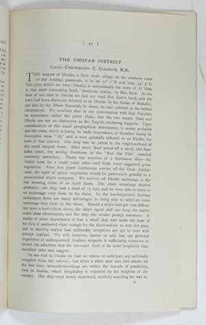
The Dhofar District. (From: The Geographical Journal. Vol. LXIII No. 2 [February 1919]).
Verlag: London, The Royal Geographical Society, 1919., 1919
Anbieter: Antiquariat INLIBRIS Gilhofer Nfg. GmbH, Vienna, A, Österreich
Verbandsmitglied: ILAB VDA VDAO
Bewertung:
8vo. pp. 97-105. With 2 photoplates. Modern wrappers. Early account of a visit to the seaport of Dhofar (Oman) on the southern coast of the Peninsula, including an interesting account of the local boats and the sailing skills of their owners. The illustrations show Makalla in Hadramaut, a camel drawing water in Dhofar, and the ruins of the temple of al-Bilad. - Macro, Bibliography of the Arabian Peninsula, 777. OCLC 49427292.
-
The Dhofar District. In: The Geographical Journal. Vol. LXIII No. 2 (February 1919).
Verlag: London, The Royal Geographical Society, 1919., 1919
Anbieter: Antiquariat INLIBRIS Gilhofer Nfg. GmbH, Vienna, A, Österreich
Verbandsmitglied: ILAB VDA VDAO
Bewertung:
8vo. pp. 97-105 (entire volume: iv, 65-128 pp., with 18 photographic illustrations and a folding colour map). Original printed blue wrappers. Early account of a visit to the seaport of Dhofar (Oman) on the southern coast of the Peninsula, including an interesting account of the local boats and the sailing skills of their owners. The illustrations show Makalla in Hadramaut, a camel drawing water in Dhofar, and the ruins of the temple of al-Bilad. - Macro 777. OCLC 49427292.
-
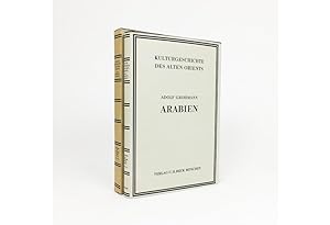
ARABIAN PENINSULA: KULTURGESCHICHTE DES ALTEN ORIENTS. DRITTER ABSCHNITT, VIERTER UNTERABSCHNITT: ARABIEN.
Verlag: München: C. H. Beck 196
Anbieter: Antiquariat Dasa Pahor GbR, München, Deutschland
Bewertung:

Buch
Small 4°: 307 pp. with illustrations in text, XXVIII illustrations, colour folding map, black linen binding with gilt title on spine, original tan dust jacket with printed black title, original box (Mint condition A detailed illustrated work on Arabic archeological discoveries by an Austrian scientist Adolf Grohmann (1887 1977) was published in a series of books on cultural history of ancient Orei.
-
Sexta Asie Tabula.Ulm, Lienhart Holle, 1482. Oblong 1mo (whole sheet: 41.5 by 57 cm). With a double-page woodcut map. Finely coloured by a contemporary hand, with near-contemporary manuscript vignette illustrations of an Ababeel bird, Makkah (Mecca) and the Kaaba in pen and wash highlighted in gold.
Anbieter: Antiquariaat FORUM BV, Houten, Niederlande
Bewertung:
The first map of the Arabian peninsula ever printed, from a woodcut, here finely coloured by a contemporary hand and adorned with unique, hand-drawn illumination added by a contemporary artist. The map was published in the first atlas printed outside Italy, the first atlas to be illustrated with woodcut maps. Remarkably, the hand-drawn vignette illustrations include a depiction of the relief of Makkah (Mecca), besieged by Abrahah, through the Ababeel birds, who pelted the attacking army of war elephants with burning stones from the pits of the fires of hell. The image shows a gigantic blue-and-gold Ababeel bird above the city, engulfed in flames - not only one of the earliest depictions of Makkah but also an amazing example of cross-cultural exchange of narratives during the early Renaissance, proving a Western illustrator s familiarity with a Middle Eastern tradition famously referenced in the Qur an (sura 105, known as al-Fil, The Elephant): "Wa arsala Aalayhim tayran Ababeel, Tarmeehim bihijaratin min sijjeel" ("And He sent against them birds in flocks, striking them with stones of burning clay"). No other example with these illustrations of Makkah is known, nor do they appear in any printed edition of Ptolemy.l Campbell, Earliest Printed Maps, p. 179-210 Schreiber 5032; Tibbetts 8 (p. 37); The Heritage Library, Islamic treasures, s. v. "Maps"; cf. Heritage Library, Qatar, p. 8f (illustration); Robert Carter, Sea of pearls, p. 21.

![Bild des Verkäufers für Omoumi Mamalik Mahrousi Shahani [General map of the protected countries. Ottoman Empire]. zum Verkauf von Antiquariat INLIBRIS Gilhofer Nfg. GmbH](https://pictures.abebooks.com/inventory/md/md31018121149.jpg)
![Bild des Verkäufers für [United States Geological Survey of the Kingdom of Saudi Arabia]. Arabian Peninsula. Map I-270 B-2. zum Verkauf von Antiquariat INLIBRIS Gilhofer Nfg. GmbH](https://pictures.abebooks.com/inventory/md/md31300842317.jpg)
![Bild des Verkäufers für Carte de la mer Rouge, relevée sur celle de James Bruce.[Egypt, probably Cairo], 1827. Folio leaf (46 x 31.5 cm). Manuscript map in pen and ink with watercolour, with a French text on Middle Eastern hand-made paper. zum Verkauf von Antiquariaat FORUM BV](https://pictures.abebooks.com/inventory/md/md31567145615.jpg)
![Bild des Verkäufers für [United States Geological Survey of the Kingdom of Saudi Arabia]. Arabian Peninsula. Map I-270 B-1. zum Verkauf von Antiquariat INLIBRIS Gilhofer Nfg. GmbH](https://pictures.abebooks.com/inventory/md/md30657314548.jpg)
![Bild des Verkäufers für The Dhofar District. (From: The Geographical Journal. Vol. LXIII No. 2 [February 1919]). zum Verkauf von Antiquariat INLIBRIS Gilhofer Nfg. GmbH](https://pictures.abebooks.com/inventory/md/md19555825008.jpg)