Gesamtpreis (1 Artikel Artikel):
Versandziel:

blaeu joan krogt peter (38 Ergebnisse)
Direkt zu den wichtigsten Suchergebnissen
Produktart
- Alle Produktarten
- Bücher (38)
- Magazine & Zeitschriften
- Comics
- Noten
- Kunst, Grafik & Poster
- Fotografien
- Karten
-
Manuskripte &
Papierantiquitäten
Zustand
Einband
Weitere Eigenschaften
Gratisversand
Land des Verkäufers
Verkäuferbewertung
-
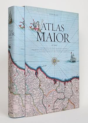
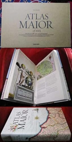
Atlas Maior, Germany
Verlag: Taschen Deutschland GmbH+, 2015
ISBN 10: 3836522926ISBN 13: 9783836522922
Buch
Gut/Very good: Buch bzw. Schutzumschlag mit wenigen Gebrauchsspuren an Einband, Schutzumschlag oder Seiten. / Describes a book or dust jacket that does show some signs of wear on either the binding, dust jacket or pages.
Mehr Angebote von anderen Verkäufern bei ZVAB
Gebraucht ab EUR 13,50
Mehr entdecken Hardcover Softcover Erstausgabe
-
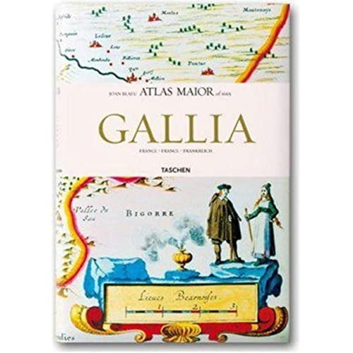
Atlas Maior - Gallia (Joan Blaeu Atlas Maior 1665)
Verlag: Taschen, 2006
ISBN 10: 3822851051ISBN 13: 9783822851050
Anbieter: Powell's Bookstores Chicago, ABAA, Chicago, IL, USA
Bewertung:

Buch
Zustand: Used - Like New. 2006. Hardcover. Folio. 207 pp. Illustrated throughout. Fine. Dust jacket is fine.
Mehr Angebote von anderen Verkäufern bei ZVAB
Gebraucht ab EUR 29,83
-

Atlas Maior - Anglia, Scotia Et Hibernia (Multilingual) (JUMBO)
Verlag: TASCHEN, 2006
ISBN 10: 3822851043ISBN 13: 9783822851043
Buch
Hardcover. Zustand: Very Good.
Mehr Angebote von anderen Verkäufern bei ZVAB
Gebraucht ab EUR 30,21
-
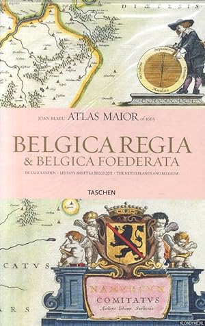
Atlas Maior. Belgica Regia & Belgiaca Foederata
Verlag: Taschen America Llc, 2006
ISBN 10: 3822851035ISBN 13: 9783822851036
Buch
Zustand: Good. Dutch, French, English.
-
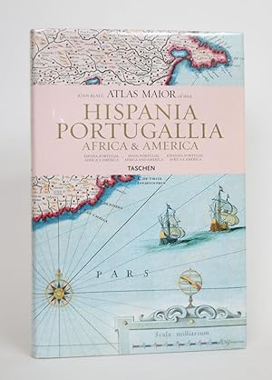
Atlas Maior of 1665: Hispania, Portugallia, Africa & America
Verlag: Taschen, Hong Kong, 2006
Anbieter: Minotavros Books, ABAC ILAB, Whitby, ON, Kanada
Bewertung:
Hardcover. Zustand: Near Fine. Zustand des Schutzumschlags: Near Fine. 4to. White paper pictorial boards. 231 p.p. Map endpapers. In Spanish, English, and Portuguese. With 64 maps of Spain, Portugal, Africa and America, and the original commentaries of Joan Blaue's Atlas Maior of 1665, "The greatest and finest atlas ever published." Bumping to edges of boards and spine ends, some soiling to boards. Dust jacket near fine overall. The Atlas Maior was a cartographical masterpiece of the Baroque period.
-
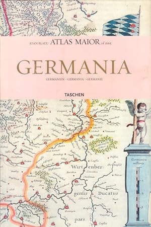
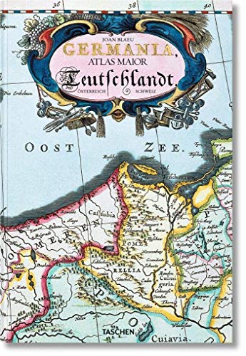
Germania, Volgo Deutschlandt, Band 1 Germanien, Germania, Germanie
Verlag: Köln: Taschen Verlag, 2015
Buch
Zustand: Sehr gut. 215 Seiten Zustand: Schutzumschlag mit Randläsuren und leicht berieben, , Einband minimal berieben, Schnitt leicht angeschmutzt // Mit Umschlaggestaltung und zahlreichen farbigen Illustrationen, sämtiche 124 Karten von Germanien. Atlas Maior Nr. 1. Germania : Atlas maior of 1665 ; 124 Tafeln mit Karten von Germanien, Österreich und der Schweiz, sowie Originaltexte von Joan Blaeu aus seinem Atlas Major von 1665, "dem grössten und prachtvollsten Atlas, der jemals veröffentlicht wurde" Altersfreigabe FSK ab 0 Jahre Sprache: Deutsch Gewicht in Gramm: 2000 gr.4°, 39,0 x 26,5 cm, Hardcover in Pappband, mit Schutzumschlag.
-
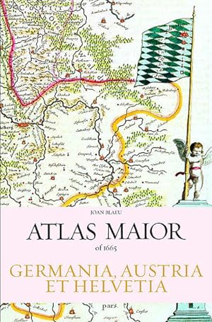
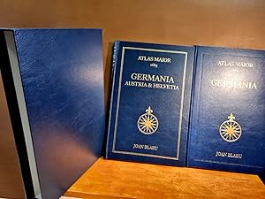
Atlas Maior - Germania, Austria et Helvetia, 2 Volume (Joan Blaeu Atlas Maior 1665)
Verlag: TASCHEN 06.11.2006., 2006
ISBN 10: 3822851027ISBN 13: 9783822851029
Anbieter: Modernes Antiquariat - bodo e.V., Dortmund, NRW, Deutschland
Bewertung:

Buch
Zustand: Gut. Auflage: 1.,. 404 Seiten *Werktagsversendung innerhalb von 24 Stunden* -- Exempl. in einem guten Gesamtzust., geringe Gebrauchsspuren möglich --mit SU. ISBN: 9783822851029 Alle Sendungen werden mit beiliegender Rechnung, inkl. ausgewiesener MwSt., verschickt. Sprache: Englisch Gewicht in Gramm: 4406 26,7 x 6,4 x 39,4 cm, Gebundene Ausgabe.
Mehr Angebote von anderen Verkäufern bei ZVAB
Gebraucht ab EUR 33,55
-

Köln, [etc.], Taschen, 2006. 2 vols. 404 pp. Col. maps. Orig. uniform hardcovers, d/j. Sm. folio. Including all the 124 maps of Germany, Austrai and Switzerland, and the original commentaries from Joan Blaeu's Atlas maior of 1665. Text in English, German & French. - Based on the copy in the Österrechische Nationalbibliothek, Vienna.
-
Atlas Maior of 1665. Band 1: Germania und Band 2: Germania, Austria und Helvetia. Sämtliche 124 Karten von Germanien, Österreich und der Schweiz sowie Originaltexte von Joan Blaeu aus seinem Atlas Maior von 1665, dem größten und prachtvollsten Atlas, der jemals veröffentlicht wurde. Einführung und Texte von Peter van der Krogt. Mit einer Auswahl der Originaltexte von Joan Blaeu.
Verlag: Benedikt Taschen Verlag., Köln., 2006
403 Seiten. Gr.-4to. Gut erhalten. Illustrierte O-Pappbände mit O-schutzumschlägen im illustrierten O-Pappschuber.
-

Joan Blaeu. Atlas Maior of 1665 Blaeu, Joan and Krogt, Peter Van der
Verlag: Taschen America Llc, 2016
ISBN 10: 3836538032ISBN 13: 9783836538039
Buch
Hardcover. Zustand: gebraucht; wie neu. Ungelesenes Lagerexemplar; nicht mehr OVP. Neuwertig!.
Mehr Angebote von anderen Verkäufern bei ZVAB
Neu ab EUR 60,00
Gebraucht ab EUR 60,00
Mehr entdecken Hardcover
-
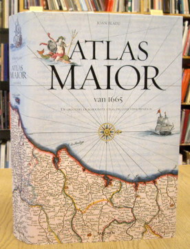
Taschen, 2005. 45 x 30 cm. Gebonden met stofomslag. Hardcover with dustjacket. Rijk geďllustreerd in kleur en z/w. , ook vouwkaarten. 593 pag. ALS NIEUW / AS NEW * ** Text in Dutch, French and English [ Cartography / cartografie ].
-
Der Atlas Maior des niederländischen Verlegers Joan Blaeu ist einer der schönsten Atlanten des Barock. Das komplett faksimilierte Exemplar in lateinischer Sprache entstammt der Österreichischen Nationalbibliothek und hat mehrere Ausklapptafeln Kt., SU, Pappschuber, sehr guter Zustand 9783836524117.
-

Atlas Maior of 1665
Verlag: Taschen, 2005
ISBN 10: 3822831255ISBN 13: 9783822831250
Anbieter: Powell's Bookstores Chicago, ABAA, Chicago, IL, USA
Bewertung:
Buch
Zustand: Used - Very Good. 2005. Illustrate. Hardcover. Cloth, dj. Elephant folio. 594 pp. Profusely illustrated. Text in English, German, and French. Slight shelf wear to dust jacket. Very Good.
-
Köln, [etc.], Taschen, [2005]. 512 pp. Col. maps. Orig. hardcover (dec. boards), d./j. Sm. folio. Introduction and texts by Peter van der Krogt. With a selection of original texts by Joan Blaeu. Text in English, Dutch & French. - Based on the copy in the Österrechische Nationalbibliothek, Vienna. ISBN: 3822846805.
-
Atlas Maior of 1665
Verlag: Taschen, Koln, 2010
Anbieter: Minotavros Books, ABAC ILAB, Whitby, ON, Kanada
Bewertung:
Hardcover. Zustand: Very Good. Zustand des Schutzumschlags: Near Fine. 4to. "The greatest and finest atlas ever published." Based on the copy in the Osterreichische Nationalbibliothek, Vienna. In English, German, and French. Extensively illustrated in colour. Light blue paper boards with black lettering. Navy endpapers. 512 p.p. In illustrated dust jacket depicting the Kingdom of Portugal. Bumping to spine ends, worse at head. Creasing to RFEP. Bumping to head of dust jacket, else fine. In matching pictorial slip case. Some soiling to spine, head and tail edge of slip case, bruising to corners.
-
![Bild des Verkäufers für De Lage Landen. Belgica Regia & Belgica Foedereta. Les Pays-Bas et la Belgique - The Netherlands and Belgium. [ Joan Blaeu Atlas Maior of 1665. Alle 63 kaarten van Nederland en België met originele citaten uit Joan Blaeus Atlas Maior van 1665 ]. isbn 9789089980410 zum Verkauf von Frans Melk Antiquariaat](https://pictures.abebooks.com/inventory/md/md31323049071.jpg)
De Lage Landen. Belgica Regia & Belgica Foedereta. Les Pays-Bas et la Belgique - The Netherlands and Belgium. [ Joan Blaeu Atlas Maior of 1665. Alle 63 kaarten van Nederland en België met originele citaten uit Joan Blaeus Atlas Maior van 1665 ]. isbn 9789089980410
ISBN 10: 9089980415ISBN 13: 9789089980410
Buch
Librero, 2010. 38 x 25 cm. Paperback / Softcover. Richly illustrated in color and b/w. Text in Dutch, French and English. 207 pages. NEAR FINE COPY [ Cartography / cartografie ].
-
Atlas Maior 1665 - Germania, Austria & Helvetia: Germania, Austria Et Helvetia: 2 Bände (Joan Blaeu Atlas Maior 1665)
Verlag: Taschen Verlag, 2006
Buch
Zustand: Gut. 416 Seiten Gebundene Ausgabe 2 Bände im Schuber - - ISBN: 3822851027 Sprache: Deutsch.
-
Hongkong, Köln, [etc.], Taschen Verlag, [2006]. 207 pp. Num. col. ills. Hardcover, d/j. Sm. folio. Depicting all the 63 maps of the Netherlands and Belgium as published in Joan Blaeu's Atlas maior of 1665. - Text in English, French and Dutch language.
-
ATLAS MAIOR OF 1665 VOL. 1: ANGLIA AND VOL. 2: SCOTIA & HIBERNIA.
Verlag: Koln: Taschen, 2006., 2006
Anbieter: Grant's Bookshop, Cheltenham, VIC, Australien
Bewertung:
Two volumes 58 color maps in Vol. 1, 55 in Vol. 2. Folio, original boards in colour illus dustwrappers, in colour illus slipcase. A fine set. . Reproductions of 17th century maps, text in English, French and German (translated form the original Latin). Part of the influential 11-volume Atlas ("Theatrum Orbis Terrarum") by the Dutch printer and mapmaker Joan Blaeu (1596-1673).
-

Atlas Maior of 1665 by Joan Blaeu
Verlag: Taschen ( 1665) 2005, Koln, 1665
Anbieter: Muir Books -Robert Muir Old & Rare Books - ANZAAB/ILAB, PERTH, WA, Australien
Bewertung:
Erstausgabe
Boards in d.j. 1st edition thus. 1st ed. thus, folio, text in English, German and French. Profusely illustrated with 594 colour maps with some folding reproduced from the original Atlas published in 1665, original pictorial bds., dustjacket. Slight edgewear to the top edge of the dustjacket. Near-fine condition. This is a very heavy book, please inquire regarding postage rates. Facsimile of Latin edition of Atlas Maior first published in Amsterdam 1665. Blaeu's Atlas Maior was a remarkable achievement of the 17th century and one of history's finest examples of mapmaking.
-
![Beispielbild für Atlas Maior 1665 - Italien. Aus der Österreichischen Nationalbibliothek, Wien: Italia [Gebundene Ausgabe]Joan Blaeu (Autor), Peter van der Krogt (Autor) zum Verkauf von BUCHSERVICE / ANTIQUARIAT Lars Lutzer](https://pictures.abebooks.com/isbn/9783822851074-de-300.jpg)
Atlas Maior 1665 - Italien. Aus der Österreichischen Nationalbibliothek, Wien: Italia [Gebundene Ausgabe]Joan Blaeu (Autor), Peter van der Krogt (Autor)
Verlag: Taschen, 2007
ISBN 10: 3822851078ISBN 13: 9783822851074
Anbieter: BUCHSERVICE / ANTIQUARIAT Lars Lutzer, Wahlstedt, Deutschland
Bewertung:
Buch
Hardcover. Zustand: gut. 2007. Der Atlas Maior, das kartographische Meisterwerk des Barock, wurde in den Jahren 1662 bis 1665 von dem Amsterdamer Verleger Joan Blaeu, einem der führenden holländischen Kartographen, herausgegeben. Ursprünglich auf Latein erschienen, umfasste der Atlas 594 Karten in 11 Bänden, die die gesamte, damals bekannte Welt der frühen Neuzeit zeigten. Er war somit das umfangreichste und teuerste Buch, das im 17. Jahrhundert veröffentlicht wurde. Dieses Werk blieb über 100 Jahre der verbindliche Weltatlas und zählt heute zu den gesuchtesten und wertvollsten antiquarischen Raritäten. TASCHENs bibliophiler Nachdruck enthält alle 60 Karten zu Italien. Der vorliegenden Ausgabe liegt das kolorierte und mit Gold gehöhte Exemplar Österreichischen Nationalbibliothek in Wien zu Grunde. Neben Originalzitaten von Joan Blaeu zu den einzelnen Karten, erläutern die Texte von Peter van der Krogt die historischen und kulturellen Zusammenhänge und führen den Leser in die faszinierende Welt der frühneuzeitlichen Karthographie ein. Die Texte sind in Französich, Englisch und Deutsch. Synopsis:This work contains maps of Italy from Joan Blaeu's exquisite world atlas of 1665. "The Atlas Maior", the cartographical masterpiece of the Baroque period, was brought out between 1662 and 1665 by the Amsterdam publisher Joan Blaeu, one of Holland's leading cartographers. Originally appearing in Latin, the atlas comprised 594 maps in 11 volumes, which depicted the whole of the world as known to early modern Europe. It was the largest and most expensive book published during the 17th century. For more than 100 years, it remained the definitive atlas of the world, and today is among the most sought-after and valuable antiquarian rarities. This reprinted edition in six volumes is based on the hand-colored, gold-heightened copy in the "Osterreichische Nationalbibliothek" in Vienna, thus ensuring the best possible detail and quality. Alongside Joan Blaeu's original commentaries on the individual maps, a new text by Peter van der Krogt explains the historical and cultural associations and introduces the reader to the fascinating world of early modern cartography. This volume features all 60 maps of Italy and the text is in Italian, English, and German. In englischer Sprache. 207 pages. 38,8 x 25,8 x 2,8 cm.
-
Atlas Maior of 1665: Germania + Germania, Austria et Helvetia. Sämtliche 124 Karten von Germanien, Österreich und der Schweiz.Vol 1 + 2 ( 2 Bände )
Verlag: Taschen
( nach dem Original in der Österreichischen Nationalbitliothek, Wien. Mehrsprachige Ausgabe in Deutsch, Englisch und Französisch ) Mit zusammen 404 Seiten mit zahlreichen farbigen Karten. Jeweils in blauem, goldgeprägten Oldr ( oder Kunstleder ? ) in einem blauen Ganzlederschuber ( oder Kunstlederschuber ? ), Folio ( 39 x 26 cm ). Von insgesamt guter und dekorativer Erhaltung. Zusammen 2 Bände. ( Gewicht 4000 Gramm ) ( Lagerort Gondel 3 )( Weitere Pics auf Anfrage - further images at request ).
-
The Atlas Blaeu - Van der Hem of the Austrian National Library.
Anbieter: Antiquariaat A. Kok & Zn. B.V., Amsterdam, Niederlande
Bewertung:
't Goy-Houten, 1996. 2 vols. 632,732 pp. Ills. Hardcovers. Vol. I: Spain, Portugal and France. Descriptive catalogue of volumes 1-8 of the Atlas. Vol. II: Italy, Malta, Switzerland and the Low Countriews. Descriptive catalogue of volumes 9-17 of the Atlas.
-
't Goy-Houten, 2008. 580 pp. B./w. ills. Hardcover.
-
Atlas Maior of 1665. "Der grösste und prachtvollste Atlas, der jemals veröffentlicht wurde". Einführung und Texte von Peter van der Krogt. Nach dem Original aus der Österreichischen Nationalbibliothek Wien. Mit einer Auswahl d. Originaltexte v. Joan Blaeu
Verlag: Taschen, Köln, Los Angeles, London, Madrid, Paris, Tokyo, 2005
Zustand: 0. Text Deutsch/Englisch/Französisch. In originalem, intaktem Verlagskarton mit Plastikgriff. Gestalteter Schutzumschlag, unverletzt. Identisch gestalteter kartonierter Einband, TADELLOS. Breiter Leseband. Frontispiz. 583 Seiten mit zahlreichen farbigen Karten. Ein Prachtband in NEUWERTIGEM ZUSTAND. +++ Text in English, German and French. The reprinted cartografical masterpiece of the Baroque, brought out in 1662 and 1665 by the Amsterdam publisher Joan Blaue. This very copy is based on the hand-colored atlas, nowadays in the Austrian national library in Vienna. Presented in its original card-board box with its undamaged dustjacket, 583 profusely illustrated pages, MINT CONDITION. +++ Texte en Français/Allemand/Anglais. Ouvrage présenté dans sa mallette en carton d'origine avec sa jaquette intacte. C'est ici la reimpression monumentale de ce chef d'oeuvre de la cartographie de l'époque baroque qui se base sur l'exemplaire conservé ŕ la bibliothčque nationale d'Autriche ŕ Vienne. 583 pages avec multiples reproductions en couleur, impeccable, ÉTAT NEUF. +++ 30 x 45 cm, 7 kg. , +++ Stichwörter/Keywords/Mots-clés: Geografie geography géographie Atlas cartographie Erdkunde Atlanten Kartografie cartography atlases Gewicht in Gramm: 7000 Unverletzter S.U Hardcover Neuwertig.
-
The Atlas Blaeu - Van der Hem of the Austrian National Library. [.]. Vols I - VI. Editorial committee: Günther Schilder, Bernard Aikema & Peter van der Krogt.
Anbieter: Antiquariaat A. Kok & Zn. B.V., Amsterdam, Niederlande
Bewertung:
t Goy-Houten, 1996-2008. 6 (of 8) vols. Text & ills. Uniform hardcovers. First six volumes (of eight) of the descriptive and illustrated catalogue of the Atlas Blaeu - Van der Hem, one of the largest and finest atlases ever assembled. The 46-volume atlas is an expanded version of Joan Blaeu's Atlas Maior, published in Amsterdam between 1660 and 1663. The atlas is composed by the Amsterdam lawyer and collector Laurens van der Hem (1621-1678). He added other maps, views, and drawings of his own choice, including four volumes of manuscript maps of Africa and Asia made for the Dutch East India Company (VOC). - - Vol. 1: Spain, Portugal and France. Descriptive catalogue of volumes 1-8 of the Atlas; Vol.2: Italy, Malta, Switzerland and the Low Countries. Descriptive catalogue of volumes 9-17 of the Atlas; Vol. 3: The British Isles, Northern and Eastern Europe. Descriptive catalogue of volumes 18-24 of the Atlas; Vol. 4: Holy Roman Empire, Hungary, Greece, Constantinople, Smyrna and Bible maps. Descriptive catalogue of volumes 25-34 of the Atlas; Vol. 5: Africa, Asia and America, including the "secret" atlas of the Dutch East India Company (VOC). Descriptive catalogue of volumes 35-46 of the Atlas; Vol. 6: The supplemental volumes (Ergänzungsbände). Descriptive catalogue of the four supplemental volumes to the Atlas. General indexes.