Gesamtpreis (1 Artikel Artikel):
Versandziel:

capper benjamin pitts (17 Ergebnisse)
Direkt zu den wichtigsten Suchergebnissen
Produktart
- Alle Produktarten
- Bücher (16)
- Magazine & Zeitschriften
- Comics
- Noten
- Kunst, Grafik & Poster
- Fotografien
- Karten (1)
-
Manuskripte &
Papierantiquitäten
Zustand
Einband
Weitere Eigenschaften
- Erstausgabe (2)
- Signiert
- Schutzumschlag
- Angebotsfoto (16)
Land des Verkäufers
Verkäuferbewertung
-
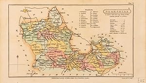
Berkshire. Pl II.
Verlag: London. 1808, 1808
Anbieter: Peter Harrington. ABA/ ILAB., London, Vereinigtes Königreich
Verbandsmitglied: ABA ILAB PBFA
Bewertung:

A charming miniature map of the royal county of Berkshire by Benjamin Capper, published by Richard Phillips in the atlas titled "A Topographical Dictionary". The map features a numerical "Hundreds" table and other noteworthy information. Size: 122 x 210 mm. Copperplate engraving with full original wash colour. Slight age toning, but in excellent condition.
-
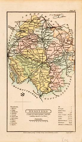
Herefordshire. Pl XV.
Verlag: London: 1808, 1808
Anbieter: Peter Harrington. ABA/ ILAB., London, Vereinigtes Königreich
Verbandsmitglied: ABA ILAB PBFA
Bewertung:
A charming miniature map of the delightful county of Herefordshire by Benjamin Capper, published by Richard Phillips in the atlas titled "A Topographical Dictionary". The map features a numerical "Hundreds" table, a mileage scale and other noteworthy information. Size: 210x 125 mm. Copperplate engraving with full original wash colour. Slight age toning but in very good condition otherwise.
-
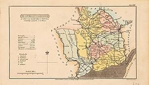
Monmouthshire. Pl XXIII.
Verlag: London: 1808, 1808
Anbieter: Peter Harrington. ABA/ ILAB., London, Vereinigtes Königreich
Verbandsmitglied: ABA ILAB PBFA
Bewertung:
A charming miniature map of the Welsh county of Monmouthshire by Benjamin Capper, published by Richard Phillips in the atlas titled "A Topographical Dictionary". The map features a numerical "Hundreds" table, a mileage scale and other noteworthy information. Size: 125 x 210 mm. Copperplate engraving with full original wash colour. Slight age toning but in very good condition otherwise.
-
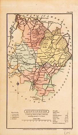
Huntingdon. Pl XVII.
Verlag: London: 1818, 1818
Anbieter: Peter Harrington. ABA/ ILAB., London, Vereinigtes Königreich
Verbandsmitglied: ABA ILAB PBFA
Bewertung:
A charming miniature map of the delightful Fen-land county of Huntingdonshire by Benjamin Capper, published by Richard Phillips in the atlas titled "A Topographical Dictionary". The map features a numerical "Hundreds" table, a mileage scale and other noteworthy information. Size: 210x 125 mm. Copperplate engraving with full original wash colour. Slight age toning but in very good condition otherwise.
-
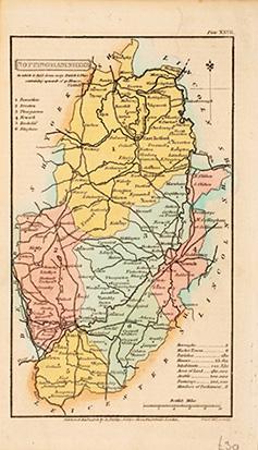
Nottinghamshire. Pl XXVII.
Verlag: London: 1808, 1808
Anbieter: Peter Harrington. ABA/ ILAB., London, Vereinigtes Königreich
Verbandsmitglied: ABA ILAB PBFA
Bewertung:
A charming miniature map of the Midland county of Nottinghamshire by Benjamin Capper, published by Richard Phillips in the atlas titled "A Topographical Dictionary". The map features a numerical "Hundreds" table, a mileage scale and other noteworthy information. Size: 210 x 125 mm. Copperplate engraving with full original wash colour. Slight age toning but in very good condition otherwise.
-
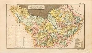
Somerset. Pl XXXL.
Verlag: London. 1808, 1808
Anbieter: Peter Harrington. ABA/ ILAB., London, Vereinigtes Königreich
Verbandsmitglied: ABA ILAB PBFA
Bewertung:
A charming miniature map of the western county of Somerset by Benjamin Capper, published by Richard Phillips in the atlas titled "A Topographical Dictionary". The map features an extensive, numerical "Hundreds" table. Size: 122 x 210 mm. Copperplate engraving with full original wash colour. Slight age toning, but in excellent condition.
-

A Statistical Account Of The Population And Cultivation, Produce And Consumption, Of England And Wales
Verlag: LIGHTNING SOURCE INC, 2016
ISBN 10: 1354682203ISBN 13: 9781354682203
Buch
Gebunden. Zustand: New.
-
A Topographical Dictionary of the United Kingdom . accompanied by forty-six maps, etc.
Verlag: British Library, Historical Print Editions, 2011
ISBN 10: 1241313458ISBN 13: 9781241313456
Buch
Zustand: New.
-
A Topographical Dictionary of the United Kingdom accompanied by forty-six maps, etc.
Verlag: British Library, Historical Print Editions, 2011
ISBN 10: 1241323054ISBN 13: 9781241323059
Buch
Zustand: New. KlappentextbTitle:/b A Topographical Dictionary of the United Kingdom . accompanied by forty-six maps, etc.br/br/bPublisher:/b British Library, Historical Print Editionsbr/br/The British Library is the national library of the United Ki.
-

TOPOGRAPHICAL DICTIONARY OF THE UNITED KINGDOM: CONTAINING EVERY CITY, TOWN, VILLAGE, HAMLET, PARISH, DISTRICT, OBJECT AND PLACE IN ENGLAND, WALES, SCOTLAND, IRELAND.
Verlag: Whittaker,, London,, 1839
Hardcover. Zustand: Good. Fifth Edition. Hardback. No Dust Jacket. Very large 8vo. pp 1053; 152; 8. Original publisher's green cloth spine over marbled boards, lettered black on spine label. 5th edition. 46 maps, including frontispiece, some folding. Wales map is on one large folding page not two. Some rubbing and chipping to marbled boards and darkening to spine label, otherwise sound, used, near very good with clean text.
-
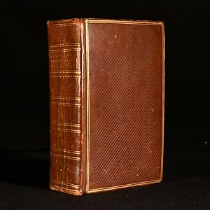
A Topographical Dictionary of the United Kingdom; Containing Every City, Town, Village, Hamlet, Parish, District, Object, and Place in England, Wales, Scotland, Ireland, and the Small Islands Dependent
Verlag: Geo. B. Whittaker, London, 1825
Leather. Zustand: Good. Not Stated (illustrator). An uncommon edition of this popular topographical dictionary of the United Kingdom, with numerous maps. An uncommon new edition. In a full calf binding with gilt detail, and new endpapers. With a folding map frontispiece, a further six folding maps, and thirty-nine full-page maps. Collated complete. Wales is on one plate, not two as stated in the list of maps, as is common for this edition. A comprehensive topographical dictionary of England, Wales, Scotland and Ireland, from the early nineteenth century. Containing every city, town, village, hamlet, parish, and district. Benjamin Pitts Capper was a British gazetteer publisher. His best known work was this topographical dictionary, which was published in over twenty different editions. In a full calf binding. Externally, a trifle rubbed. Rubbing to the extremities. Fading to the spine. Marks to the boards. Crack to the upper rear board. Front hinge is starting but still firm. Light marks to the paste-downs and free endpapers. Internally, binding slightly strained but still firm. Pages lightly age-toned to the edges, otherwise generally bright and clean. Spotting and cockling to the frontispiece map. Loss to the upper title page. Some offsetting and scattered marks to the title page. Scattered spots throughout, heavier to the plates. Occasional offsetting on the pages facing the plates. Scattered handling marks and the odd ink mark. Ink mark to the map of Essex. Good. book.
-
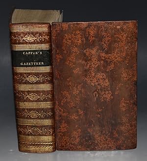
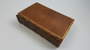
A Topographical Dictionary of the United Kingdom
Verlag: Richard Phillips, London, 1808
Erstausgabe
Leather. Zustand: Good. Not Stated (illustrator). First edition. A smart first edition of this topographical dictionary for the UK, with folding maps throughout. First edition. Illustrated with thirty-nine maps and seven folding maps, for a total of forty-six. Collated complete. A topographical dictionary of the UK, with geographical, topographical, and statistical accounts of every district and place in England, Scotland, Wales, Ireland, and various small islands of the British Empire. Compiled from parliamentary and authenticated documents. Written by Benjamin Pitts Capper, an English author and topographer. Bound in contemporary full calf. Externally, sound with rubbing and wear resulting in light loss to the extremities. Fading to the spine and the odd mark to the board. Creases to the spine. Internally, firmly bound. Pages are bright and clean with the odd handling mark. Contemporary ink inscription to the front pastedown dated 1849. Good. book.
-
A TOPOGRAPHICAL DICTIONARY OF THE UNITED KINGDOM.in England, Wales, Scotland, Ireland and the Small Islands Dependent with forty-seven Maps
Verlag: Whittaker (Geo. B), London, 1825
Anbieter: Old Hall Bookshop, ABA ILAB PBFA BA, Brackley, Vereinigtes Königreich
Verbandsmitglied: ABA ILAB PBFA
Bewertung:
Cloth. Zustand: Good. No Jacket. xxiv, 865 pp, 1p addendum,(England and Wales) 152 pp,Scotland) 40 pp, (Ireland), 46 folding country and county maps,(note: Wales is on 1 map, not 2, as stated in list of contents) recent brown cloth, new endpapers, Geo. B. Whittaker, London, 1825. The book has been recently rebound with new endpapers. No pages present before the folding map of the United Kingdom which faces the title page. This map and the title page have some offsetting. Otherwise a very sound copy with all maps present and, apart from an occasional mark or stain, in very good condition. Size: 9 x 5.8 Ins.
-
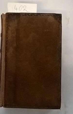
A Topographical Dictionary of the United Kingdom
Verlag: London: Richard Phillips, 1808, 1808
Anbieter: Scarthin Books ABA, ILAB., Cromford, Vereinigtes Königreich
Bewertung:
Buch
Hardcover. Zustand: Very Good. Good. Textually a very good copy with very little browning and almost no foxing to pages or maps. Maps all present, note that Wales is in one map rather than the two maps listed at the outset, making 46 maps in all, as claimed on the title page.Maps plain. The frontispiece folded map of the whole country has marginal bookworm burrows at the bottom edge. Full suede binding with marbled endpapers and ticket of W.Hoon, Stationer, Ashborne; recently expertly rebacked with original boards and spine relaid onto new suede, linen hinges inside, tucked under the endpapers. Handles well and good for another century or two of use.
-
A Topographical Dictionary of the United Kingdom; Compiled from Parliamentary an other authentic documents and authorities; containing geographical, topographical & statistical accounts of every district, object and place in England, Wales, Scotland, Ireland, and the various small islands of the British Empire. Accompanied by Forty-Six Maps, Drawn Purposley for this Work, on an original plan.
Verlag: London, Richard Philips, 1808, 1808
Anbieter: PROCTOR / THE ANTIQUE MAP & BOOKSHOP, DORCHESTER, Vereinigtes Königreich
Verbandsmitglied: PBFA
Bewertung:
Hardback, 8.5 x 5 inches. In full tree calf leather fine binding, black leather spine label lettered in gilt, with gilt banding and decoration. Plain endpapers and edges. In very good condition. Corners slightly bumped with some slight rubbing to edges and ends of spine. Bookplate to front ?Will. Bridges Neynce, Esq.? Front free endpaper removed. A couple of minor light spots, some minor handling marks else pages and maps all very clean and bright. Else a very clean and tight copy. Unpaginated. Illustrated with 46 hand-coloured engraved maps (some folding).
-
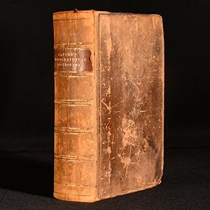
A Topographical Dictionary Of The United Kingdom; Compiled From Parliamentary, And Other Authentic Documents And Authorities; Containing Geographical, Topographical, & Statistical Accounts Of Every District, Object, And Place In England, Wales, Scotland, Ireland, And Various Small Islands Dependant On The British Empire. Accompanied By Forty-Six Maps, drawn purposely for this work, on an original plan
Verlag: Published by Richard Phillips, London, 1808
Karte Erstausgabe
, xiv, unpaginated, approx 1092 pages, 46 hand-coloured maps as called for on title page but Wales was printed on 1 map not 2, includes folding map of British Isles as frontispiece, double-column text First Edition , edges of boards and spine rubbed, few light scuffs to boards, spine slightly dulled and darkened in places, splits at upper and lower joints with front board a little loose, pages and plates clean, in good+ condition , full tan calf with gilt ruling and blindstamped floral borders, gilt titles on red leather spine panel, gilt decorated compartments, 5 raised bands, marbled edges Octavo Hardback ISBN:
-
![Bild des Verkäufers für [the] Universal Gazetteer . Revised, Considerably Enlarged, and Improved, by Arthur Kershaw. the Fourth Edition. zum Verkauf von moluna](https://pictures.abebooks.com/inventory/md/md31567619184.jpg)
[the] Universal Gazetteer . Revised, Considerably Enlarged, and Improved, by Arthur Kershaw. the Fourth Edition.
Verlag: British Library, Historical Print Editions, 2011
ISBN 10: 1240909845ISBN 13: 9781240909841
Buch
Zustand: New.