
Gesamtpreis (1 Artikel Artikel):
Versandziel:

department army staff (19 Ergebnisse)
Direkt zu den wichtigsten Suchergebnissen
Produktart
- Alle Produktarten
- Bücher (18)
- Magazine & Zeitschriften
- Comics
- Noten
- Kunst, Grafik & Poster
- Fotografien
- Karten (1)
-
Manuskripte &
Papierantiquitäten
Zustand
Einband
Weitere Eigenschaften
- Erstausgabe (1)
- Signiert
- Schutzumschlag
- Angebotsfoto (9)
Land des Verkäufers
Verkäuferbewertung
-
U. S. Army Combat Skills Handbook
Verlag: Rowman & Littlefield Publishers, Incorporated, 2004
ISBN 10: 1592283837ISBN 13: 9781592283835
Buch
Zustand: Good. Former library book; may include library markings. Used book that is in clean, average condition without any missing pages.
-

U. S. Army Combat Pistol Training Manual
Verlag: Rowman & Littlefield Publishers, Incorporated, 2003
ISBN 10: 1592281575ISBN 13: 9781592281572
Buch
Zustand: Good. Former library book; may include library markings. Used book that is in clean, average condition without any missing pages.
Mehr Angebote von anderen Verkäufern bei ZVAB
Gebraucht ab EUR 5,99
-
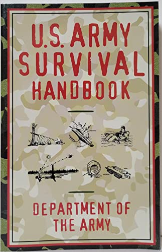
U. S. Army Survival Handbook
Verlag: Rowman & Littlefield Publishers, Incorporated, 2002
ISBN 10: 1585745561ISBN 13: 9781585745562
Buch
Zustand: Good. Used book that is in clean, average condition without any missing pages.
-
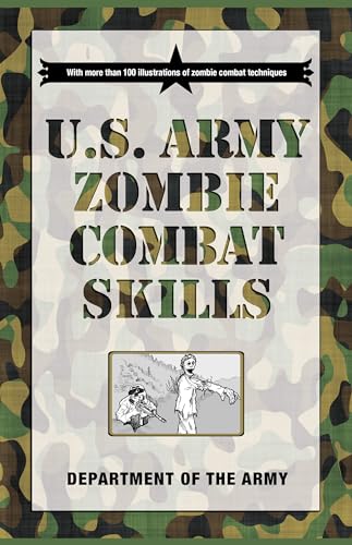
U. S. Army Zombie Combat Skills
Verlag: Rowman & Littlefield Publishers, Incorporated, 2009
ISBN 10: 1599219093ISBN 13: 9781599219097
Buch
Zustand: Good. Used book that is in clean, average condition without any missing pages.
-

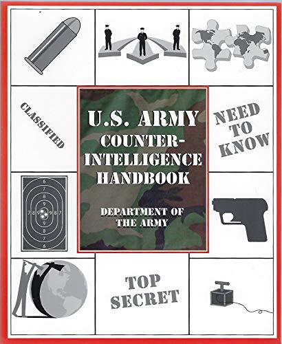
U. S. Army Counter-Intelligence Handbook
Verlag: Rowman & Littlefield Publishers, Incorporated, 2004
ISBN 10: 1592283802ISBN 13: 9781592283804
Buch Erstausgabe
Zustand: Very Good. First edition. Former library book; may include library markings. Used book that is in excellent condition. May show signs of wear or have minor defects.
-
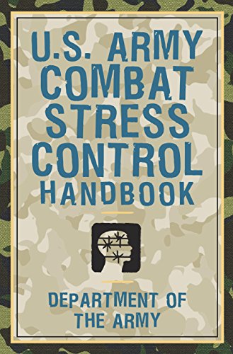
U. S. Army Combat Stress Control Handbook
Verlag: Rowman & Littlefield Publishers, Incorporated, 2003
ISBN 10: 1585747831ISBN 13: 9781585747832
Buch
Zustand: Very Good. Former library book; may include library markings. Used book that is in excellent condition. May show signs of wear or have minor defects.
Mehr Angebote von anderen Verkäufern bei ZVAB
Gebraucht ab EUR 8,50
-
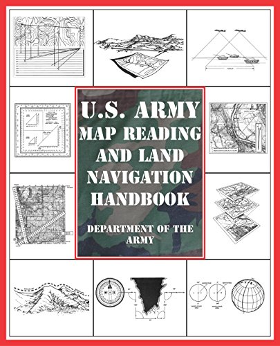
U. S. Army Map Reading and Land Navigation Handbook
Verlag: Globe Pequot Press, The, 2004
ISBN 10: 1592283829ISBN 13: 9781592283828
Buch
Zustand: Good. Used book that is in clean, average condition without any missing pages.
-

Legal Guide for the Soldier
Verlag: Department of the Army
Anbieter: Wonder Book, Frederick, MD, USA
Bewertung:

Zustand: Good. Good condition. Slightly dampstained.
-
![Bild des Verkäufers für She ji di ren san bing de fang fa].[Chinese Propaganda Poster - Methods to Fire At Enemy Paratroopers]. ?????????.[Fang kong chang shi gua tu zhi shi yi].[Chinese Propaganda Poster - Poster no.11 of Air Defence Common Knowledge]. zum Verkauf von Asia Bookroom ANZAAB/ILAB](https://pictures.abebooks.com/inventory/md/md22521716588.jpg)
She ji di ren san bing de fang fa].[Chinese Propaganda Poster - Methods to Fire At Enemy Paratroopers]. ?????????.[Fang kong chang shi gua tu zhi shi yi].[Chinese Propaganda Poster - Poster no.11 of Air Defence Common Knowledge].
Verlag: (Circa1970)., [??].[Beijing]., 1970
Anbieter: Asia Bookroom ANZAAB/ILAB, Canberra, ACT, Australien
Bewertung:
Coloured, poster no.11 of the Chinese Air Defence poster set. Damp staining, horizontal and vertical creases where poster has been folded, closed tears several of which have been repaired with tape on reverse. Text in Chinese. Poster measures 53.8 x 77.4cm. This poster shows three methods which can be used to fire at enemy paratroopers - each with detailed instructions. A chart in the centre gives useful information regarding the shooting distance required to hit enemy paratroopers based on a multiplication of the shooter's height. ??????????????[Mobilization Division of People's Liberation Army General Staff Department] was first formed in 1954 and later joined with ?????????????? [Military Division of People's Liberation Army General Staff Department] to form a joint division in 1969. In 1975 it returned to its original name.
-
![Bild des Verkäufers für Dui kong she ji zi shi].[Chinese Propaganda Poster - Anti-aircraft Firing Positions]. ?????????.[Fang kong chang shi gua tu zhi shi er].[Chinese Propaganda Poster - Poster no.12 of Air Defence Common Knowledge]. zum Verkauf von Asia Bookroom ANZAAB/ILAB](https://pictures.abebooks.com/inventory/md/md22521716589.jpg)
Dui kong she ji zi shi].[Chinese Propaganda Poster - Anti-aircraft Firing Positions]. ?????????.[Fang kong chang shi gua tu zhi shi er].[Chinese Propaganda Poster - Poster no.12 of Air Defence Common Knowledge].
Verlag: No publication details. (Circa1970)., [??].[Beijing]., 1970
Anbieter: Asia Bookroom ANZAAB/ILAB, Canberra, ACT, Australien
Bewertung:
Coloured, poster no. 12 of the Chinese Air Defence poster set. Lightly stained along upper edge, brown stain with a little minor loss, tape repairs in several places along the upper edge on the reverse of the poster. Good copy. Text in Chinese. Poster measures 53.9 x 77.7cm. This poster depicts 5 anti-aircraft firing positions. They are: one person lifts and stabilises the rifle while the other person aims; position aided by fortification; position aided by tree branches; position aided by walls; and kneeling position. ??????????????[Mobilization Division of People's Liberation Army General Staff Department] was first formed in 1954 and later joined with ?????????????? [Military Division of People's Liberation Army General Staff Department] to form a joint division in 1969. In 1975 it returned to its original name.
-
Fang kong chang shi gua tu].[Chinese Propaganda Poster Set (Incomplete) - Air Defence Common Knowledge].
Verlag: No publication details. (circa1970)., [??].[Beijing]., 1970
Anbieter: Asia Bookroom ANZAAB/ILAB, Canberra, ACT, Australien
Bewertung:
Coloured Chinese Air Defence broken run of 5 posters. Each poster in this small collection is numbered. The collection is made up of poster numbers 10, 11, 12, 13 and 16. The posters are in secondhand condition. Two are poorer condition than the others as there is loss along a margin of each, although this loss does not affecting the images themselves. There is creasing and wear and tear particularly at edges and one poster is damp stained. There are some tape repairs on the reverse, one Text in Chinese. Poster sheets measure appoximately 54 x 77.5 cm. Poster no. 10 shows 3 images which demonstrate the methods which could be used to fire at enemy aeroplanes. The images are accompanied by detailed instructions. The speed and size of the aeroplane, and the angle from which the shot is taken and the distance from the target are all taken into consideration. A chart in the centre gives details of how to prepare in advance for shooting an enemy aircraft. The chart gives details of how to calculate the plane's length taking into account its size and distance to make sure of an accurate shot. Poster no. 11 shows 3 images which demonstrate methods to fire at enemy paratroopers, again with detailed instructions of how to do this. A chart in the centre gives details of how to prepare in advance for shooting an enemy aircraft. The chart gives details of how to calculate the plane's length taking into account its size and distance to make sure of an accurate shot. Poster no. 12 depicts 5 images showing various anti-aircraft firing positions. They are: position for one person to lift and stabilise the rifle while the other person aims; position aided by fortification; position aided by tree branches; position aided by walls; and kneeling position. Poster no. 13 includes 5 images showing two squads (rifle shooting squad and machine gun shooting squad) who are in charge of the anti-aircraft placement and the three main targeted aircraft (bomber, military cargo aircraft and helicopter) which these squads wish to shoot. Poster no. 16 includes 6 images showing plans and the actions required to rescue, perform urgent repairs, and maintain law and order. Each with detailed instructions. It suggests: to report to the relevant government agency and evacuate nearby civilians unexploded bombs are discovered; during air strikes, lay down perimeters around shops to prevent from looting; to restore transportation by clearing roads immediately after air raids; to urgently repair damaged electric wires and water pipes; the major patrol sites: factories, shops, warehouses, dams, bridges and the power station, and to arrest suspects if necessary; to put out fire immediately and to make sure the safety of the civilians are the most important. ??????????????[Mobilization Division of People's Liberation Army General Staff Department] was first formed in 1954 and later joined with ?????????????? [Military Division of People's Liberation Army General Staff Department] to form a joint division in 1969. The Division returned to its original name in 1975.
-
Fang kong chang shi gua tu].[Chinese Propaganda Poster Set (Incomplete) - Air Defence Common Knowledge].
Verlag: No publication details. (circa1970)., [??].[Beijing]., 1970
Anbieter: Asia Bookroom ANZAAB/ILAB, Canberra, ACT, Australien
Bewertung:
Coloured Chinese Air Defence poster incomplete set consisting of 9 posters, each poster is numbered. The set includes poster numbers 4, 8, 10, 11, 12, 13, 14, 15, and 16. These posters are in secondhand condition. The posters show some creasing with a number of small tears particularly at margins, some mending on reverse with tape. Two posters are considerably torn at margin affecting the image slightly in one case. There is some browning and staining and there is considerable annotation on the reverse of poster number 8. Text in Chinese. Sheets measure appoximately 53.9 x 77.9cm. Poster no. 4 depicts 9 images of different types of simple air defence shelters (trenches, caves, etc.). Brief descriptions of each type of shelter are provided below the images. Three images in the lower section suggest that when selecting the site for air defence shelters one should not build too close to buildings, flammables and electric wire. Poster no. 8 includes 9 images showing the alternative shelters when air raids happen and no nearby air defence shelter available. Alteratives suggested include basements, beneath a bridge, the corner of a wall and under solid staircases as good alternative shelters. Poster no. 10 shows 3 methods to use to fire at enemy aeroplanes each with detailed instructions. The speed and size of the aeroplane, and shooting angles and distance are all taken into consideration. A chart in the centre gives the calculations required to be prepared in advance to successfully shoot down an aeroplane. The calculations require taking into account the plane's size and distance. Poster no. 11 includes 3 images to demonstrate methods to fire at enemy paratroopers with detailed instructions. A chart in the centre gives the calculations for advance preparation taking into account the person's height and distance from the invading paratroopers. Poster no. 12 depicts 5 images showing various anti-aircraft firing positions. They are: a position where a single person lifts and stabilises the rifle while the other person aims; position aided by fortification; position aided by tree branches; position aided by walls; and kneeling position. Poster no. 13 is illustrated with 5 images showing two squads (rifle shooting squad and machine gun shooting squad) who are in charge of the anti-aircraft placement and three main targeted aircrafts (bomber, military cargo aircraft and helicopter) to shoot. Poster no. 14 shows 10 images of self-rescue and first aid for other people after air raids with detailed instructions. Self-rescue actions featured are emergency bleeding control and fire evacuation; first aid treatment introduced are treatment for bone rapture, CPR and transport the wounded. Poster no. 15 depicts 5 images demonstrating methods to extinguish fire bombs. Methods include: burying or covering the burning objects with sand and soil; covering the burning objects with soaking wet quilts or sack bag; throwing the burning objects into water containers with iron shovel; and using a fire extinguisher (extinguishing powder) or carbon nitride. Poster no. 16 includes 6 images showing plans and actions of rescue, urgent repair, and maintance of law and order with detailed instructions. It suggests: to report to the relevant government agency and evacuate nearby civilians when unexploded bombs are discovered; during air strikes, lay down perimeters around shops to prevent from looting; to restore transportation by clearing roads immediately after air raids; to urgently repair damaged electric wires and water pipes; it gives the major patrol sites as the factory, shops, warehouses, dams, bridges and power station, and urges the viewer to arrest suspects if necessary; to put out fire immediately and to make sure the safety of the civilians is paramount. ??????????????[Mobilization Division of People's Liberation Army General Staff Department] was first formed in 1954 and later joined with ?????????????? [Military Division of People's Liberation Army General Staff Department] to form a joint division in 1969. The Division returned to its original name in 1975.
-
Sichuan sheng quan tu./Wenchuan xian ji zhou bian di shi tu]. [Special Maps for Earthquake Disaster Relief: Map of Sichuan Province./ Map of Wencuan County and Its Vicinity].
Verlag: ???????.[Xing qiu di tu chu ban she]. May2008., ??.[Beijing]., 2008
Anbieter: Asia Bookroom ANZAAB/ILAB, Canberra, ACT, Australien
Bewertung:
Two large coloured maps printed on double sided on a single sheet, folded, issued shortly after the devastating 2008 Wenchuan Earthquake which was occurred on 12 May 2008. Small tears along folds mended by both non-acidic tape and cello tape, some creasing, generally good. Text in Chinese. Sheet measures 84.9 x 119.7cm. Map of Sichuan Province: scale 1: 1,100,000, inset map lower right corner showing the provincial capital city Chengdu, a statistical chart lower section listing counties within Sichuan Province, their population and territory size. Map of Wenchuan County and Its Vicinity: 1: 300,000, various colour representing altitude differences, inset map showing the position Wenchuan County within Sichuan Province, a mileage chart listing the distance between Wenchuan County to nearby cities. A brief introduction of Wenchuan on left section accompanying the images of the rescue forces. The Great Wenchuan Earthquake was the biggest earthquake in Chinese history, with a casualty over 69,000 people.
-
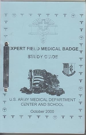
Expert Field Medical Badge Study Guide
Verlag: U.S. Army Medical Department Center and School
Buch
softcover paperback. Zustand: good; used. Prompt shipment, with tracking. we ship in CLEAN SECURE BOXES NEW BOXES 8vo; pages not numbered concurrently; good softcover paperback; tips bumped; scuff to face cover; clean pages; prompt shipping with tracking.
-

Manual of the War Plans Division of the General Staff
Verlag: BiblioGov, 2012
ISBN 10: 1249917883ISBN 13: 9781249917885
Buch
Zustand: New. KlappentextThis manual is published for the guidance and compliance of all officers and civilians of the War Plans Division with a view to promoting efficiency and uniformity of methods. Sections include information on organization and f.
-
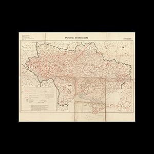
WORLD WAR II UKRAINE / OPERATION BARBAROSSA / TANK WARFARE / THIRD REICH CARTOGRAPHY: Ukraine: Straßenkarte.
Verlag: [Berlin:] Generalstab des Heeres, Abteilung fu?r Kriegskarten und Vermessungswesen, May ., 1941
Anbieter: Antiquariat Dasa Pahor GbR, München, Deutschland
Bewertung:

Buch
A very rare, large format map of Ukraine made by the General Staff of the German Army on the eve of Operation Barbarossa, the Nazi 'blitzkrieg' invasion of the Soviet Union, featuring advanced intelligence on the condition of highways and roads for the use of officers commanding tanks and armoured vehicles; the present example being a unique artefacts hailing from an archive of the 11th Panzer Division, featuring wartime manuscript additions of tank itineraries. Off-set print in 2 colours, with contemporary manuscript additions in crayon and pencil (Good, but with clear signs of field use, with wear and tears along old folds with some minor loss and some old repairs from verso, noticeable toning and staining especially to lower half, a chip of loss to righthand margin taking out just touch of the neatline), 74.5 x 96 cm (29.5 x 38 inches). This very rare and fascinating map depicts all of Ukraine and its road system and was made by the General Staff of the German Army in May 1941, the month before the Nazis launched Operation Barbarossa, their 'blitzkrieg' invasion of the Soviet Union. Their plan called for the swift conquest of Ukraine, not only as the Nazis coveted its fertile plains for 'lebensraum', but also because it provided the easiest route to the Baku Oil Fields, which could provide the Third Reich with the vast petroleum resources they desperately needed. Importantly, this particular example of the map comes from an original archive of the 11th Panzer Division and was clearly used by a Wehrmacht officer in theatre, as it features manuscript tank itineraries leading all across Ukraine. The present map was prepared by the War Maps & Surveying Department of the German General Staff from the very best intelligence. It is marked as a 'Sonderausgab nur fu?r den Dienstgebrauch' [Special Issue for official use only] and would have been classified for the exclusive use of senior officers and tank and armoured vehicle commanders. Given that the success of the German invasion of the USSR relied upon speed, a sophisticated knowledge of the routes fit for tanks and armoured vehicles was especially important. Thus, the present map would not have been merely helpful, but rather a vital necessity. The 'Zeichenerklärung' (Explanation of Symbols) describes the various types of transport routes featured on the map (often with the German terms accompanied by the corresponding Ukrainian terms transliterated into Latin), including: 'Autostraße' (Motorways); 'Hauptstraßen' (Major Roads); 'Fahrwege' (Provincial Routes); 'Hauptstraßen, parallel dazu zweite Fahrbahn im Bau' (Main Roads parallel to a second carriageway under construction); 'Hauptstraßen im Bau im Zuge eines bisherigen Fahrweges' (Main Roads under construction along the route of an existing road); and 'Hauptstraßen im Bau, Verlauf unsicher' (Main Roads under construction, route not secure). The map also delineates railways (primary and secondary), electrified railroads, as well as railways under construction. Additionally, the distances in kilometres are marked between key points along major routes, while the 'Bemerkungen ' (Comments) notes on the qualities of the thouroughfares in each category. Of note, the 'Autostraße Be Kiew-Brjansk-Moskva' (Kiev-Bryansk-Moscow Motorway) is marked as a straight, bold route and is described as 'Genauer Verlauf unbekannt' (exact route unknown), while the key major road leading east-southeast from of Kiev is described as 'verlauf unsicher' (route not secure). The Manuscript Additions to the Present Map - The present map comes from a larger archive of maps and documents regarding the 11th Panzer (Tank) Division. This corps was formed in August 1940 and served during the German invasion of Yugoslavia. The division joined the German Army Group South during Operation Barbarossa, and took part in the invasion of Ukraine, before moving up into Russia to participate in the unsuccessful attack upon Moscow, although the division fought with great skill and success in its own right. The 11th avoided capture at the Battle of Stalingrad (August 23, 1942 February 2, 1943) and aided the German retreat from the Volga and Donbass regions. As the Wehrmacht was progressively rolled back out of Ukraine in 1943-44, the 11th Panzer Division was almost completely destroyed at the Battle of the Korsun Cherkasy Pocket (January 24 February 16, 1944); what remained of the force was deployed to the Western Front for the remainder of the conflict. Upon the present map, the supposed routes of a group of 11th Panzer Division tanks is expressed by very neat lines made of baby blue and green dots. The dots seem to refer to an amalgam of various itineraries conducted in the summer of 1941, during Operation Barbarossa, as well as the division's operations during the gradual German retreat from Ukraine in the wake of the Battle of Stalingrad. Additionally, several towns, presumably of strategic interest, are distinguished in manuscript pink highlighting; the boundary lines of some of Ukraine's western oblasts are traced in green crayon; while some distances between key points in Eastern Ukraine are added in kilometres. Finally, the lower margin, is a pencil sketch of a junction in the Perekop area, on the isthmus that connects Crimea to the mainland. SEE OUR WEB PAGE FOR A LONGER DESCRIPTION.
-
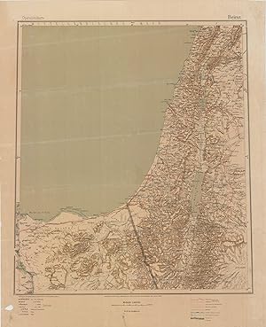
WORLD WAR I MIDDLE EAST / LEBANON / ISRAEL / PALESTINE / SYRIA / JORDAN / EGYPT / SUEZ CANAL: Operationskarte / Beirut.
Verlag: Berlin: Kartographische Abteilung des Stellvertretenden Generalstabes der Armee, ., 1916
Anbieter: Antiquariat Dasa Pahor GbR, München, Deutschland
Bewertung:
Karte
Rare - a seminal map used for strategic planning by German commanders during the Sinai and Levant theatre of World War I, a classified work created under the supervision of the orientalist Franz Gustav Taeschner for the German General Staff, it depicts all details necessary to inform broad military movement during one of the most dramatic and surprising campaigns of the Great War. Colour print (Good, evenly toned, uneven folds and creasing mostly to margins, tack marks to corners), 68.5 x 55.5 cm (27 x 22 inches This rare and important map was made by the German Army high command during the height of World War I and depicts almost all of the critical Sinai-Levant theatre of the conflict, extending from Beirut and Damascus, in the north, down to the Suez Canal, in the southwest. In February 1915, the Ottoman-German forces (headquartered in Damascus) attempted to take the Suez Canal, the lifeline of the British Empire, and then hopefully Cairo (the British headquarters in the Middle East). However, in a campaign of brutal desert fighting that see-sawed back and forth, by January 1917, the British drove the German-Ottoman army out of the Sinai and into Palestine. After a great stalemate, the British eventually pushed their opposition northwards, taking Jerusalem in December 1917. After another protracted period of deadlock, in September 1918, after winning the Battle of Megiddo, they drove the Ottoman-German forces out of Palestine, and advanced to conquer Lebanon and most of Syria by war's end. While he is non the map as the author, the present map was prepared under the supervision of Franz Gustav Taeschner (1888 - 1867), subsequently a famous orientalist, who was then working as a mapmaker at the Kartographische Abteilung des Stellvertretenden Generalstabes der Armee in Berlin, the cartographic department of the General Staff of the German Army. The map, labelled, 'Nur fu?r den Dienstgebrach!' (For official use only!), was intended for use in strategic planning only by senor German and Ottoman officers and was the best general map of the region available at the time. The map is predicated upon a composite of the most recent surveys and features the most up-to-date information with regards to wartime infrastructure development. Areas of elevation are shown by careful shading, while coasts, rivers and wadis are precisely depicted. All cities, towns and villages of any import are marked, while, importantly, the map labels all railways (being major, small gauge, and proposed), as well as key roadn routraph lines; and the locations of wells (critically important in a desert land). Notably, the map depicts, the railway that the Ottoman-Germans completed running north-south down the heart of Palestine, from Tulkarm to Beersheba. To aid their venture in the Sinai they also built rail lines in southern Palestine down to and crossing the Egyptian boundary, along with a vast network of camps, forts and defensive works. Also shown is a good part of the Hejaz Railway that ran from Damascus down to Medina, providing the Ottomans with their only link to the Red Sea. The Suez Canal, the Ottoman-German side's key target, runs along the lower-left corner of the map. The present map was part of the 'Operationskarte' series that the German Army debuted early in the war to depict major conflict zones in Europe and the Middle East to a strategically useful scale of 1:800,000. The Operationskarte maps were the 'gold standard' of Central Powers cartography used during the early part of the conhe maps were evseded by the Karte von Mesopotamien und Syrien (a series of 29 adjoining maps), drawn to double the scale (1:400,000), covering all of the Levant and Southern Anatolia, while arching down to take in all of Iraq (the sheets were gradually rolled out between 1916 and 1918). A Note on Editions and Rarity - The present 'Beirut' Operationskarte appears to have be issued in two editions, with the present being the first edition (dated 1916), followed by another dated 1917. Both editions of the map were issued in small print runs for the classified use of senior field commanders, they were not be otherwise distributed or sold. Moreover, most examples, would have perished due to field use. Indeed, the present example shows signs of having been tacked up to a headquarters wall where it would have been presumably the focus of many a strategy session. While we can trace about a dozen or so examples in various libraries worldwide, examples the map only very rarely ever appears on tht. World War I in the Sinai aLevant - During World War I, the Suez Canal was the seminal lifeline of the British Empire, the funnel through which hundreds of thousands of troops and vast amounts of critical commodities flowed in to Europe from India, Australia, New Zealand and Malaya. The 100-mile long channel was also considered by the German-Ottoman side to be the 'weakest link' in Britain's global transport network. The Suez Canal was bordered on the east by the vast deserts of the Sinai Peninsula, beyond which was Ottoman Palestine. On one hand, the Sinai provided a level of protection for the Suez, as with no real roads, few waterholes and scorching temperatures that could reach 50 Celsius, it was notoriously difficult to cross. On the other hand, the place was so desolate that it would be difficult to detect any force that somehow managed to traverse the peninsula, leaving the Suez vulnerable to stealth attack. Moreover, a clear breach of the canal by a large enemy force would lea grave danger. SEE OUR WEB PAGE FODESCRIPTION References: Staatsbibliotek zu Berlin: Kart. F 1448-10; Bayerische Staatsbibliothek: Mapp. I,98 ia-Q,8 / OCLC: 163353078.

![Bild des Verkäufers für Fang kong chang shi gua tu].[Chinese Propaganda Poster Set (Incomplete) - Air Defence Common Knowledge]. zum Verkauf von Asia Bookroom ANZAAB/ILAB](https://pictures.abebooks.com/inventory/md/md22656934796.jpg)
![Bild des Verkäufers für Fang kong chang shi gua tu].[Chinese Propaganda Poster Set (Incomplete) - Air Defence Common Knowledge]. zum Verkauf von Asia Bookroom ANZAAB/ILAB](https://pictures.abebooks.com/inventory/md/md22521716587.jpg)
![Bild des Verkäufers für Sichuan sheng quan tu./Wenchuan xian ji zhou bian di shi tu]. [Special Maps for Earthquake Disaster Relief: Map of Sichuan Province./ Map of Wencuan County and Its Vicinity]. zum Verkauf von Asia Bookroom ANZAAB/ILAB](https://pictures.abebooks.com/inventory/md/md30553307768.jpg)