
Gesamtpreis (1 Artikel Artikel):
Versandziel:

glen brown (45 Ergebnisse)
Direkt zu den wichtigsten Suchergebnissen
Produktart
- Alle Product Types
- Bücher (41)
- Magazine & Zeitschriften (1)
- Comics
- Noten
- Kunst, Grafik & Poster
- Fotografien
- Karten (3)
- Manuskripte & Papierantiquitäten
Zustand
Einband
Weitere Eigenschaften
Gratisversand
- Versand nach USA gratis
Land des Verkäufers
Verkäuferbewertung
-

And I, Francis : The Life of Francis of Assisi in Word and Image
Verlag: Continuum, 2000
ISBN 10: 0826412726ISBN 13: 9780826412720
Anbieter: Wonder Book, Frederick, MD, USA
Bewertung:

Buch
Zustand: Very Good. Very Good condition. A copy that may have a few cosmetic defects. May also contain a few markings such as an owner's name, short gifter's inscription or light stamp.
-

Drug Therapy Decision Making Guide
Verlag: Saunders, 1996
ISBN 10: 0721642152ISBN 13: 9780721642154
Anbieter: Wonder Book, Frederick, MD, USA
Bewertung:
Buch
Zustand: Good. Good condition. A copy that has been read but remains intact. May contain markings such as bookplates, stamps, limited notes and highlighting, or a few light stains.
-
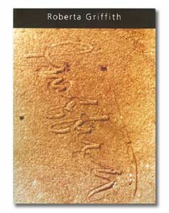
Roberta Griffith : A Retrospective
Verlag: Artworks Publishing, 2002
ISBN 10: 0972242406ISBN 13: 9780972242400
Buch
Zustand: Very Good. Former library book; may include library markings. Used book that is in excellent condition. May show signs of wear or have minor defects.
-

Paperback. Zustand: Very Good. The book has been read, but is in excellent condition. Pages are intact and not marred by notes or highlighting. The spine remains undamaged.
Mehr Angebote von anderen Verkäufern bei ZVAB
Neu ab EUR 16,17
Gebraucht ab EUR 6,05
Mehr entdecken Softcover
-

Paperback. Zustand: Fine.
Mehr Angebote von anderen Verkäufern bei ZVAB
Neu ab EUR 13,29
Gebraucht ab EUR 8,73
Mehr entdecken Softcover
-

Mother Naked
Verlag: Peninsula Press 2024-06-06, London, 2024
ISBN 10: 1913512487ISBN 13: 9781913512484
Buch
paperback. Zustand: New. Language: ENG.
-

Sirtfood Diet Cookbook For Beginners - Breakfast and Lunch: How to Use the Sirtuins Foods to Fast Weight Loss with Quick and Easy Recipes and Why Once You Start Using Them You Can't Stop Eating Them
Verlag: Diamond Mind LTD 16 F
ISBN 10: 1802087915ISBN 13: 9781802087918
Buch
Hardcover. Zustand: Very Good. Sirtfood Diet Cookbook For Beginners - Breakfast and Lunch: How to Use the Sirtuins Foods to Fast Weight Loss with Quick and Easy Recipes and Why Once You Start Using Them You Can't Stop Eating Them This book is in very good condition and will be shipped within 24 hours of ordering. The cover may have some limited signs of wear but the pages are clean, intact and the spine remains undamaged. This book has clearly been well maintained and looked after thus far. Money back guarantee if you are not satisfied. See all our books here, order more than 1 book and get discounted shipping. .
-

hardcover. Zustand: Good.
-

Gut/Very good: Buch bzw. Schutzumschlag mit wenigen Gebrauchsspuren an Einband, Schutzumschlag oder Seiten. / Describes a book or dust jacket that does show some signs of wear on either the binding, dust jacket or pages.
Mehr Angebote von anderen Verkäufern bei ZVAB
Neu ab EUR 23,00
Gebraucht ab EUR 20,70
Mehr entdecken Softcover
-
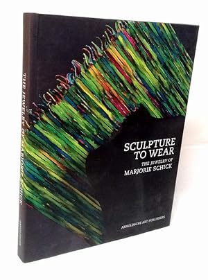
Sculpture to wear. The Jewelry of Marjorie Schick.
Verlag: Stuttgart, Arnoldsche Art Publishers, 2007
ISBN 10: 3897902583ISBN 13: 9783897902589
Anbieter: Antiquariat Dennis R. Plummer, Bingen am Rhein, Deutschland
Bewertung:
Buch Erstausgabe
239 SS. mit vielen Abbildungen. Erste Ausgabe. - Schutzumschlag etwas berieben, sonst sauber und gut erhalten. Sprache: Englisch Gewicht in Gramm: 1629 Fol., Original-Pappband mit Schutzumschlag.
-

Clinical neuroendocrinology
Verlag: Blackwell, Boston, u.a, 1988
ISBN 10: 0865420416ISBN 13: 9780865420410
Anbieter: Gebrauchtbücherlogistik H.J. Lauterbach, Gummersbach, NRW, Deutschland
Bewertung:
Buch
Leinen. Zustand: Gut. 24x19cm XIII.; 609. Gewebe (Blauer Leinen). Sprache: Englisch, Zustand: Gut bis Sehr Gut min. gebräunt (Innen); Einband (Außen) hat geringe Gebrauchsspuren; Schutzumschlag fehlt, oder es gibt keinen; * Die Photos sind original von uns erstellt worden, u.a. erkennbar an einem kleinen weißen Stück Papier im oberen Schnitt. Ab und an verwenden Suchmaschinen Verlagsphotos, bei den Portalen selbst, werden aber nur unsere Originalphotos gezeigt.
-

Art and Literature: An International Review: 5, Summer 1964
Verlag: S.E.L.A., Lausanne, Switzerland, 1964
Anbieter: Between the Covers-Rare Books, Inc. ABAA, Gloucester City, NJ, USA
Verbandsmitglied: ABAA ESA ILAB IOBA
Bewertung:
Erstausgabe
Softcover. Zustand: Near Fine. Single issue. Illustrated. Self wrappers. 213pp. Spine lightly age-toned, near fine. Poetry, drama, art and more by Allan Kaplan, Harry Mathews, Philippe Sollers, Keith Cohen, William Berkson, George Seferis, Osip Mandelshtam, Joseph Ceravolo, Howard Sutton, George Feldman, David W. McKain, Jane Brown, Scott Burton, Myfanwy Piper, Robert H. Byington, Glen E. Morgan, Michael Benedikt, Georg Christoph Lichtenberg, and James Mechem.
-

Star Wars
Verlag: Random House Worlds 2017-10-03, New York, 2017
ISBN 10: 0345511476ISBN 13: 9780345511478
Buch
hardback. Zustand: New. Language: ENG.
-

Jun Kaneko
Verlag: Daum Museum of Contemporary Art, Sedalia, Missouri, 2002
Anbieter: ERIC CHAIM KLINE, BOOKSELLER (ABAA ILAB), Santa Monica, CA, USA
Bewertung:

Erstausgabe
Softcover. Zustand: vg. First edition. Quarto. 39 (1)pp. Original illustrated wrappers with black lettering on cover and spine. Frontispiece photograph. Yellow title page. Exhibition catalog of Japan born ceramic artist Jun Kaneko for a 2003 exhibition at the Daum Museum. Profusely illustrated with color photographs of exhibited ceramics, paintings, and sculptures and some in-text b/w photographs. Includes Kaneko's vitae and list of exhibitions. Wrappers with very light wear along edges. Wrappers and interior in overall very good condition.
-
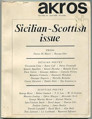
Akros - Vol. 9, No. 27, April 1975: Sicilian - Scottish Issue
Verlag: Akros Publishing, Lancashire, Scotland, 1975
Anbieter: Between the Covers-Rare Books, Inc. ABAA, Gloucester City, NJ, USA
Verbandsmitglied: ABAA ESA ILAB IOBA
Bewertung:
Erstausgabe
Softcover. Zustand: Very Good. Magazine. Octavo. 104pp. Short tears on edges, sticker abrasion on front wrapper, very good. Laid in is a handwritten note Signed by poet Dana Gioia addressed to fellow poet Daniel Hoffman. Prose, Sicilian poetry and Scottish poetry with contributions by Franco Di Marco, Crescenzio Cane, Santo Cali, Pietro Terminelli, Ignazio Apolloni, Gianni Diecidue, Rolando Certa, Fiore Torrisi, Giuseppe Addamo, Carmelo Pirrera, Antonino Cremona, Emanuele Mandara, Giuseppe Zagarrio, Mariella Bettarini, Cesare Zavattini, Danilo Dolci, Nat Scammacca, Duncan Glen, George Bruce, Robert Garioch, T.S. Law, W.S. Graham, Maurice Lindsay, Edwin Morgan, Alexander Scott, George Mackay Brown, Alastair Mackie, Iain Crichton Smith, David Angus, Frederick Lindsay, James Rankin, Donald Campbell, David Black, Alan Bold, Tom Leonard, Liz Lochhead, and Raymond Falconer.
-

Management of Countertransference With Borderline Patients
Verlag: American Psychiatric Association, 1994
ISBN 10: 0880485639ISBN 13: 9780880485630
Buch Erstausgabe
hardcover. Zustand: Very Good. First Edition. First edition.
Mehr Angebote von anderen Verkäufern bei ZVAB
Gebraucht ab EUR 40,83
Mehr entdecken Hardcover Erstausgabe
-

Zustand: Wie neu. Zustand: Wie neu | Seiten: 110.
-

Zustand: Sehr gut. Zustand: Sehr gut - Gepflegter, sauberer Zustand. | Seiten: 162 | Sprache: Englisch.
-
![Bild des Verkäufers für The Singers 1970-1974 Boat to Progress [Vinyl LP] zum Verkauf von Buchpark](https://pictures.abebooks.com/inventory/md/md31845743049.jpg)
Zustand: Gut. Zustand: Gut - Gebrauchs- und Lagerspuren. Außen: Markierungen oder Aufkleber auf der Hülle.
-

Zustand: Sehr gut. Zustand: Sehr gut - Gepflegter, sauberer Zustand. | Seiten: 230 | Sprache: Englisch.
-

Jun Kaneko. The Space Between. A Retrospective.
Verlag: Scheidegger & Spiess,, 2020
ISBN 10: 3858818658ISBN 13: 9783858818652
Buch
4°. 264 S. Minimale Lagerspuren. Wegen Urlaubs werden eingehende Bestellungen zwar bestätigt, können aber erst am 04. Juni 2024 versendet werden. Due to holidays incoming orders will be confirmed but cannot be shipped before June 4th, 2024. Sprache: Deutsch Gewicht in Gramm: 0.
-

Zustand: Wie neu. Zustand: Wie neu | Seiten: 230.
-
Book Condition: new. Buch verlagsfrisch, noch in der ungeöffneten Plastikfolie.An schweizer Kunden versenden wir zwecks Reduzierung der Portokosten einmal im Monat direkt aus der Schweiz. Bitte setzen Sie sich mit uns in Verbindung.
-

Ceramics - Art and Perception, Issue 69, 2007, International: Recent Work of Mel Robson
Verlag: Ceramics: Art and Perception Pty Ltd, Sydney, Australia, 2007
Magazin / Zeitschrift Erstausgabe
Single Issue Magazine. Zustand: Very Good. First Edition. Features: Essential Clay - Galerie Besson, London; Steve Mattison - In Silent Conversation; Recent Work of Mel Robson; Dale Bowen and Pate-sur-pate; Alice at the Allport; Roland Summer - Enduring Rewards; For the Table and Beyond; James Marshall - The Liminal Object; Bruce Cochrane - Visible Reality; Malcolm Greenwood - Art of Production; The State of Clay; Angela bakker - Nomads I; Corinne Peterson Unearthing the Immutable; and much more. 120 glossy pages sumptuously illustrated with colour photography. Clean and unmarked with light wear. A quality copy.; Sm4to.
-
Geology of the Arabian Peninsula. Shield Area of Western Saudi Arabia. U.S. Geological Survey Professional Paper 560-A. Prepared in cooperation with the Ministry of Petroleum and Mineral Resources, Deputy Ministry of Mineral Resources, Jiddah, Kingdom of Saudi Arabia [and] A Review of the geology of western Saudi Arabia as refined from U.S. Geological Survey Miscellaneous Geologic Investigations Map I-270-A, "Geologic Map of the Arabian Peninsula", 1963.
Verlag: WashingtonUnited States Government Printing Office ., 1989
Anbieter: Robert Frew Ltd. ABA ILAB, London, Vereinigtes Königreich
Verbandsmitglied: ABA ILAB PBFA
Bewertung:
Buch Erstausgabe
FIRST EDITION. 4to. (29 x 23 cm). pp.x+188. Original paper wrappers printed in green, text printed in two columns, 6 colour-printed folding maps housed in matching slipcase. Photographic frontispiece, 40 coloured photographs and 26 uncoloured, numerous diagrams, and 6 large colour-printed folding maps: Geologic Map of the Saudi Arabian Shield (100 x 116 cm), Geologic Map of the Saudi Arabian Shield (78 x 125 cm), Physiographic Provinces of the Arabian Peninsula (70 x 87 cm), Map of Cenozoic Igneous Rocks of Saudi Arabia (63 x 101 cm), Map of Cenozoic Igneous Rocks of Saudi Arabia (98 x 69.5 cm) Maps Showing Details of Sharms Along the Arabian Coast of the Red Sea and the Gulf of 'Aqaba, Saudi Arabia (34 x 49 cm).
-
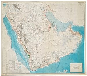
[United States Geological Survey of the Kingdom of Saudi Arabia]. Arabian Peninsula. Map I-270 B-2.
Verlag: Washington, D.C., The Survey (U.S. Geological Society), 1967., 1967
Anbieter: Antiquariat INLIBRIS Gilhofer Nfg. GmbH, Vienna, A, Österreich
Verbandsmitglied: ILAB VDA VDAO
Bewertung:
Large chromolithographed map (122 x 139 cm). Scale 1:2,000,000. On cloth. Second edition. A highly detailed map of the complete Peninsula, the first modern map in 1:2,000,000 scale. Based on the groundbreaking series prepared by the U.S. Geological Survey and the Arabian American Oil Company under the joint sponsorship of Saudi Arabia and the U.S. State Department, "a unique experiment in geological cooperation among several governments, petroleum companies, and individuals" (Seager/Johnston). Also includes the territories of today's Kuwait, Qatar, Bahrain, United Arab Emirates, Oman, and Yemen. "The plan for a cooperative mapping project was originally conceived in July 1953 [. By 1955] there was established a cooperative agreement between the Kingdom of Saudi Arabia, the U.S. Department of State, and the Arabian-American Oil Co. to make available the basic areal geology as mapped by Aramco and the U.S. Geological Survey" (ibid.). The plan provided for 21 maps on a 1:500,000 scale in both geologic and geographic versions; "a peninsular geologic map on a scale of 1:2,000,000 was to conclude the project [.] The first geographic quadrangle was published in July 1956 and the last in September 1962. While preparation of the geographic sheets was in progress, a need arose for early publication of a 1:2,000,000-scale peninsular geographic map. Consequently, a preliminary edition was compiled and published in both English and Arabic in 1958" (ibid.). This revised, final version ("I-270 B-2") that first appeared in 1963 incorporated additional photographic, topographic and cultural data. The present map, printed in 1967, is a re-issue of the 1963 edition, merely differing in the date. Includes a key with symbols for water pipelines, desert watering points, oil fields, pumping stations, refineries, and a glossary of Arabic names. - "Although the search for oil, gas and minerals was ultimately to drive geological survey work across the region [.], in its early years it was the need for water that was the catalyst for Saudi Arabia's resource exploration. In 1944 King 'Abd al-'Aziz approached the United States for a technical expert who could assist with the identification and plotting of the kingdom's natural resources, particularly its groundwater reserves. The individual who arrived, Glen F. Brown, was one of the pioneers of a partnership between the United States Geological Survey (USGS) and the government of Saudi Arabia that was to span the next five decades and play an important role in the development of the kingdom [.] By 1954 the Saudi Ministry of Finance, USGS and Aramco were working together to produce the first full series of geographic and geologic maps of the country. The first of their type in the Peninsula, these were published [.] in both Arabic and English versions, and the information they contained formed the basis of subsequent Saudi national development plans. To this day, all modern maps of the kingdom trace their roots back to these first publications" (Parry). - Several small tears and paper loss to right and upper margin, professionally restored. - James V. Parry, "Mapping Arabia", in: Saudi Aramco World 2004/1, p. 20ff. OCLC 6681002. O. A. Seager/W. D. Johnston, Foreword to the Geology of the Arabian Peninsula series (U.S. Geological Survey Professional Paper 560-A-D, 1966).
-
Arabian Peninsula. I-270 B-2
Verlag: Washington DCDepartment of the Interior United States Geological Survey and the Kingdom of Saudi Arabia Ministry of Finance ., 1963
Anbieter: Robert Frew Ltd. ABA ILAB, London, Vereinigtes Königreich
Verbandsmitglied: ABA ILAB PBFA
Bewertung:
Karte
SECOND EDITION, ENGLISH ISSUE. Large chromolithohraphed map (122 x 139 cm) of the Arabian peninsula shown with topographic relief, and marked with water pipelines, oases, oil fields, oil pipelines, ports and harbours, oil wells, natural gas fields, quarries and mines. Key lower left. The map includes the territories of modern day Kuwait, Qatar, Bahrain, United Arab Emirates, Oman, and Yemen, and was the work of a team lead by the distinguished geologist Glen F. Brown, whose pioneering work on surface geology, with its emphasis on water resources, minerals, and oil, pertains to this day. Minor light spotting lower right, generally in excellent condition. Issued simultaneously in an English and Arabic versions. Originally conceived in 1953 this second edition shows significant additional topographical detail and noticeably showing the growth in oil fields and accompanying infrastructure. Brown (1911-2001) began his career conducting coal investigations in South China and the Philippines and ground water investigations in Mississippi and Colorado, the latter mostly concerned with supplying water to military installations. In response to a request from Ibn Sa'ud for assistance from the United States Geological Survey (USGS), Brown was selected in 1944 to investigate water supplies in the Saudi Arabian desert. Brown "arrived in Saudi Arabia early in 1945 and joined a mission sponsored by the US Foreign Economic Administration to study possibilities for agricultural development in central Arabia. As part of the mission he carried out a detailed investigation of the geologic formations in the Al Kharj district and identified substantial ground-water resources in buried aquifers. His report on the results of that investigation was very enthusiastically received by Saudi officials. [Brown returned to Saudi Arabia at the request of Ibn Saud] to conduct reconnaissance geologic mapping, mineral evaluation, and water-resource studies in the western and central parts of the kingdom. The mapping was carried forward from 1950 to 1958 by [Brown] with USGS and Saudi associates and extended to the entire Arabian Peninsula in cooperation with the Arabian American Oil Company (Aramco), as well as to organizations and companies of other countries in the peninsula. This resulted in a remarkable series of bilingual geologic and geographic maps of Saudi Arabia at a scale of 1:500,000, and a geologic and geographic map of the entire Arabian Peninsula at a scale of 1:2,000,000, all of which were published by the USGS. These maps, together with reports on the geology, mineral deposits, and water resources prepared by [Brown] and his associates, providing the basis for Saudi Arabia to undertake a major national resource exploration and development program" (obituary Geological Society of America). The map includes the territories of modern day Kuwait, Qatar, Bahrain, United Arab Emirates, Oman, and Yemen. Although the hunt for oil, gas and minerals ultimately drove geological survey work across the region, in its early years it was the need for continual water sources which was the catalyst for Saudi Arabia's resource exploration. In 1944 King 'Abd al-'Aziz approached the United States for a technical expert who could assist with the identification and plotting of the kingdom's natural resources, particularly its groundwater reserves. Glen F. Brown, who undertook the task and is responsible for this map, was one of the pioneers of a partnership between the United States Geological Survey (USGS) and the government of Saudi Arabia. This collaboration was one of international importance, spanning the next five decades and influencing the development of the kingdom significantly. By 1954, the Saudi Ministry of Finance, United States Geological Survey (USGS) and Aramco were working together to produce the first full series of geographic and geologic maps of the country. The first of their type in the Peninsula, were published between the late 1950s and early 1960s in both Arabic and English copies. The information these maps contained formed the basis of subsequent Saudi national development plans. To this day, all modern maps of the kingdom trace their roots back to these publications.
-
![Bild des Verkäufers für [Map case, maps, and ephemera belonging and related to Glen F. Brown] zum Verkauf von Daniel Crouch Rare Books Ltd](https://pictures.abebooks.com/inventory/md/md31456524162.jpg)
[Map case, maps, and ephemera belonging and related to Glen F. Brown]
Verlag: U.S. Geological Survey and the U.S. Department of State, Saudi Arabia Aerial Survey Department, 1956-1982., Washington and Riyadh,, 1956
Anbieter: Daniel Crouch Rare Books Ltd, London, Vereinigtes Königreich
Verbandsmitglied: ABA ILAB PBFA
Bewertung:

Karte
"His efforts contributed materially to the phenomenal economic progress development that Saudi Arabia has experienced." Wooden case with the words 'Saudi Arabia' and 'Maps', printed to the front (317 by 336 by 197mm ), containing 30 geological maps, covering large parts of the Arabian peninsula (29 of which are housed in their original sleeves), a further three maps detailing areas of Saudi Arabia (all three with a few small tears along folds), a booklet containing two maps on the the use of computer-enhanced imagery on the geological mapping of western Arabia, a Distinguished Service Letter for Glen F. Brown, Glen F. Brown's 1995 Hollis D. Hedberg Award medal (housed in original box) and programme, the Geological Society of America's memorial service programme for Glen F. Brown, Brown's New York Times obituary, a brass plaque commemorating 30 years of Saudi American co-operation, and a postcard of the Portuguese fort Qatif. The map case belonging to Professor Glen F. Brown, the leading American geologist working in Saudi Arabia in the mid-twentieth century. His contribution to the geology of the region was vital for the wealth and prosperity of Saudi Arabia and the surrounding regions. Although the hunt for oil, gas and minerals ultimately drove geological survey work across the region, in its early years it was the need for continual water sources which was the catalyst for Saudi Arabia's resource exploration. In 1944 King 'Abd al-'Aziz approached the United States for a technical expert who could assist with the identification and plotting of the kingdom's natural resources, particularly its groundwater reserves. Glen F. Brown, who undertook the task and is responsible for the maps with this case, was one of the pioneers of a partnership between the United States Geological Survey (USGS) and the government of Saudi Arabia. This collaboration was one of international importance, spanning the next five decades and influencing the development of the kingdom significantly. By 1954, the Saudi Ministry of Finance, United States Geological Survey (USGS) and Aramco were working together to produce the first full series of geographic and geologic maps of the country. The first of their type in the Peninsula, were published between the late 1950s and early 1960s in both Arabic and English copies. The information these maps contained formed the basis of subsequent Saudi national development plans. To this day, all modern maps of the kingdom trace their roots back to these publications. The box contains 30 geological maps (of which 29 are housed within their original sleeves) on a scale of 1:500,000. The maps were produced in two versions. The sheets marked with the suffix 'A' combine geology and geography, whilst 'B' showed just the geography. The sheets marked by the prefix 'GM' are reprints of earlier maps, whilst the prefix 'AP' denotes maps of the whole of the Arabian peninsula. As well as the geological maps the box also contains: a paper on the use of computer enhanced imagery for the mapping of western Arabia; Glen Brown's Distinguished Service Citation letter from the State Department; Glen Brown's 1995 Hollis D. Hedberg Award medal and programme; the Geological Society of America's memorial service programme for Glen F. Brown; Brown's New York Times obituary; a brass plaque commemorating 30 years of Saudi American co-operation; and a postcard of the Portuguese fort Qatif. List of contents 1. Map I-200 A. Wadi As Sarhan (1963) 2. Map I-200 B. Wadi As Sarhan (1962) 3. Map I-202 A. Darb Zubaydah (1963) 4. Map I-202 B. Darb Zubaydah (1976) 5. Map I-204 B. Northwestern Hijaz (1959) 6. Map I-205 A. Northeastern Hijaz (1963) 7. Map GM-205 B. Northeastern Hijaz (1977) 8. Map I-206 A. Wadi Ar Rimah (1963) 9. Map I-207 A. Northern Tuwayq (1958) 10. Map I-207 B. Northern Tuwayq (1957) 11. Map I-210 A. Southern HIjaz (1963) 12. Map I-210 B. Geographic map of the Southern Hijaz (1958) 13. Map I-210 B. Geographic map of the Southern Hijaz (1958 revised 1968) 14. Map I-211 A. Southern Najd (1963) 15. Map GM-211 B. Southern Najd (1978) 16. Map I-212 A. Southern Tuwayq (1956) 17. Map I-212 A. Southern Tuwayq (1956) 18. Map I-212 B. Southern Tuwayq (1956) 19. Map I-216 A. Tihamat Ash Sham Without relief (1958) 20. Map I-216 A. Tihamat Ash Sham (1958) 21. Map I-216 B. Tihamat Ash Sham (1958 revised 1968) 22. Map I-216 B. Tihamat Ash Sham (1958) without sleeve 23. Map I-217 A. Asir (1959) 24. Map I-217 A. Asir (1959) 25. Map I-217 B. Asir (1958) 26. Map I-217 B. Asir (1958 revised 1968) 28. Map AP-1 Topographical Map of the Arabian Peninsula (1972) 29. Map AP-2 Tectonic Map of the Arabian Peninsula (1972) 30. Geological Map of the Arabian Peninsula (1963 republished 1980) 31. MINISTRY OF DEFENCE. Al Fufuf (1964) loose 32. AERIAL SURVEY DEPARTMENT MINISTRY OF PETROLEUM. Ar Riyad (1984) loose 33. AERIAL SURVEY DEPARTMENT MINISTRY OF PETROLEUM. Najd 3 (1967 reprint 1983) loose. Together with: 1. U.S. DEPARTMENT OF THE INTERIOR Geological Mapping by Use of Computer-Enhanced Imagery in Western Saudi Arabia. Washington, 1982. 4to (290 by 230mm), paper covers, 10pp., 2 folding maps housed in sleeve, 2. U.S. STATE DEPARTMENT. Distinguished Service Award Citation Letter for Glen F. Brown. 3. GEOLOGICAL SOCIETY OF AMERICA. Memorial to Glen F. Brown 1911-2001 3p. programme. 4. NEW YORK TIMES. Obituaries, Thursday, March 1, 2001, for Glen F. Brown, laminated. 5. Brass Plaque commemorating 30 years of Saudi American co-operation, 12th September 1963 12th September 1993. 6. Photograph of the Portuguese Fort Qatif, Saudi Arabia. 7. SOUTHERN METHODIST UNIVERSITY The 1995 Hollis D. Hedberg Award in Energy. 4pp. programme and medal in presentation box. Although individual geological maps of the Arabian peninsula do come to the market from time to time, it is unusual to have such a large collection, especially with a link to Glen F. Brown, the geologist responsible for.
-
[United States Geological Survey of the Kingdom of Saudi Arabia]. Arabian Peninsula. Map I-270 B-1.
Verlag: Washington, D.C., The Survey (U.S. Geological Society), 1958., 1958
Anbieter: Antiquariat INLIBRIS Gilhofer Nfg. GmbH, Vienna, A, Österreich
Verbandsmitglied: ILAB VDA VDAO
Bewertung:
1380:1216 mm. Lambert conformal conic projection, constant ratio linear horizontal scale 1:2,000,000. Relief shown by hachures and spot heights. Folded. A highly detailed map of the complete Peninsula, the first modern map in 1:2,000,000 scale: the rare preliminary edition, issued five years before the officical release. Based on the groundbreaking series prepared by the U.S. Geological Survey and the Arabian American Oil Company under the joint sponsorship of Saudi Arabia and the U.S. State Department, "a unique experiment in geological cooperation among several governments, petroleum companies, and individuals" (Seager/Johnston). Also includes the territories of today's Kuwait, Qatar, Bahrain, United Arab Emirates, Oman, and Yemen. "The plan for a cooperative mapping project was originally conceived in July 1953 [. By 1955] there was established a cooperative agreement between the Kingdom of Saudi Arabia, the U.S. Department of State, and the Arabian-American Oil Co. to make available the basic areal geology as mapped by Aramco and the U.S. Geological Survey" (ibid.). The plan provided for 21 maps on a 1:500,000 scale in both geologic and geographic versions; "a peninsular geologic map on a scale of 1:2,000,000 was to conclude the project [.] The first geographic quadrangle was published in July 1956 and the last in September 1962. While preparation of the geographic sheets was in progress, a need arose for early publication of a 1:2,000,000-scale peninsular geographic map. Consequently, a preliminary edition was compiled and published in both English and Arabic in 1958" (ibid.). While the revised, final version that appeared in 1963 ("I-270 B-2") would incorporate some additional photographic, topographic and cultural data, the exceedingly uncommon present, preliminary edition is surprisingly complete in virtually all respects - a testament to the precision with which Aramco's cartographers proceeded from the very first. Includes a key with symbols for water pipelines, desert watering points, oil fields, pumping stations, refineries, and a glossary of Arabic names. - "Although the search for oil, gas and minerals was ultimately to drive geological survey work across the region [.], in its early years it was the need for water that was the catalyst for Saudi Arabia's resource exploration. In 1944 King 'Abd al-'Aziz approached the United States for a technical expert who could assist with the identification and plotting of the kingdom's natural resources, particularly its groundwater reserves. The individual who arrived, Glen F. Brown, was one of the pioneers of a partnership between the United States Geological Survey (USGS) and the government of Saudi Arabia that was to span the next five decades and play an important role in the development of the kingdom [.] By 1954 the Saudi Ministry of Finance, USGS and Aramco were working together to produce the first full series of geographic and geologic maps of the country. The first of their type in the Peninsula, these were published [.] in both Arabic and English versions, and the information they contained formed the basis of subsequent Saudi national development plans. To this day, all modern maps of the kingdom trace their roots back to these first publications" (Parry). - In excellent condition. - James V. Parry, "Mapping Arabia", in: Saudi Aramco World 2004/1, p. 20ff. OCLC 30099393. O. A. Seager/W. D. Johnston, Foreword to the Geology of the Arabian Peninsula series (U.S. Geological Survey Professional Paper 560-A-D, 1966).
-
![Bild des Verkäufers für [United States Geological Survey of the Kingdom of Saudi Arabia]. Arabian Peninsula. Map I-270 B-1. zum Verkauf von Antiquariat INLIBRIS Gilhofer Nfg. GmbH](https://pictures.abebooks.com/inventory/md/md30912223282.jpg)
[United States Geological Survey of the Kingdom of Saudi Arabia]. Arabian Peninsula. Map I-270 B-1.
Verlag: Washington, D.C., The Survey (U.S. Geological Society), 1958., 1958
Anbieter: Antiquariat INLIBRIS Gilhofer Nfg. GmbH, Vienna, A, Österreich
Verbandsmitglied: ILAB VDA VDAO
Bewertung:
1380 × 1216 mm. Lambert conformal conic projection, constant ratio linear horizontal scale 1:2,000,000. Relief shown by hachures and spot heights. Framed and glazed. A highly detailed map of the complete Peninsula, the first modern map in 1:2,000,000 scale: the rare preliminary edition, issued five years before the officical release. Based on the groundbreaking series prepared by the U.S. Geological Survey and the Arabian American Oil Company under the joint sponsorship of Saudi Arabia and the U.S. State Department, "a unique experiment in geological cooperation among several governments, petroleum companies, and individuals" (Seager/Johnston). Also includes the territories of today's Kuwait, Qatar, Bahrain, United Arab Emirates, Oman, and Yemen. "The plan for a cooperative mapping project was originally conceived in July 1953 [. By 1955] there was established a cooperative agreement between the Kingdom of Saudi Arabia, the U.S. Department of State, and the Arabian-American Oil Co. to make available the basic areal geology as mapped by Aramco and the U.S. Geological Survey" (ibid.). The plan provided for 21 maps on a 1:500,000 scale in both geologic and geographic versions; "a peninsular geologic map on a scale of 1:2,000,000 was to conclude the project [.] The first geographic quadrangle was published in July 1956 and the last in September 1962. While preparation of the geographic sheets was in progress, a need arose for early publication of a 1:2,000,000-scale peninsular geographic map. Consequently, a preliminary edition was compiled and published in both English and Arabic in 1958" (ibid.). While the revised, final version that appeared in 1963 ("I-270 B-2") would incorporate some additional photographic, topographic and cultural data, the exceedingly uncommon present, preliminary edition is surprisingly complete in virtually all respects - a testament to the precision with which Aramco's cartographers proceeded from the very first. Includes a key with symbols for water pipelines, desert watering points, oil fields, pumping stations, refineries, and a glossary of Arabic names. - "Although the search for oil, gas and minerals was ultimately to drive geological survey work across the region [.], in its early years it was the need for water that was the catalyst for Saudi Arabia's resource exploration. In 1944 King 'Abd al-'Aziz approached the United States for a technical expert who could assist with the identification and plotting of the kingdom's natural resources, particularly its groundwater reserves. The individual who arrived, Glen F. Brown, was one of the pioneers of a partnership between the United States Geological Survey (USGS) and the government of Saudi Arabia that was to span the next five decades and play an important role in the development of the kingdom [.] By 1954 the Saudi Ministry of Finance, USGS and Aramco were working together to produce the first full series of geographic and geologic maps of the country. The first of their type in the Peninsula, these were published [.] in both Arabic and English versions, and the information they contained formed the basis of subsequent Saudi national development plans. To this day, all modern maps of the kingdom trace their roots back to these first publications" (Parry). - Some insignificant browning; a few slight edge defects professionally repaired. Altogether in fine condition. - James V. Parry, "Mapping Arabia", in: Saudi Aramco World 2004/1, p. 20ff. OCLC 30099393. O. A. Seager/W. D. Johnston, Foreword to the Geology of the Arabian Peninsula series (U.S. Geological Survey Professional Paper 560-A-D, 1966).

![Bild des Verkäufers für Geology of the Arabian Peninsula. Shield Area of Western Saudi Arabia. U.S. Geological Survey Professional Paper 560-A. Prepared in cooperation with the Ministry of Petroleum and Mineral Resources, Deputy Ministry of Mineral Resources, Jiddah, Kingdom of Saudi Arabia [and] A Review of the geology of western Saudi Arabia as refined from U.S. Geological Survey Miscellaneous Geologic Investigations Map I-270-A, "Geologic Map of the Arabian Peninsula", 1963. zum Verkauf von Robert Frew Ltd. ABA ILAB](https://pictures.abebooks.com/inventory/md/md31255497473.jpg)
![Bild des Verkäufers für [United States Geological Survey of the Kingdom of Saudi Arabia]. Arabian Peninsula. Map I-270 B-2. zum Verkauf von Antiquariat INLIBRIS Gilhofer Nfg. GmbH](https://pictures.abebooks.com/inventory/md/md31300842317.jpg)
![Bild des Verkäufers für [United States Geological Survey of the Kingdom of Saudi Arabia]. Arabian Peninsula. Map I-270 B-1. zum Verkauf von Antiquariat INLIBRIS Gilhofer Nfg. GmbH](https://pictures.abebooks.com/inventory/md/md30657314548.jpg)