
Gesamtpreis (1 Artikel Artikel):
Versandziel:

maldives (5 Ergebnisse)
Direkt zu den wichtigsten Suchergebnissen
Produktart
- Alle Produktarten
- Bücher (4)
- Magazine & Zeitschriften
- Comics
- Noten
- Kunst, Grafik & Poster (1)
- Fotografien
- Karten
-
Manuskripte &
Papierantiquitäten
Zustand
- Alle
- Neu
- Antiquarisch/Gebraucht
Einband
- alle Einbände
- Hardcover
- Softcover (3)
Weitere Eigenschaften
- Erstausgabe
- Signiert
- Schutzumschlag
- Angebotsfoto (3)
Land des Verkäufers
Verkäuferbewertung
-
![Beispielbild für Maldives: A Nation of Islands [Paperback] maldives zum Verkauf von tomsshop.eu](https://pictures.abebooks.com/isbn/9789627024033-de-300.jpg)
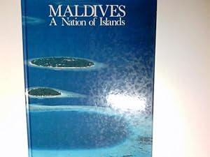
Maldives: A Nation of Islands [Paperback] maldives
Verlag: Published by Media Transasia for Dept. of Tourism, Republic of Maldives, 1983
ISBN 10: 9627024031ISBN 13: 9789627024033
Buch
Leichte Lagerspuren am Cover. Blitzversand Bestellung vor 21:00 werden am nächsten Tag versandt. Versand in luftgepolstertem Kuvert aus Deutschland, Auslandsversand auf Anfrage, Für Mehrfachbestellungen kà nnen Preisnachlässe angefragt werden. International enquiries welcome. Enviamos al extranjero. Very Good - Gebraucht - Sehr gut.
-
Maldives: A Nation of Islands
Verlag: Published by Media Transasia for Dept. of Tourism, Republic of Maldives, 1983
ISBN 10: 9627024031ISBN 13: 9789627024033
Buch
Paperback. Zustand: Used; Good. Dispatched, from the UK, within 48 hours of ordering. This book is in good condition but will show signs of previous ownership. Please expect some creasing to the spine and/or minor damage to the cover.
-
Maldives: A Nation of Islands
Verlag: Published by Media Transasia for Dept. of Tourism, Republic of Maldives, 1983
ISBN 10: 9627024031ISBN 13: 9789627024033
Anbieter: Antiquariat Buchhandel Daniel Viertel, Diez, Deutschland
Bewertung:

Buch
4°, Hardcover/Pappeinband. Zustand: Gut. unpag. mit zahlr. Abb. in gutem Zustand 19089 ISBN 9789627024033 Sprache: Englisch Gewicht in Gramm: 485.
-
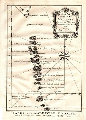
Karte der Malediven,
Anbieter: Antiquariat Martin Barbian & Grund GbR, Saarbruecken, Deutschland
Bewertung:
Kunst / Grafik / Poster
Kupferstich, 1750, 22x15 cm (Faltspuren) (Landkarten / Antique Maps / Indischer Ozean / Asien) *Schöner kräftige Abzug.
-
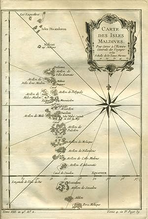
Carte des Isles Maldives
Verlag: Paris, 1775
Anbieter: Antipodean Books, Maps & Prints, ABAA, Garrison, NY, USA
Verbandsmitglied: ABAA ANZAAB ESA ILAB
Bewertung:

Zustand: Very good condition. Detailed copper engraved map of the Maldives, southwest of India and Sri Lanka, and extending from Isles Divandorou down to Pora Moluque. The low elevation above sea level makes these islands the Earth's lowest nation, with concerns about rising sea levels causing its government to make a carbon neutral pledge. From Prevost's "L'Histoire Generale des Voyages". Bellin (1703 - 1772), one of the most noted French mapmakers of the 18th century, was named the hydrographer (chief cartographer) to the French Navy, and later, the Official Hydrographer to the French King. With a compass rose, rhumb lines and decorative cartouche. Strong impression, very clean.