
Gesamtpreis (1 Artikel Artikel):
Versandziel:

ptolemy claudius (113 Ergebnisse)
Direkt zu den wichtigsten Suchergebnissen
Produktart
- Alle Produktarten
- Bücher (110)
- Magazine & Zeitschriften
- Comics
- Noten
- Kunst, Grafik & Poster
- Fotografien
- Karten (3)
-
Manuskripte &
Papierantiquitäten
Zustand
Einband
Weitere Eigenschaften
- Erstausgabe (4)
- Signiert
- Schutzumschlag
- Angebotsfoto (107)
Land des Verkäufers
Verkäuferbewertung
-
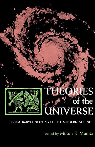
Theories of the Universe: From Babylonian Myth to Modern Science (Library of Scientific Thought)
Verlag: The Free Press, 1965
ISBN 10: 0029222702ISBN 13: 9780029222706
Anbieter: Wonder Book, Frederick, MD, USA
Bewertung:

Buch
Zustand: Good. Good condition. (Cosmology, Philosophy, Science) A copy that has been read but remains intact. May contain markings such as bookplates, stamps, limited notes and highlighting, or a few light stains.
-
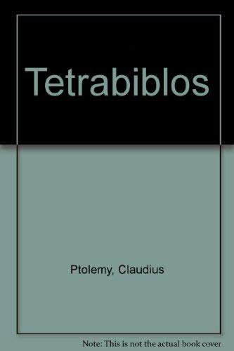
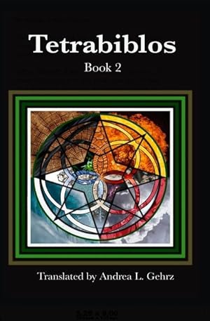
Tetrabiblos, Together with the Centiloquy
Verlag: Symbols & Signs, 1974
ISBN 10: 0912504315ISBN 13: 9780912504315
Buch
Zustand: Very Good. Used book that is in excellent condition. May show signs of wear or have minor defects.
-
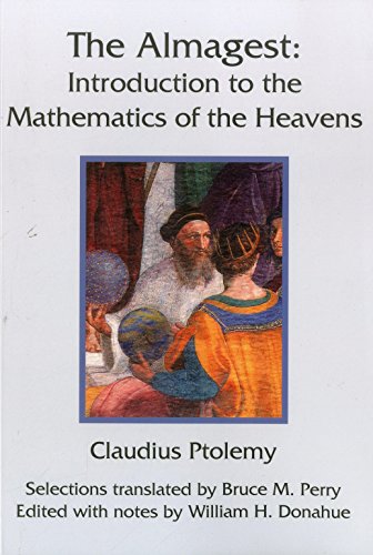
The Almagest
Verlag: Green Lion Press 2014-12-07, Santa Fe, 2014
ISBN 10: 1888009438ISBN 13: 9781888009439
Buch
paperback. Zustand: New. Language: ENG.
Mehr Angebote von anderen Verkäufern bei ZVAB
Neu ab EUR 21,65
-
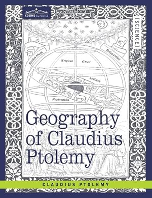
Geography of Claudius Ptolemy
Verlag: COSIMO CLASSICS, 2011
ISBN 10: 1605204382ISBN 13: 9781605204383
Buch
Zustand: New. KlappentextrnrnGeography of Claudius Ptolemy, originally titled Geographia and written in the second century, is a depiction of the geography of the Roman Empire at the time. Though inaccurate due to Ptolemy s varying methods of measurement and .
-

Zustand: New.
-
Zustand: New.
-

Zustand: New.
-

Hardcover. Zustand: Very Good. An oversized facsimile with 26 maps in color and decorative writing in Latin of an unknown edition of Ptolemy's Cosmographia. Bound in beigh cloth with a brown leather spine with gilt decoration by Gray Parrot of Hancock, Maine. There is no title page, English text, or other indication of what this is a facsimile of.
-
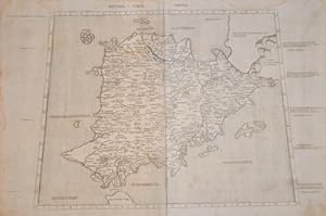
Tabula Prima Asiae continet Pontum, Bithyniam, Asiam propriae dictam, (.)
Verlag: Gaspar Trechsel, 1541
Anbieter: Antiquariaat Dat Narrenschip, Middelburg, Niederlande
Bewertung:
Karte
No Binding. Zustand: Very Good. Trapezoidal map of Turkey and Asia Minor. This map by Laurent Fries is based on Claudius Ptolemy (87-150), the famous geographer from Antiquity. Some minor spots in the margins. Woodcut, published in Vienne in 1541 by Gaspar Trechsel in "Claudii Ptolemaei Alexandrini Geographicae Enarrationis, Libri Octo, (.)" Dimensions (picture): 30 x 47 cm.
-
Asiae Tabula decima continet Indiam intra Gangem.
Verlag: Gaspar Trechsel, 1541
Anbieter: Antiquariaat Dat Narrenschip, Middelburg, Niederlande
Bewertung:
Karte
No Binding. Zustand: Near Fine. Trapezoidal map of the region in Asia that largely corresponds to present-day India. This map by Laurent Fries is based on Claudius Ptolemy (87-150), the famous geographer from Antiquity. Woodcut, published in Vienne in 1541 by Gaspar Trechsel in "Claudii Ptolemaei Alexandrini Geographicae Enarrationis, Libri Octo, (.)." Dimensions (picture): 30 x 48.
-
Claudii Ptolemaei Alexandrini. Geographiae libri octo Graeco-Latini.
Erscheinungsdatum: 1605
Anbieter: Altea Antique Maps, London, Vereinigtes Königreich
Verbandsmitglied: ABA ILAB PBFA
Bewertung:
Erstausgabe
Amsterdam: Cornelis Nicolai and Jodocus Hondius, 1605. Folio (425 x 280mm), contemporary red morocco gilt, arabesque central ornament within fillet and roll-tool frames, single ornament in spine compartments, remains of silk ties; pp. (10)+215+(32)(index); engr. title, portrait of Mercator in text and 28 double-page engraved maps with Latin text on verso. Old ink signature on printed title page, some faint damp staining. A fine example of the first edition of the Geographia to have Greek text in parallel with the Latin, with verse by Daniel Heinsius, P. Vertius and J. Gruterus among the preliminary matter. The titlepage has been re-engraved, but the maps are identical to the first state of 1578. This was the first of Gerard Mercator's works to be published by Jodocus Hondius, a year after he purchased the printing plates. His edition of Mercator's modern atlas first appeared in 1606. KOEMAN: 1:511C, ''The Ptolemy edition of 1605 is the first work printed in Greek in Amsterdam, and is a typographic masterpiece'.
-
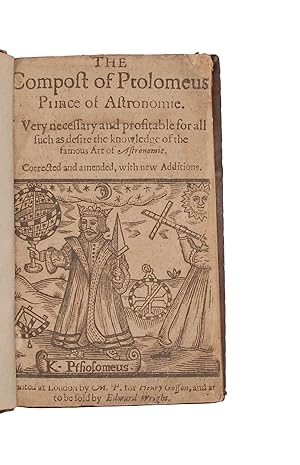
The Compost of Ptolomeus, Prince of Astronomie. Very necessary and profitable for all such as desire the knowledge of the famous art of astronomie.
Verlag: London, M. P[arsons] for Henry Gosson, and are [to be sold by Edward Wright], 1638
Anbieter: Sokol Books Ltd. ABA ILAB, London, Vereinigtes Königreich
Bewertung:

Buch
Hardcover. Zustand: Good. [AMERICANUM] 4to. 72 unnumbered leaves. A-I . Black letter some Roman. Large astronomical woodcut of K. Ptholomeus and an astronomer (just chipped at fore-edge) on title, woodcut and typographical headpieces, small floriated initials, sixty three woodcuts in the text, including a figure of the heavens, the 12 signs of the zodiac, a world map, physiognomoligcal portraits, a large woodcut of a dragon in landscape on verso of last, chiromantic hands, and stars etc, monogram H. R. with shelf mark on fly. Light general age browning, heavier in places, title slightly dusty, light waterstaining on first few leaves, occasional mark or stain. A good copy in English calf circa 1800, covers bordered with a single gilt rule, spine gilt ruled, title gilt lettered, a.e.r. a little rubbed. Exceptionally rare edition of this popular astronomical text, very charmingly illustrated with numerous woodcuts, the last of the early editions, the only edition printed in the seventeenth century. The rather rudimentary map is marked i.a. with Mexico, New England, the West indies, Peru, the Straits of Magelan, Brasil and Virginia. Below the two southmost capes is a the land mass described as the South Continent . The work was originally translated from the French Compost et kalendrier des bergiers , and appeared in two forms throughout the C16th; one as The Kalender of Shepards and the other with the title The Compost of Ptholomeus . Although they are often described as containing nothing from Ptolemy, other than the falsification of authorial attribution, the work does have a general articulation of some of the astrological matters set forth in Ptolemy s Quadripartitum. The influence of astronomy over individuals is discussed, and this version has a chapter on palmistry added at the end. In the Kalendar of Shepherds , the putative source of the astrological and health information is initially an unnamed, ancient shepherd. the authentication for the information in the text was a natural and pastoral figure of wisdom, the void of book learning. In the prologue, it is also stated that this boke was made for them that be no Clerkes to brynge them to great understandynge thus identifying itself as a text for a non-elite readership yet at the same time offering access to the very traditional classical learning skills and intimating a connection between the occult knowledge and active reading. . In Notary s 1506 edition, Ptolemy is merely cited in the table of contents in relation to the twelve signs of the zodiac but not mentioned in the text. In Pynson s 1518 edition, Ptolemy is referenced both textually and visually, again in relation to the zodiac, but as a very minor reference in the text. . Beginning in the 1530s, the strand of the multi-text breaks off; the text is condensed, new images are added, others are eliminated, and the title is changed to the Compost of Ptolomeus, Prince of Astronomy . These editions, initially published by Robert Wyer, make a significant modification: the name of the Ptolemy is increasingly inserted into the verbal text, shifting the authentication from the ancient shepherd to Ptolemy. . The Catholic feast day calendar is eliminated, along with much of the Christian moralising and, generally, a narrower focus on the astrological components. Neither the woodblock image of the shepherd nor that of the scholar carries over once the text is renamed The compost of Ptolomeus; instead, the symbolic function previously vested in the figure of the scholar shepherd is now conflated into the single figure of Claudius Ptolomy, Prince of Astronomeye . .In his editions of the Compost, Wyer not only strengthened the association of the verbal and visual text with Ptolemy, but also incorporated specifically geographical information; Wyer appends a Rutter , a navigational chart of the distances between various port cities, consequently increasing the function of the text as a source of geographic information.
-
[Tetrabiblos]. Hoc in libro nunquam ante typis aeneis in lucem edita haec insunt. [Greek:] KLAUDIOU ptolemaiou plousieos tetrabiblos sotaxis, pros Syron adelfos. TOU AUTOU karpos, pros ton auton Syros. [Latin:] Claudii Ptolemaei Pelusiensis libri quat. - [EDITIO PRINCEPS OF "THE BIBLE OF ASTROLOGY"]
Norimbergae [Nürnberg], (Apud Ioannem Petreium), 1535. 4to. Bound in a beautiful contemporary full blindstamped vellum binding over wooden boards. Boards with blindstamped borders with portraits of Marcus, Johannes, Mattheus, Lucas, inside which large square blindstamped centre-piece with floriated decorations and small portriats. Three raised bands to back. Brass clasps to boards partially preserved. A bit of overall wear and general use. Overall a very nice and tight copy. Internally very nice and clean with only a bit of occasional minor brownspotting and soiling. Two leaves with a spot to outer margin (looks like remain of wax or lacquer), far from affecting text. Last four leaves of Greek text with dampstaining. First leaf of Latin text with coloured initial and a couple of red and green underlinings. Woodcut initials. First ab. 10 leaves of text with neat contemporary annotations in Latin and Greek. (6),59, (4) ff. + 84, (24) ff. (The four leaves in between the Greek and the Latin text being the title page: "Librorum de Iudiciis Astrologicis quatuor, duo priores conuersi in linguam Latinam ŕ Ioachimo Camerario Pabergense. Annotatiunculae in eosdem. Aliquot loci translati de tertio & quarto libro Ptolemaei, per eundem Camerarium.", two leaves of preface/dedication, dated 1535, one blank). The very rare first Greek/Latin edition, i.e. the editio princeps of the Greek text and the first edition of Camerarius' seminal translation into Latin (directly from the Greek), of Ptolemy's famous textbook of astrology known under the name "Tetrabiblos" or "Quadripartitum", derived from its four books, the work which "ranks as the Bible of Astrology" (Stillwell) and which Ptolemy himself considered the natural complement to his "Almagest": "as the latter enables one to predict the positions of the heavenly bodies, so the former expounds the theory of their influences on terrestrial things." (D.S.B. XI:198). The present edition also contains the editio princeps of the Greek text of the "Karpos", or "Centiloquium" (because of its 100 aphorisms), erroneously attributed to Ptolemy, as well as Pontano's famous Latin version of it.The "Tetrabiblos" is considered one of, if not the, most important surviving ancient texts on astrology, and its impact and influence on this field has been immense. It was by far the most popular astrological work of Antiquity and it also greatly influenced the Islamic world, the Medieval Latin West, and the Renaissance. It was reprinted continuously for centuries, and its great popularity is often attributed to the fact that it is a textbook on the art of astrology itself and a "scientific" defense of it rather than a mere manual instructing lay people on how to practice the art. "Of Ptolemy's genuine works the most germane to and significant for our investigation is his "Tetrabiblos", "Quadripartium", or four books on the control of human life by the stars. In the "Tetrabiblos" the art of astrology receives sanction and exposition from perhaps the ablest mathematician and closest scientific observer of the day or at least from one who seemed so for succeeding generations. Hence from that time on astrology was able to take shelter from any criticism under the aegis of his authority." (Thorndike I:111).As opposed to the "Karpos", almost all research points to the fact that the "Tetrabiblon" must genuinely be by Ptolemy, and as such, it is to be considered of the greatest importance, not only to astrology, the history and impact of the science, but also to astronomy and to the understanding of the man who wrote one of the most important astronomical works of all times. In the "Tetrabiblos" Ptolemy first discusses the validity of the art of judicial astrology, and the introductory chapters are devoted to defending astrology against charges that it is uncertain and useless. According to Ptolemy, the laws of astronomy are beyond dispute, but the art of predicting human affairs from the movement of the stars should be attacked using more reason than that, and his main argument is that one should not reject the art itself merely because it can be abused, and frequently is, by impostors, or because it is an art not yet fully developed and may be difficult to handle properly. In book I Ptolemy goes on to explain the technical concepts of astrology, in book II, the influences on the earth in general, and in books II and IV, the influences on human life. "Although often dependent on earlier authorities, Ptolemy often develops his own dogma. The discussion in books III and IV is confined to what can be deduced from a man's horoscope." (D.S.B. XI:198). "The great influence of the "Tetrabiblos" is shown not only in medieval Arabic commentaries and Latin translations, but more immediately in the astrological writings of the declining Roman Empire, when such astrologers as Hephaestion of Thebes, Paul of Alexandria, and Julius Firmicus Maternus cite it as a leading authoritative work. Only the opponents of astrology appear to have remained ignorant of the "Tetrabiblos", continuing to make criticisms of the art which do not apply to Ptolemy's presentation of it or which had been specifically answered by him." (Thorndike I: 115-16).Camerarius's translation of the "Tetrabiblon", here printed for the first time, is probably the most important and influential of the many Latin versions of the text. It is considered the best, most widely used, and most important for the spreading of Ptolemaean astrology in the Renaissance, where this came to play a great role at the universities and beyond. "Melanchton never doubted the scientific accuracy of astrology. For instance, in 1535 Joachim Camerarius' edition of Ptolemy's "Tetrabiblos" was warmly received by Melanchton" in the same year he began lecturing on Ptolemy's work at Wittenberg and stressed the scientific character of the work in his opening address. And in the following year he commented on the second book, beginning with an exhortation to app.
-
Geographia Universalis, vetus et nova, complectens Claudii Ptolemaei Alexandrini enarrationis libros VIII
Anbieter: Redins antikvariat, Enköping, Schweden
Bewertung:
Basel, Henrichum Petrum (Heinrich Petrus) 1545. (54),(2 blank),195.(1) pages. Folio. A few illustrations in text. Old vellum binding in fine condition. Small holes in the upper margin of the title. First leaf of Liber I with small piece of the upper margin cut out (5,5x2 cm.) A few old ink notes in margins. Occational foxing. From page 167 - 195 water-staind in upper margin. All 54 plates are missing.*Plates missing.[#213977].
-
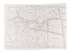
Quinta Asiae Tabula
Verlag: [1507]., 1507
Anbieter: Maggs Bros. Ltd ABA, ILAB, PBFA, BA, London, Vereinigtes Königreich
Verbandsmitglied: ABA ILAB PBFA
Bewertung:
Double-page engraved map, printed on two sheets totalling 355 by 530 mm. Some faint water-staining to the left side, a few instances of mild spotting, otherwise very good. One (later?) annotation in ink to Susa, ?Cittŕ Reale di Persiani? [Rome, Evangelista Tosinus], The second printed map of Persia. Claudius Ptolemy, often considered the ?Father of Geography? was a Greco-Egyptian scholar working in Alexandria, Egypt, circa 150 A.D. His most lasting monument was the Geographia, a summation of the geographical knowledge of the world as it was known in his time, possibly illustrated with maps, but certainly incorporating the technical data necessary to create them. With the fall of the Western Roman Empire, the text was lost to western scholars until about 1406 when the scholar Jacobo d'Angelo prepared a Latin translation of a Greek manuscript. The rediscovery prompted great excitement; numerous manuscript copies were made, many of them containing maps from Ptolemy's calculations. Later, with the invention of printing - particularly printing from engraved plates - Ptolemy's text, and the accompanying maps, formed the basis of the earliest printed atlases. This printing plate was published by Arnold Buckinck in Rome in 1478; his was the second printed edition of Ptolemy with maps, but the first version, issued in 1477, is so rare as to be unobtainable, leaving this as the oldest map of Persia acquirable by a collector. The present example is from the third printing of the atlas, which took place in 1507. It shows all of Persia and part of Turkmenistan, to the southeast of the Caspian Sea.
-
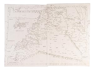
Quarta Asiae Tabula
Verlag: 1507]., 1507
Anbieter: Maggs Bros. Ltd ABA, ILAB, PBFA, BA, London, Vereinigtes Königreich
Verbandsmitglied: ABA ILAB PBFA
Bewertung:
Double-page engraved map, printed on two sheets totalling 370 by 550mm. Trimmed into the marginal text. Two later annotations/additions in ink; a cross above Jerusalem and ?Bagdad? neatly written above Babylon. A few small dark spots to the centre, otherwise very good. [Rome, Evangelista Tosinus, A lovely copy of the second printed map of Mesopotamia (modern-day Iraq), the Levant and the Holy Land. Claudius Ptolemy, often considered the ?Father of Geography? was a Greco-Egyptian scholar working in Alexandria, Egypt, circa 150 A.D. His most lasting monument was the 'Geographia', a summation of the geographical knowledge of the world as it was known in his time, possibly illustrated with maps, but certainly incorporating the technical data necessary to create them. With the fall of the Western Roman Empire, the text was lost to western scholars until about 1406 when the scholar Jacobo d'Angelo prepared a Latin translation of a Greek manuscript. The rediscovery prompted great excitement; numerous manuscript copies were made, many of them containing maps from Ptolemy's calculations. Later, with the invention of printing - particularly printing from engraved plates - Ptolemy's text, and the accompanying maps, formed the basis of the earliest printed atlases. This printing plate was published by Arnold Buckinck in Rome in 1478; his was the second printed edition of Ptolemy with maps, but the first version, issued in 1477, is so rare as to be unobtainable, leaving this as the oldest engraved map of Mesopotamia, the Levant and the Holy Land acquirable by a collector.
-
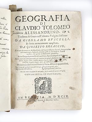
Geografia di Claudio Tolomeo Alessandrino, Tradotto di Greco nell'Idioma Volgare Italiano da Girolamo Ruscelli, et hora nuouamente ampliata de Gioseffo Rosaccio
Erscheinungsdatum: 1599
Anbieter: Maggs Bros. Ltd ABA, ILAB, PBFA, BA, London, Vereinigtes Königreich
Verbandsmitglied: ABA ILAB PBFA
Bewertung:
Quarto (227 x 165 mm); [4], [32], 42, 186, 144, [28] leaves, with a woodcut globe and table, text diagrams and sixty-nine maps, twenty-seven Ptolemaic and forty-two modern; the text in three parts, the Geografia, the ?Descrittione della Geografia Universale, con Tavole Quarantadue d?intaglio de rame . con Discorsi fatti da Gioseppe Rosaccio? and ?Espositioni et Introduttioni Universale di Girolamo Ruscelli sopra la Geografia?, 1598. 18th century mottled calf, gilt, with red morocco label and floral decoration to spine. Front joint split at head, some mild worming to spine, extremities rubbed. The title spotted, but the text generally clean. Some light waterstaining towards the rear. Venice : Heirs of Melchior Sessa, Seventh edition of Ruscelli?s version of Ptolemy, the fifth in Italian. As with the 1598 edition, it was edited by Rosaccio, and retains the additional suite of World and Continent maps after Abraham Ortelius. References: Shirley, T.PTOL-10g; Nordenskiold Collection Catalogue, III, 228.
-
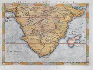
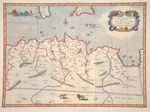
Africa nuova Tavola
Verlag: Artist: Ptolemy/ Ruscelli Claudius ( - 1566 ) ; issued in: Venice ; ca: 1564; - Girolamo Ruscelli (1500s-1566) was an Italian polymath humanist editor and cartographer active in Venice during the early 16th century Ruscelli is best known for his important revision of Ptolemy's Geographia which was published post humously in 1574 It is generally assumed that Alexius Pedemontanus was a pseudonym of Girolamo Ruscelli In a later work Ruscelli reported that the Secreti contained the experimental results of an ?Academy of Secrets? that he and a group of humanists and noblemen founded in Naples in the 1540s Ruscelli?s academy is the first recorded example of an experimental scientific society The academy was later imitated by Giambattista Della Po, 1500
Anbieter: Antique Sommer& Sapunaru KG, München, Deutschland
Bewertung:

Erstausgabe
Technic: Copper print; colorit: original colored; condition: Very good, size (in cm): 18,5 x 25 cm; - Map shows almost all of Africa with Madagascar.; - Special feature: First edition, from the atlas Geographia CL Ptolemaei Alexandrini, latin edition.
-
![Bild des Verkäufers für Tabula Europae VI [Italia]. zum Verkauf von Libreria Oreste Gozzini snc](https://pictures.abebooks.com/inventory/md/md31584031977.jpg)
[In Venetia], [per Gioan. Baptista Pedrezano], [1548], carta geografica raffigurante l'Italia, la Corsica ed altre altre isole vicine all'Italia: incisa in rame, mm. 132x172 (l'impronta della lastra), mm. 167x197 (il foglio, che reca, sull'altra facciata, la descrizione a stampa della carta). Proveniente dall'edizione della Geografia di Tolomeo stampata a Venezia dal Pedrezano nel 1548: in-8, prima edizione con le carte geografiche incise da Giacomo Gastaldi, prima edizione della traduzione italiana di Pietro Andrea Mattioli. "This important edition, printed in a portable format and thus the first to address the needs of travellers, contains the first full series of Ptolemaic maps to appear since the incunable editions of the preceding century. The maps of the present edition were engraved by the prolific Giacomo Gastaldi (c. 1500 - c.1565), cosmographer to the Republic of Venice; while Gastaldi based his engravings of the 26 Ptolemaic maps on the woodcuts by Münster which illustrated the 1540 Basel edition, the 34 modern maps (which are interposed between the ancient maps), were of his own design, and contain significant innovations. [.] The translation by the botanist Pietro Andrea Mattioli appears in this edition only; it was superseded by Girolamo Ruscelli's translation, which was first published in 1561 and frequently reprinted. The only earlier Italian version was Berlinghieri's verse paraphrase (Florence: ca. 1482)". Ottime condizioni.
-

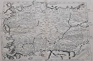
Tabula Asiae I
Verlag: Artist: Ptolemy/ Ruscelli Claudius ( - 1566 ) ; issued in: Venice ; ca: 1564; - Girolamo Ruscelli (1500s-1566) was an Italian polymath humanist editor and cartographer active in Venice during the early 16th century Ruscelli is best known for his important revision of Ptolemy's Geographia which was published post humously in 1574 It is generally assumed that Alexius Pedemontanus was a pseudonym of Girolamo Ruscelli In a later work Ruscelli reported that the Secreti contained the experimental results of an ?Academy of Secrets? that he and a group of humanists and noblemen founded in Naples in the 1540s Ruscelli?s academy is the first recorded example of an experimental scientific society The academy was later imitated by Giambattista Della Po, 1500
Anbieter: Antique Sommer& Sapunaru KG, München, Deutschland
Bewertung:
Erstausgabe
Technic: Copper print; colorit: original colored; condition: Very good, size (in cm): 18,5 x 25; - Map shows toltal Turkey, map has a trapezoidal projection.; - Special feature: First edition, from the atlas Geographia CL Ptolemaei Alexandrini, latin edition.
-

Quinta Europe tabula
Verlag: Artist: Ptolemy/ Petrus de Turre Claudius ; issued in: Rome ; ca: ; - Petrus de Turre puchased Conrad Sweynheyms plates in 1490 to reissue the maps based on Claudius Ptolemy notes Claudius Ptolemy ( arround 100- 160 aC) Geographia gives a list of geographic coordinates of spherical longitude and latitude of almost ten thousand point locations on the earth surface as they were known at his times The list is organized in Tabulae which cor- respond to specific regions of the three known continents at that time Africa Asia and Europe Research on Ptolemy?s Geographia has started at the University of Thessaloniki Greece in the eighties focused mainly but not exclusively on data re- lated to territories which are now under the sovereignty of the m, 1490
Anbieter: Antique Sommer& Sapunaru KG, München, Deutschland
Bewertung:
Technic: Woodcut; colorit: original colored; condition: Perfect condition, size (in cm): 26,5 x 55 cm; - Map shows north east Italy, Slowenis, Croatia and Dalmatia.; - Special feature: Published in the second edition Ptolomy of Angelus & Caldarini.
-

Septima Asiae Tabula
Verlag: Artist: Ptolemy/ Petrus de Turre Claudius ; issued in: Rome ; ca: ; - Petrus de Turre puchased Conrad Sweynheyms plates in 1490 to reissue the maps based on Claudius Ptolemy notes Claudius Ptolemy ( arround 100- 160 aC) Geographia gives a list of geographic coordinates of spherical longitude and latitude of almost ten thousand point locations on the earth surface as they were known at his times The list is organized in Tabulae which cor- respond to specific regions of the three known continents at that time Africa Asia and Europe Research on Ptolemy?s Geographia has started at the University of Thessaloniki Greece in the eighties focused mainly but not exclusively on data re- lated to territories which are now under the sovereignty of the m, 1490
Anbieter: Antique Sommer& Sapunaru KG, München, Deutschland
Bewertung:
Technic: Woodcut; colorit: original colored; condition: Perfect condition, size (in cm): 30 x 55; - Rare trapezoind projection map of the Caspian Sean with the bordering countries.; - Special feature: After the manuscript of Nicolas Germanus.
-
Secunda Europe Tabula
Verlag: Artist: Ptolemy/ Petrus de Turre Claudius ; issued in: Rome ; ca: ; - Petrus de Turre puchased Conrad Sweynheyms plates in 1490 to reissue the maps based on Claudius Ptolemy notes Claudius Ptolemy ( arround 100- 160 aC) Geographia gives a list of geographic coordinates of spherical longitude and latitude of almost ten thousand point locations on the earth surface as they were known at his times The list is organized in Tabulae which cor- respond to specific regions of the three known continents at that time Africa Asia and Europe Research on Ptolemy?s Geographia has started at the University of Thessaloniki Greece in the eighties focused mainly but not exclusively on data re- lated to territories which are now under the sovereignty of the m, 1490
Anbieter: Antique Sommer& Sapunaru KG, München, Deutschland
Bewertung:
Technic: Woodcut; colorit: black/white; condition: Very good, size (in cm): 34,5 x 54 cm; - Map shows in trapezoidal form the Iberian Peninsula with Spain, Portugal and the Balearic Islands (Mallorca, Menorca, Ibiza).
-
La Geografia di Claudio Tolomeo Alessandrino, Giŕ tradotte di greco in italiano da M. Giero. Ruscelli: & hora in questo nuoua editione da M. Gio. Malomba ricoretta, & purgata d'infiniti errori: come facilmente nella Prefatione a Lettori puň ciascuno. - [DEPICTING THE WORLD]
Venetia (Venice), Giordano Ziletti, 1574-(73). 4to. Hcalf from ab 1820. Gilt back. Slight rubbing to spine. (78),350 pp. and 65 double-page engraved maps with text on verso of plates (130) pp,56,65 pp. 6 textlvs. at end with brownspots in right margin, sometimes a little browning to pages, few brownspots and a few textlvs. with minor wormtracts. Complete with all 65 maps called for, each measuring ab. 19 x 26 cm. A great part of the maps have some background shadowing from the printers ink, mainly due to the fact, that this is the third Ruscelli-edition, where the plates have been used before. 3 printer's wood-cut devices and 20 smaller and larger woodcuts in the text. 2 woodcuts with Ptolemy shown observing. Third edition of Ruscelli's translation from Venice, 1561. The maps are printed from the same plates, with the exception of Ptolemy's map of the world, for which Malomba had returned to the original conical projection of Ptolemy. Moreover, one map is added: the map of "Territorio di Roma". In general the maps are enlarged copies of Gastaldi's maps from the edition of 1548 which came out in 8vo. The Ruscelli translation contains an important innovation, namely the division of the world map into two parts, one for the Old World and one for the New, as seen on the plate "Tavola Universal", depicting the 2 hemispheres. The atlas contains 27 ptolemaic maps and 38 new. 1 World, 1 Hemisphere, 10 Europe, 4 Africa, 12 Asia and 38 others. 10 of the maps relate to America.Philipps I:380. Sabin 66505. Nordenskiöld Nr. 34 (p.27).
-
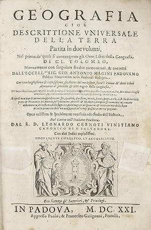
Geografia cioe` Descrittione Universale della terra partita in due volumi . XXVII. Tauole Antiche di Tolomeo, e XXXVII. altre Moderne, tutte reuiste, & in alcuni luoghi accresciute, & illustrate da ricchissimi Commentar? di detto Sig. Magini
Verlag: 1621-1620., 1621
Anbieter: Maggs Bros. Ltd ABA, ILAB, PBFA, BA, London, Vereinigtes Königreich
Verbandsmitglied: ABA ILAB PBFA
Bewertung:
Quarto (298 x 200 mm); two parts in one volume, twenty-seven Ptolemaic maps and thirty-seven modern maps; the first part the Geographia, the second Magini?s commentary and additions. The second dedication is misbound. Contemporary vellum, five raised bands and ms. title to head of spine. Vellum covering raised bands worn and in some places cracked with minor loss. Padua : Paolo and Francesco Galignani, Uncommon edition of Ptolemy?s Geografia, as published by Magini in 1596, subsequently edited by Leonard Cernoti, here reprinted in 1621. Giovanni Antonio Magini (1555-1617) was the leading mapmaker of his day working in Italy, author of the first printed atlas devoted to Italy, and also a very important (and rare) wall-map of Italy. Because of the rarity of these works, he is perhaps best known for this edition of Ptolemy, which met both with critical and commercial success, and was reprinted to 1621. Magini?s edition is significant for the greatly expanded commentary to the maps that he added. The maps were engraved by Girolamo Porro (1529-1600), the most famous of the Italian map engravers of the period, best known for the island maps in Tomaso Porcacchi?s Isole piu famose del Mondo, 1572, although his work is found in many illustrated books of the period. Porro was praised for the delicacy of his work, despite the handicap of poor vision in one eye. The map of Forum Julii is notable for containing a compass on which is shown magnetic variation. This edition is larger format than usual, as it has the maps printed above text, which continues on the verso. References: Shirley, T.PTOL-12c; Nordenskiold Collection Catalogue, II, 233.
-
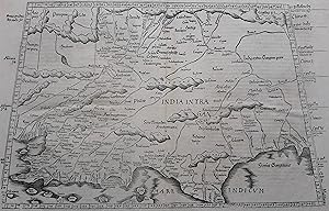
Undecima Asie tabula continet India extra Gange[m].
Anbieter: Libreria Oreste Gozzini snc, Firenze, FI, Italien
Bewertung:
Erstausgabe
[Anno MCCCCLXXXII augusti vero kalendas XVII impressum Ulme per ingeniosum virum Leonardum Hol. (Ulm, Lienhart Holle, 16 luglio 1482)]. Foglio del "Tolomeo di Ulm" (prima edizione, del 16 luglio) recante la carta geografica della penisola indocinese impressa in xilografia a doppia pagina su una facciata e il relativo testo descrittivo, stampato su una pagina dell'altra facciata. Il foglio misura mm. 401x523; l'immagine, misura, al filetto esterno della xilografia, mm. 380x300 (nel punto piů corto in larghezza) e mm. 380x372 (nel punto piů lungo in larghezza). Coloritura a mano originale. Sulla xilografia sono visibili delle ossidazioni dovute alla presenza al verso del foglio d'una cornice e d'una iniziale a stampa miniate con un colore verde che col tempo ha ossidato la carta. Nel 1482 Lienhart Holle pubblicň ad Hulm una edizione della Geografia di Tolomeo basata sulle carte di Nicolaus Germanus (c. 1420 - c. 1490) che aveva prodotto a Firenze una serie di magnifici atlanti manoscritti su pergamena negli anni 60 e 70 del Quattrocento. Il modello sul quale furono esemplate le carte di Hulm fu l'atlante manoscritto che Nicolaus aveva offerto al papa Paolo II e che pare fosse stato inviato appositamente in Germania (senza essere mai piů rispedito a Roma: č conservato allo Schloss Wolfegg). L'edizione di Ulm č il primo atlante pubblicato a Nord delle Alpi e il primo con le carte impresse in xilografia (i due incunaboli precedenti della Geografia di Tolomeo - Bologna 1477 e Roma 1478 - recavano carte incise in rame). L'incisore delle xilografie fu probabilmente Johann Schnitzer di Armsheim (il planisfero reca la sua firma). Una delle mappe piů ricercate della penisola indocinese, la terza in assoluto, in ordine di tempo, che sia stata impressa in un atlante a stampa. Per quanto riguarda il Tolomeo stampato ad Ulm cfr. Gof P1084; HC *13539; BMC II 538; IC.9309; Schreiber 5031; Sabin 66472; Nordenskiold Collection II, 199.Sheet of "Ptolemy of Ulm" (first edition, July the 16th, 1482) bearing the geographical map of the Indochinese peninsula printed in double-page woodcut on one side and the relative descriptive text, printed on one page of the other side. The sheet measures mm. 401x523; the image measures, to the external fillet of the woodcut, mm. 380x300 (at the shortest point in width) and mm. 380x372 (at the longest point in width). Original hand coloring. On the woodcut you can see some oxidations due to the presence on the back of the sheet of a frame and of an initial illuminated with a green color that over time has oxidized the paper. In 1482 Lienhart Holle published in Hulm an edition of Ptolemy's Geography based on the maps of Nicolaus Germanus (c. 1420 - c. 1490) who had produced in Florence a series of magnificent handwritten atlases on parchment in the 1460s and 1470s. The model on which Hulm's maps were patterned was the manuscript atlas that Nicolaus had offered to Pope Paul II and which seems to have been specially sent to Germany (without ever being sent back to Rome: it is kept at Schloss Wolfegg). The Ulm edition is the first atlas published north of the Alps and the first with the maps printed in woodcut (the two previous incunabula of Ptolemy's Geography - Bologna 1477 and Rome 1478 - had copper engraved maps). The engraver of the woodcuts was probably Johann Schnitzer of Armsheim (the planisphere bears his signature). One of the most sought after maps of the Indochinese peninsula, the third ever, in order of time, which has been imprinted in a printed atlas.
-
Tab. II Africae, complectens Africam proprie dictam
Verlag: Artist: Ptolemy/ Gerhard Mercator Claudius ( - 1594 ) ; issued in: Duisburg ; ca: 1578; - Gerardus Mercator (1512 - 1594) He was a cartographer philosopher and mathematician He is best known for his work in cartography in particular the world map of 1569 based on a new projection which represented sailing courses of constant bearing as straight lines He is renowned to the present day as the cartographer who created a world map based on a new projection which represented sailing courses of constant bearing as straight lines In his own day he was the world's most famous geographer but in addition he had interests in theology philosophy history mathematics and magnetism as well as being an accomplished engraver calligrapher and maker of globes, 1512
Anbieter: Antique Sommer& Sapunaru KG, München, Deutschland
Bewertung:
Technic: Copper print; colorit: original colored; condition: Very good, size (in cm): 33 x 45; - Map shows total Tunesie with Malta and partly Lybia.
-
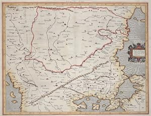
Eur: IX TAB: / Medius meridianus. 51. reliqui ad hune inclinantnr pro ratione. 43. 47. parallelorum.
Verlag: Artist: Ptolemy/ Gerhard Mercator Claudius ( - 1594 ) ; issued in: Duisburg ; ca: 1650; - Gerardus Mercator (1512 - 1594) He was a cartographer philosopher and mathematician He is best known for his work in cartography in particular the world map of 1569 based on a new projection which represented sailing courses of constant bearing as straight lines He is renowned to the present day as the cartographer who created a world map based on a new projection which represented sailing courses of constant bearing as straight lines In his own day he was the world's most famous geographer but in addition he had interests in theology philosophy history mathematics and magnetism as well as being an accomplished engraver calligrapher and maker of globes, 1512
Anbieter: Antique Sommer& Sapunaru KG, München, Deutschland
Bewertung:
Technic: Copper print; colorit: gouache; condition: Some minor restoration at upper centerfold, size (in cm): 35,5 x 45,5; - Map shows the countireis of Romania, Bulgaria, Macedonia and the european part of Turkey with the Bosporus ( partly the asian part of Turkey). With a decorative title cartouche.
-
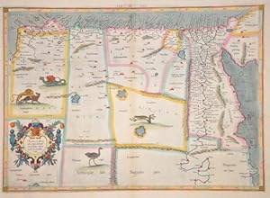
Medius meridianus 56, reliqui inclinantur ad hunc ratione 25 et 30 parallorum
Verlag: Artist: Ptolemy/ Gerhard Mercator Claudius ( - 1594 ) ; issued in: Duisburg ; ca: 1578; - Gerardus Mercator (1512 - 1594) He was a cartographer philosopher and mathematician He is best known for his work in cartography in particular the world map of 1569 based on a new projection which represented sailing courses of constant bearing as straight lines He is renowned to the present day as the cartographer who created a world map based on a new projection which represented sailing courses of constant bearing as straight lines In his own day he was the world's most famous geographer but in addition he had interests in theology philosophy history mathematics and magnetism as well as being an accomplished engraver calligrapher and maker of globes, 1512
Anbieter: Antique Sommer& Sapunaru KG, München, Deutschland
Bewertung:
Technic: Copper print; colorit: original colored; condition: Very good, size (in cm): 34,5 x 47,5; - Map shows Egypt and Lybia.
-
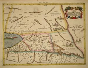
Tab. VII. Asiae exhibens Scythiam, intra Imaum Sogdianam, Bactrianam, Hircaniam.
Verlag: Artist: Ptolemy/ Gerhard Mercator Claudius ( - 1594 ) ; ca: 1578; - Gerardus Mercator (1512 - 1594) He was a cartographer philosopher and mathematician He is best known for his work in cartography in particular the world map of 1569 based on a new projection which represented sailing courses of constant bearing as straight lines He is renowned to the present day as the cartographer who created a world map based on a new projection which represented sailing courses of constant bearing as straight lines In his own day he was the world's most famous geographer but in addition he had interests in theology philosophy history mathematics and magnetism as well as being an accomplished engraver calligrapher and maker of globes and scientific instru, 1512
Anbieter: Antique Sommer& Sapunaru KG, München, Deutschland
Bewertung:
Technic: Copper print; colorit: original colored; condition: Very good, size (in cm): 35 x 46; - Map shows parts of Kazakhstan at the Caspian sea.

![Bild des Verkäufers für [Tetrabiblos]. Hoc in libro nunquam ante typis aeneis in lucem edita haec insunt. [Greek:] KLAUDIOU ptolemaiou plousieos tetrabiblos sotaxis, pros Syron adelfos. TOU AUTOU karpos, pros ton auton Syros. [Latin:] Claudii Ptolemaei Pelusiensis libri quat. - [EDITIO PRINCEPS OF "THE BIBLE OF ASTROLOGY"] zum Verkauf von Lynge & Sřn ILAB-ABF](https://pictures.abebooks.com/inventory/md/md10120242092.jpg)
![Bild des Verkäufers für La Geografia di Claudio Tolomeo Alessandrino, Giŕ tradotte di greco in italiano da M. Giero. Ruscelli: & hora in questo nuoua editione da M. Gio. Malomba ricoretta, & purgata d'infiniti errori: come facilmente nella Prefatione a Lettori puň ciascuno. - [DEPICTING THE WORLD] zum Verkauf von Lynge & Sřn ILAB-ABF](https://pictures.abebooks.com/inventory/md/md227605666.jpg)
![Bild des Verkäufers für Undecima Asie tabula continet India extra Gange[m]. zum Verkauf von Libreria Oreste Gozzini snc](https://pictures.abebooks.com/inventory/md/md22623988900.jpg)