Gesamtpreis (1 Artikel Artikel):
Versandziel:

thomas moule (148 Ergebnisse)
Direkt zu den wichtigsten Suchergebnissen
Produktart
- Alle Product Types
- Bücher (135)
- Magazine & Zeitschriften
- Comics
- Noten
- Kunst, Grafik & Poster
- Fotografien
- Karten (13)
- Manuskripte & Papierantiquitäten
Zustand
Einband
Weitere Eigenschaften
Gratisversand
- Versand nach USA gratis
Land des Verkäufers
Verkäuferbewertung
-
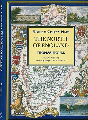
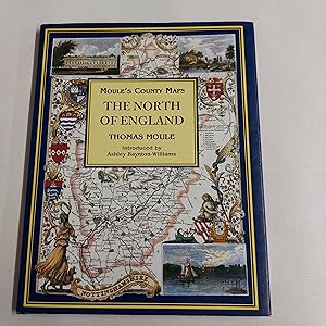
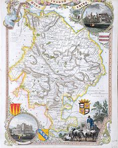
The North of England (Moule's county maps)
Verlag: Studio, 1994
ISBN 10: 185891194XISBN 13: 9781858911946
Buch
Hardback. Zustand: Very Good. The book has been read, but is in excellent condition. Pages are intact and not marred by notes or highlighting. The spine remains undamaged.
-
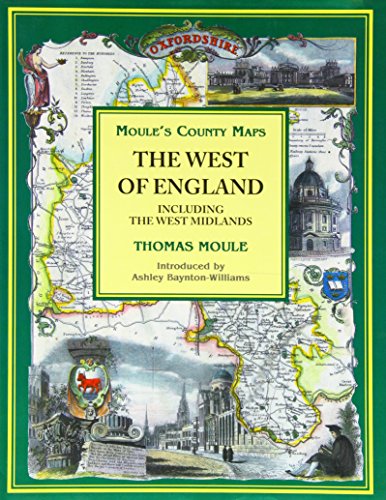
Moule's County Maps: West of England Including the West Midlands
Verlag: Bracken Books, 1994
ISBN 10: 1858911966ISBN 13: 9781858911960
Buch
Hardback. Zustand: Very Good. The book has been read, but is in excellent condition. Pages are intact and not marred by notes or highlighting. The spine remains undamaged.
-
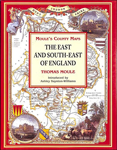
The East and South-East of England (Moule's county maps)
Verlag: Bracken Books, 1994
ISBN 10: 1858911990ISBN 13: 9781858911991
Buch
Hardback. Zustand: Very Good. The book has been read, but is in excellent condition. Pages are intact and not marred by notes or highlighting. The spine remains undamaged.
-
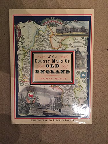
THE COUNTY MAPS OF OLD ENGLAND.
Verlag: Dolphin Publications, 1993
ISBN 10: 1858910382ISBN 13: 9781858910383
Buch
Paperback. Zustand: Very Good. The book has been read, but is in excellent condition. Pages are intact and not marred by notes or highlighting. The spine remains undamaged.
Mehr Angebote von anderen Verkäufern bei ZVAB
Gebraucht ab EUR 2,86
-
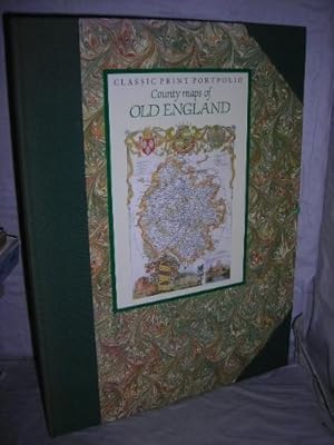
Classic Print Portfolio - County Maps of Old England
Verlag: Studio Editions, 1991
ISBN 10: 1851706852ISBN 13: 9781851706853
Buch
Zustand: VeryGood. Most items will be dispatched the same or the next working day.
Mehr Angebote von anderen Verkäufern bei ZVAB
Gebraucht ab EUR 4,12
-
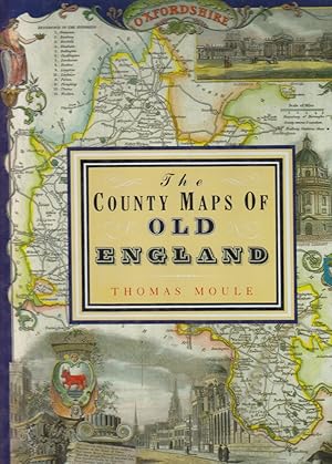
County Maps of Old England, The
Verlag: Studio Edns., 1990
ISBN 10: 1851704035ISBN 13: 9781851704033
Buch
Paperback. Zustand: Used; Good. Dispatched, from the UK, within 48 hours of ordering. This book is in good condition but will show signs of previous ownership. Please expect some creasing to the spine and/or minor damage to the cover. Missing jacket. The dust jacket of the book is missing.
Mehr Angebote von anderen Verkäufern bei ZVAB
Gebraucht ab EUR 2,55
-

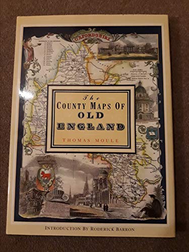
The County Maps of Old England (Hardcover)
Verlag: Studio Editions
Anbieter: Wonder Book, Frederick, MD, USA
Bewertung:

Zustand: Very Good. Very Good condition. Good dust jacket. (Great Britain, England, maps) [ISBN 1851704035] A copy that may have a few cosmetic defects. May also contain light spine creasing or a few markings such as an owner's name, short gifter's inscription or light stamp. Bundled media such as CDs, DVDs, floppy disks or access codes may not be included.
-
The County Maps of Old England. Introd. by Roderick Barron.
Verlag: London Studio Editions (Reprint d Ausg v 1830 u 1842), 1990
Buch
Hardcover. Zustand: Gut. Schutzumschlag. 126 S. Mit vielen farb. Karten engl. Grafschaften (Faks. d. Karten aus dem 19.Jh.). Folio(. Orig.-Ln. (Ecken etwas berieben, Schutzumschl. m. leichten Gebrauchsspuren). Thomas Moule (1784-1851) war einer der bekanntesten Kartographen des frühen Viktorianischen Zeitalters. In engl. Sprache. Innen sehr gut erhalten.
-
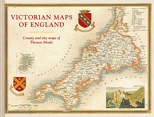
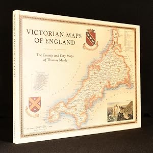
Victorian Maps of England: The county and city maps of Thomas Moule
Verlag: Batsford Ltd, United Kingdom, 2018
ISBN 10: 1849944970ISBN 13: 9781849944977
Buch
Paperback. Zustand: Very Good. The most beautiful Victorian maps of England's counties and cities in large format by one of Britain's great cartographer's Thomas Moule. Thomas Moule was one of the finest Victorian mapmakers and isregarded as the true follower of John Speed in the cartographic historyof Britain. Moules beautifully observed county and city maps presenta minutely detailed record of 19th-century England. They were firstpublished in collectable parts between 1830 and 1837 and thenpublished together in the extensive 2-volume masterwork The EnglishCounties Delineated. Moule celebrated the ancientness and history of each county byincluding pastoral or monument views within the maps, all framedby cartouches, festoons and architectural ornament in a variety ofhistorical styles. But underpinning this ancient vision is the hand ofthe British Industrial Revolution. Moules maps are deeply informedby the early technical work of the Ordnance Survey and record theunstoppable growth of the major cities and the unrelenting spread ofthe railways. The maps have remained influential and highly collectable asboth originals and as reproductions. For the first time in a generationthis new large-format volume, comprising 55 county and city maps,presents the main body of Thomas Moules work alongside his originaldetailed text descriptions. The books Introduction explains Moulescareer as a writer and antiquary and sets his celebrated maps in thecontext of the technical cartographic revolution in which they werepublished. The book examines the wide-ranging artistic and culturalinfluences exhibited as Moule combines accurate cartography withhighly decorative architectural frames and evocative, Romantic,pastoral views of the England he so cherished. In doing so it positionshim alongside his fellow celebrated Victorian pioneers, includingGeorge Virtue, William Westall, Walter Scott, Charles Dickens, JMWTurner, Augustus Pugin, Edward Stanford and George Bradshaw. The book has been read, but is in excellent condition. Pages are intact and not marred by notes or highlighting. The spine remains undamaged.
-
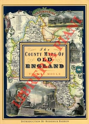
The County Maps Of Old England. Introduction by Roderick Barron.
Erscheinungsdatum: 1990
Anbieter: Libreria Piani, Monte San Pietro, BO, Italien
Bewertung:
Buch
London, Studio, 1990, 4to (cm. 36 x 26,5) legatura tutta tela con titoli dorati al dorso e sovraccopertina illustrata a colori (piccolo strappo) pp. 127 con 56 carte a colori a piena pagina nel testo.
-
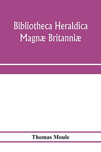
Bibliotheca Heraldica Magnae Britanniae an Analytical Catalogue of Books on Genealogy, Heraldry, Nobility, Knighthood and Ceremonies.
Verlag: Heraldry Today, 1966
Anbieter: Scarthin Books ABA, ILAB., Cromford, Vereinigtes Königreich
Bewertung:
Hardcover. Zustand: Very Good. No Jacket. London: Heraldry Today, 1966. Reprint . Book Publisher's Cloth. Very Good/No Jacket. Octavo. Reproduced from the edition of 1822. 668 pages. Frontispiece of William Camden and other illustrations, mainly as chapter headings. Bound in the original cream buckram boards. No names or inscriptions.
-
THE COUNTY MAPS OF OLD ENGLAND. WITH AN INTRODUCTION BY RODERICK BARRON.
Erscheinungsdatum: 1994
Anbieter: Graham York Rare Books ABA ILAB, Honiton, Vereinigtes Königreich
Verbandsmitglied: ABA ILAB PBFA
Bewertung:
Karte
Zustand: Very good. 1994, London, Studio Editions, elephant folio, reprint, pp127, colour maps, blue cloth in dustwrapper.
-
Bibliotheca Heraldica Magnć Brittannić. An Analytical Catalogue of Books on Genealogy, Heraldry, Nobility, Knighthood, & Ceremonies.
Heraldry Today, London 1966. 8vo. XVI+668 pages. Illustrated in b/w. Orig. offwhite cloth. * Reproduced from the original edition of 1822.
-
Moule's County Maps The North Of England
Verlag: Bracken Books, 1994
Anbieter: Cambridge Rare Books, Cambridge, GLOUC, Vereinigtes Königreich
Bewertung:
Hardcover. Zustand: GOOD. 1994. Bracken Books . Hardcover. ACCEPTABLE DJ; Acceptable, edgewear. Some pages marked. Some foxing. 12x9.
-
ORIGINAL ENGRAVED MAP OF SOMERSETSHIRE. With later hand-colouring.
Verlag: Moule, ca1837., 1837
Anbieter: PROCTOR / THE ANTIQUE MAP & BOOKSHOP, DORCHESTER, Vereinigtes Königreich
Verbandsmitglied: PBFA
Bewertung:
Karte
Framed size 16 x 14 inches. Size within mount approx 9 x 7 inches. In natural wood frame behind glass, with wide ivory mount. In very good condition. Vertical centre crease from original binding. Some small light foxing spots around edges and text. Else a clean and bright example. With later hand-colouring.
-
Victorian Maps of England: The County and City Maps of Thomas Moule
Verlag: Batsford, London, 2018
Hardback. Zustand: Near Fine. Thomas Moule (illustrator). A very smart copy of this collection of the maps of Thomas Moule, in colour. Illustrated with fifty-two colour maps of the counties and cities of England, with additional colour images. A collection of the maps of Thomas Moule, an English antiquarian, writer on heraldry, and one of Victorian England's most influential map-makers best known for his highly decorated county maps of England, first published in the 1830s. With an introduction from Moule, and a commentary on him by John Lee, an English scholar and editor. In the original pictorial paper covered boards. Externally, very smart with light shelf wear to the extremities. Internally, firmly bound. Pages are very bright and clean throughout. Near Fine. book.
-
Zustand: Sehr gut. Zustand: Sehr gut - Gepflegter, sauberer Zustand. | Seiten: 696 | Sprache: Englisch.
-
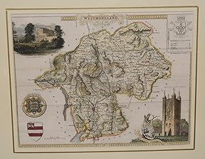
ORIGINAL ENGRAVED MAP OF WESTMORELAND. From ?The English Counties Delineated?. Or, A Topographical Description of England.
Verlag: 1837., 1837
Anbieter: PROCTOR / THE ANTIQUE MAP & BOOKSHOP, DORCHESTER, Vereinigtes Königreich
Verbandsmitglied: PBFA
Bewertung:
Karte
Engraved surface: 10 x 8 ins. In ivory mount with gilt line 14 x 12 ins. T. Moule (1754 - 1851), an authority on heraldry, embellished his maps with amorials and other features. His was the last series of British Maps to follow the tradition of decorative armorial cartography and they make a pleasing and attractive addition to any home. Nice later hand colouring. Attractive map.
-
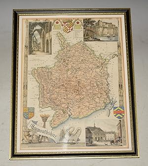
ORIGINAL ENGRAVED MAP OF MONMOUTHSHIRE. From ?The English Counties Delineated?. Or, A Topographical Description of England.
Verlag: 1831, 1831
Anbieter: PROCTOR / THE ANTIQUE MAP & BOOKSHOP, DORCHESTER, Vereinigtes Königreich
Verbandsmitglied: PBFA
Bewertung:
Karte
Framed size 22.5cm x 28.5cm. Engraved surface approx 20cm x 26.5cm. In black and gold Hogarth wood frame behind glass. In very good condition. Nice later hand colouring. Attractive map. T.Moule (1754 - 1851), an authority on heraldry, embellished his maps with amorials and other features. His was the last series of British Maps to follow the tradition of decorative armorial cartography and they make a pleasing and attractive addition to any home.
-

ORIGINAL HAND COLOURED ENGRAVED MAP OF MIDDLESEX From ?The English Counties Delineated?. Or, A Topographical Description of England.
Verlag: 1837., 1837
Anbieter: PROCTOR / THE ANTIQUE MAP & BOOKSHOP, DORCHESTER, Vereinigtes Königreich
Verbandsmitglied: PBFA
Bewertung:
Karte
Hand coloured engraved map, in black and gold wooden frame with glass. Size in frame 29.5cm x 23cm. Engraved surface approx 26.5cm x 20cm. In very good condition. A very clean with attractive colouring. Nice later hand colouring. Decorative border with views of Westminster Bridge & Abbey and Buckingham Palace. T. Moule (1754 - 1851), an authority on heraldry, embellished his maps with amorials and other features. His was the last series of British Maps to follow the tradition of decorative armorial cartography and they make a pleasing and attractive addition to any home.
-

Bibliotheca Heraldica Magnć Britannić : An Analytical Catalogue of Books on Genealogy, Heraldry, Nobility, Knighthood,& Ceremonies, With a List of Provincial Visitations, Pedigrees, Collections of Arms, and Other Manuscripts; And a Suppleme
Verlag: Forgotten Books, 2015
ISBN 10: 1331986931ISBN 13: 9781331986935
Buch
Zustand: Sehr gut. Zustand: Sehr gut - Gepflegter, sauberer Zustand. | Seiten: 702 | Sprache: Englisch.
-
Heraldry of Fish. Notices of the Principal Families Bearing Fish in their Arms.
Verlag: London, John Van Voorst,, 1842
Buch Erstausgabe
8°, cloth-bound ca. 1900. 1st ed. Illustrated by engravings on wood, XV, 250 p. Binding minimal rubbed, otherwise fine copy. Sprache: Englisch Gewicht in Gramm: 0.
-
Zustand: Wie neu. Zustand: Wie neu - Gepflegter, sauberer Zustand. | Seiten: 464.
-
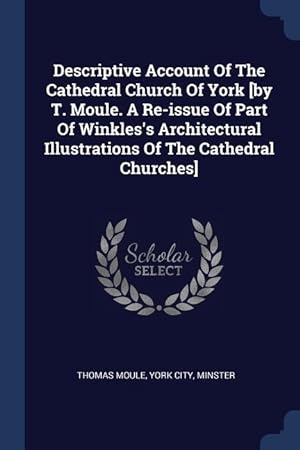
Descriptive Account Of The Cathedral Church Of York [by T. Moule. A Re-issue Of Part Of Winkles\ s Architectural Illustrations Of The Cathedral Churche
Verlag: CHIZINE PUBN, 2018
ISBN 10: 1377154165ISBN 13: 9781377154169
Buch
Zustand: New.
-
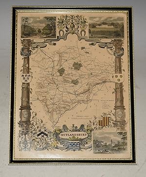
ORIGINAL ENGRAVED MAP OF RUTLANDSHIRE. From ?The English Counties Delineated?. Or, A Topographical Description of England.
Verlag: 1837., 1837
Anbieter: PROCTOR / THE ANTIQUE MAP & BOOKSHOP, DORCHESTER, Vereinigtes Königreich
Verbandsmitglied: PBFA
Bewertung:
Karte
Framed size 22.5cm x 28.5cm. Engraved surface approx 20cm x 26.5cm. In black and gold Hogarth wood frame behind glass. In very good condition. Nice later hand colouring. Attractive map. T.Moule (1754 - 1851), an authority on heraldry, embellished his maps with amorials and other features. His was the last series of British Maps to follow the tradition of decorative armorial cartography and they make a pleasing and attractive addition to any home.
-
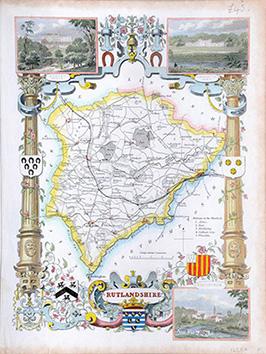
Rutlandshire
Verlag: The English Counties Delineated. 1842, 1842
Anbieter: Peter Harrington. ABA/ ILAB., London, Vereinigtes Königreich
Verbandsmitglied: ABA ILAB PBFA
Bewertung:
Highly decorative map with border, coat of arms, scale and reference to the hundreds. Inset views of Burley House, Normanton Park and Epingham. Steel engraving. Hand coloured. In fine condition. Size: 26 x 20 cm. (10 x 8 inches).
-

Details of Elizabethan Architecture
Verlag: Legare Street Press, 2022
ISBN 10: 1016610041ISBN 13: 9781016610049
Buch
Zustand: New.
-
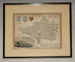
ORIGINAL ENGRAVED MAP OF DORSETSHIRE. Dorset From ?The English Counties Delineated?. Or, A Topographical Description of England.
Verlag: 1836, 1836
Anbieter: PROCTOR / THE ANTIQUE MAP & BOOKSHOP, DORCHESTER, Vereinigtes Königreich
Verbandsmitglied: PBFA
Bewertung:
Karte
In black and gilt wooden frame, with glass. Size of engraved surface 10.5 x 8.5 inches. Frame 14.5 x 12.5 inches. In very good condition. Some light tanning & a few small foxing spots. A few small fly spots lower margin. With later hand-colouring. T.Moule (1754 - 1851), an authority on heraldry, embellished his maps with amorials and other features. His was the last series of British Maps to follow the tradition of decorative armorial cartography and they make a pleasing and attractive addition to any home. This map has two shields, two seals and a vingette of Shaftesbury. Also the Hundreds and Liberties are numbered and listed.
-
Huntingdonshire
Verlag: The English Counties Delineated. 1842, 1842
Anbieter: Peter Harrington. ABA/ ILAB., London, Vereinigtes Königreich
Verbandsmitglied: ABA ILAB PBFA
Bewertung:
Highly decorative map with border, coat of arms, scale and reference to the hundreds. Inset views of Hichingbrook and Brampton Park. Steel engraving. Hand coloured. In good condition. Upper margin cropped. Size: 26 x 20 cm. (10 x 8 inches).